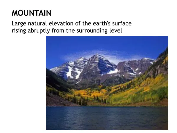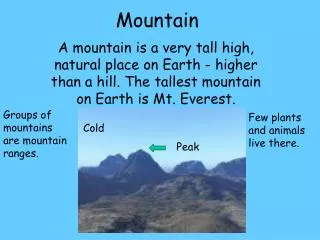
MOUNTAIN
MOUNTAIN. OPERATIONS. REFERENCES : FM 3-04.202 (1-202) ENVIRONMENTAL FLIGHT AERONAUTICAL INFORMATION MANUAL (AIM). OVERVIEW. The mountain environment requires special flying techniques due to: Its severe and rapidly changing weather Impacts on aircraft performance capabilities
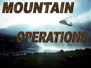

MOUNTAIN
E N D
Presentation Transcript
MOUNTAIN OPERATIONS
REFERENCES: • FM 3-04.202 (1-202) ENVIRONMENTAL FLIGHT • AERONAUTICAL INFORMATION MANUAL • (AIM)
OVERVIEW • The mountain environment requires special flying techniques due to: • Its severe and rapidly changing weather • Impacts on aircraft performance capabilities • Acceleration of crew fatigue
WINDS • Winds associated with mountains can be broken down into three main categories. • Prevailing winds: upper-level winds flowing predominately from west to east in the continental US. • Local winds: also called valley winds, are created by convection heating & cooling. They flow parallel to larger valleys. During the day, these winds tend to flow up valley; at night, they flow down valley. • Surface wind: the layer of air which lies close to the ground. It is less turbulent than prevailing & local winds.
DEMARCATION LINE • Demarcation line: the point which separates the up flow from the down flow of air. • It forms from the highest point of the mountain & extends diagonally upward. • The velocity of the wind and the steepness of the uplift slope will determine the position of the demarcation line. • Generally, the higher the wind speed, & steeper the terrain, the steeper the demarcation line.
TURBULENCE & DOWNFLOW PREVAILING WINDS DEMARCATION LINE LOCAL WIND (UPFLOW) SURFACE WINDS
LIGHT WINDS • Light winds: 1-10 knots • Accelerates slightly on the upslope, giving rise to a gentle updraft. • Follows the contour of the terrain feature over the crest • At some point past the crest, turns into a gentle downdraft.
PREVAILING WINDS DEMARCATION LINE LIGHT WINDS
MODERATE WINDS • Moderate wind: 11 to 20 knots • Will increase the strength of the up drafts and downdrafts and create moderate turbulence. • An updraft will be experienced on the lee (the side sheltered from the wind) slope near the crest of the mountain. • The demarcation line forms closer to the hill crest and is steeper
PREVAILING WINDS DEMARCATION LINE MODERATE WINDS
STRONG WINDS • Strong winds: above 20 knots • The demarcation line will move forward to the leading edge of the hill crest • Becomes progressively steeper and the severity of updrafts, downdrafts, and turbulence will also increase. • Under these conditions, the best landing spot is close to the forward edge of the terrain feature.
PREVAILING WINDS DEMARCATION LINE STRONG WINDS
MOUNTAIN WAVE • A phenomenon that occurs when the airflow over mountainous terrain meets certain criteria: • Low-level layer of unstable air • Stable layer of air above the lower levels • Wind direction fairly constant with altitude • Wind speed increasing w/ altitude • Mountain lying perpendicular to the airflow
MOUNTAIN WAVE • The following conditions can exist in a Mountain Wave: • Vertical currents of 2,000fpm are common, 5,000fpm possible • Moderate to severe turbulence • Wind gusts up to 22 knots • Altimeters errors up to 1,000 feet • Icing can be expected
STABLE LAYER WIND MOUNTAIN WAVE
CLOUD FORMATIONS ASSSOCIATED WITH MOUNTAIN WAVE • When proper conditions exist, clouds will form that provide visible indications of the existence of a mountain wave. Three types of clouds may form as a result of a mountain wave. • Lenticular Clouds • Rotor Clouds • Cap Clouds
CLOUD FORMATIONS ASSSOCIATED WITH MOUNTAIN WAVE • Lenticular Clouds: • lens shaped, high altitudes, 25,000-40,000’. Form in bands or as single clouds, located above and slightly downwind from the ridge of the mountain, turbulence may be encountered under the cloud • Rotor Clouds: • downwind from the ridge, several rows lying parallel to the ridge, bases at or below ridge level, up/down drafts in excess of 5,000fpm. Short duration & tend to disappear rapidly. • Cap Clouds: • formed primarily from vertical updrafts, up/down as they pass over the mountain. Part of the cloud extends upwind, with finger-like extensions running down the slope on downwind side of the ridge.
LENTICULAR CLOUDS CAP CLOUD ROTOR CLOUDS CLOUD FORMATIONS ASSSOCIATED W/ MOUNTAIN WAVE
SLACK WINDS STABLE LAYER STRONG GRADIENT WINDS WIND SHEAR 30K ROTOR CLOUD 25K 20K STRONG WINDS UNSTABLE AIR ROTOR STREAMING TURBULENCE
WIND ACROSS A RIDGE • Smooth air and updrafts will be experienced on the windward side of the ridge and downdrafts on the lee side. • The steeper the updraft slope & the higher the wind velocity, the more severe the updrafts. • As the air flows over the crest, a venturi effect is created. An area of low pressure develops on the lee side of the mountain. • Where the ridge line is irregular, a funneling of air through the gaps will occur, causing a mixing of air on the lee side. This condition tends to increase the turbulence. • Wind striking the ridge at less than 90° produces fewer updrafts and downdrafts.
WIND WIND ACROSS A RIDGE
WIND ACROSS A SNAKE RIDGE • Down drafts and turbulent air may be encountered on the windward slope of succeeding ridges. • The severity will be determined by the distance between the ridges, the depth of the valley, and the angle the wind strikes the slope. • The closer the ridges are together and the closer the wind is to 90° to the slope, the updrafts and turbulence will be more severe. • Greater turbulence will be experienced on the downdraft slope of succeeding ridges due to turbulent air flowing over the ridge.
WIND SNAKE RIDGE
WIND ACROSS A CROWN • Airflow in the vicinity of a crown is normally lateral around its outer edges and over the top. • Turbulence will develop on the lee side of the hill, but will not extend too far out from the ground.
WIND WIND ACROSS A CROWN
SHOULDER WIND • The airflow around a shoulder is extremely turbulent regardless of the wind direction. • Extreme downdrafts may be experienced if the shoulder is located on the lee side of the mountain. • Rotary turbulence may be experienced on the uplift side of the shoulder.
WIND BACKLASH SHOULDER WIND
WIND ACROSS A CANYON • Usually the lower winds flow parallel to the canyon floor. The degree of turbulence in the low areas of a canyon depends on the width & depth of the canyon and the wind speed. • In a narrow canyon, the most severe turbulence is in the low area • In a wide canyon, the low area may be turbulent free.
STRONG WINDS WIND ACROSS A CANYON
TECHNIQUES FLYING
FLYING TECHNIQUES • During Mountain Flying the aviator’s senses are sometimes unreliable. • A natural tendency is to judge airspeed as too slow and altitude too high. • Difficulty may be experienced in maintaining the proper flight altitude. • Frequent reference should be made to the flight instruments. • Update the PPC to compensate for gross weight changes and center of gravity.
MOUNTAIN TAKEOFF • Hover power check should be conducted. • PPC: as a minimum: max torque available, go/no-go torques, predicted hover torque • When performing a mountain takeoff, apply torque as necessary to gain forward airspeed while maintaining sufficient altitude to clear any obstacles until climb airspeed is reached. • Where drop-offs are located along the takeoff path, the aircraft may be maneuvered downslope to gain airspeed.
NORMAL TAKEOFF AIRSPEED OVER ALTITUDE MOUNTAIN TAKEOFF
FLIGHT ALONG A VALLEY • Aircraft should be flown in the smoother upflowing air on the lifting side of the valley. • Requires less power and gives the aircraft a safe flight path. • The velocity of the wind will determine how close you will fly to the lifting side. • In strong winds, it is advisable to avoid flying close to the slope because of turbulence caused by irregular projections may be encountered. • In light winds, aircraft should be flown closer to the side of the valley to allow for maximum horizontal clearance for a 180° turn
WIND DOWNDRAFT & TURBULENCE UPDRAFT FLIGHT ALONG A VALLEY
RIDGE CROSSING • Crossing at a 45° angle facilitates turning away from the ridge should the helicopter be carried below the crest by a downdraft.
RIDGE CROSSING 45° ANGLE
APPROACH & LANDING
FACTORS IN THE CONSIDERATION OF AN APPROACH PATH • Wind direction and velocity • Vertical air currents • Escape routes • Terrain contour & obstacles • Position of the sun • Approach paths and areas to be avoided
TYPE OF APPROACH • There is no standard type of mountain approach. • Light wind/when demarcation line is shallow: • A relatively low angle of descent or flat approach should be used- requires less power & control movement. If downdrafts are encountered insufficient altitude may be available to continue the approach. • Stronger wind/steeper demarcation line: • Steeper approach angle. Higher rate of descent & requires more power to terminate the approach. Provides more terrain clearance if downdrafts are encountered. • Running landing: • Used if insufficient torque to make a normal or shallow approach and landing area is suitable. Effective translational lift is maintained until contact with the ground.
LZ FIGURE EIGHT CIRCULAR LZ LZ RACETRACK LZ RECONNAISSANCE
After Reconnaissance • Avoid descents greater than 700fpm • Normally, pattern altitude will not exceed 500 feet above the touchdown point. • Mountain approach: • When 50’ above the touchdown point begin losing effective translational lift. Do not hover OGE. Prior to reaching the near edge of the landing area, the descent should be stopped & forward airspeed reduced to a brisk walk.
WIND AREA TO BE AVOIDED
AREA TO BE AVOIDED WIND
WIND AREA TO BE AVOIDED
SETTLING WITH POWER • Vertical / Near Vertical Descent • at least 300fpm • Low Forward Airspeed • Using some of available Engine Power • 20%-100% HOVER OGE -Large blade-tip vortexes -High velocity of induced airflow HOVER IGE -Reduced rotor tip vortex -Reduced velocity of induced airflow
QUIZ Click on the link below to access the Mountain Flying Techniques Quiz http://ang.quizstarpro.com Log-in and Click “Search” Tab Class Name = Mountain Flying Techniques