Download
1 / 21
230 likes | 1.02k Vues
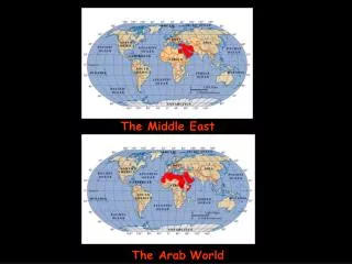
Water and Livelihood Initiative for the Middle East. The Palestinian Targeted Area and Priority Issues. Ministry of Agriculture (MoA) National Agricultural Research Center (NARC) Hebron University (HU) Land Research Center (LRC) Applied Research Institute – Jerusalem (ARIJ).

E N D
Water and Livelihood Initiative for the Middle East The Palestinian Targeted Area and Priority Issues Ministry of Agriculture (MoA) National Agricultural Research Center (NARC) Hebron University (HU) Land Research Center (LRC) Applied Research Institute – Jerusalem (ARIJ) Badia Workshop, Amman, Jordan, 12-14 May 2009
*Rainfall varies from 405 to 173 mm. *Temperatures vary from 26.2 0C to 13.5 0C *Humidity varies from Max. 70% to Min 63%. Climatic condition * Palestine situated at the corners between the desert ecosystems (south) and Mediterranean Sea (East). * Of a Mediterranean type, marked by a mild rain winter, prolonged dry and hot summer West Bank Gaza *Rainfall varies from 716 mm to 49 mm 70% of rainfall amounts accumulated between November and March *Monthly Average temperatures vary from 30.0 0C to 7.1 0C Coldest month is January, Hottest month is August *Humidity varies from 65 % to 47 %
Agro-ecological zones Eastern Slopes: * Forms 27.8% of WB area * elevations 150m to 600 m above sea level, *Rainfall 200mm to 350mm, *Soil type Gray calcareous steppe soils, *Famous as rangelands Central highlands *Forms 56.7% of WB area, *Elevations from 300-1000 meters above sea level, *Rainfall from 350-700 mm, *Dominant soil type Terra Rossa, *Cultivations: Olive trees, stone fruit trees, grapes, cultivation of rainfed vegetables, and field crops Jordan Valley: Forms 7.1% of WB area Elevation from 375 m below sea level to 200 meters above sea level, Rainfall from 200 mm to 50 mm / year, Soils: Alluvial soils, Cultivations: Irrigated vegetables, citrus, banana, and fruit trees. Semi-Coastal *forms 8.4% of WB area *Elevation from 100 to 300 m above sea level. *Rainfall: annual average is 600 mm *Soil types are Alluvial, Terra Rossa *Cultivation:Irrigated agriculture (Vegetable, Citrus, and olive Biological diversity • 2,500 species of Flowering Plants • 470 species of Birds • 95 species of Mammals • 93 species of Reptiles • 7 species of Amphibians
Palestine In Statistic • In 2007, the total Number of the Palestinian people inside the occupied Palestinian Territory (oPT) were 3.6 million (63% in the W B and 37% in Gaza Strip) • During the agricultural year 2006/07 up to 1,835 km2 of the Palestinian farm lands were cultivated. • The total number of small ruminants is up to 1.2 million heads. • The Palestinians are allowed to use just 118 MCM/year (18%) of their ground water resources in the West Bank while the Israelis control the remaining amount of water (82%) • The total water accessible for agriculture in the WB is 84.3 MCM/year. • The employment proportion within the agricultural sector increased from 11.5% in 1996 to 14.2% in 2008, and its contribution to GDP increased from 6.4% in 1997 to 8.2% in 2007
The Palestinian Benchmark The Eastern Slopes Agro-Eco Zone is the targeted area by the Water and Livelihood Initiative for the Middle East Why the Easter Slopes Zone: It contains the marginalized rainfed lands and largest part of the rangeland area in the West Bank
The demographics communities/populations at the Eastern Slopes • The total area of the Eastern Slopes is approximately 1,500 Km2 . (29% of the West bank area) • The Eastern Slopes zone locates in six Governorates of the West Bank and contains 66 localities of which 57 are rural, 6 are semi-Bedouins and 2 are urban areas and 1 is a refugee camp. • The population of the Eastern slopes reaches 87,000 people.
Physical, Natural and economical characteristics of the Eastern slopes • The ES elevation varies from 800 above Sea level to 150 m below sea level. • The climate is arid to semi arid with low annual rainfall varying between 50-400 mm. • ES is famous as a rangeland area; it forms 91% of the total pasture lands in the West Bank. • The Israeli settlements and military bases occupied 4% of the ES area. • About 65% of the pastures and forest areas in the ES are defined as closed military areas and inaccessible to the Palestinian people.
Filed crops and forages are main cultivated crops in addition to fruit trees cultivations under rainfed conditions in the ES. • Irrigated agriculture is concentrated in the areas where springs or artesian wells are available. • The grazing capacity of the ES is limited Due to many reasons including: • Limited access to rangeland which led to very high grazing pressure • The continues increase in the number of small ruminants led sever grazing for many years • Land degradation and deterioration • Low rainfall and climate change (drought) These reasons led to reduce the vegetation cover and plant biomass which led to water runoff and sever soil erosion The rang land provide only 15% from the feed required for small ruminants which led to bad nutritional status.
Economical situation: • 88.4%, 60.6% and 25% of the labor force in the semi-Bedouins communities, rural communities and urban areas are working in the agricultural sector (plant and livestock production), respectively. • Up to 25% of the Bedouin communities labor force are currently unemployed compared with 16.7% for rural areas and 12.4% for urban areas in the ES.
The Eastern Slops selected sub-sites • To conduct the most proper activities, obtain better results and achieve a sustainable impact for the project, two sub-sites were selected by the WLI project Palestinian partners.
Sub-site one (Tammun Area) • It is located in the northeastern part of the ES and called Tammoun area with average rainfall from 160 mm in the east to 330 in the west. • The total area of this site is approximately 88 km2. • Rainfed and irrigated agriculture occupied 28% of this area while the rangelands form 27%.
Sub-site Two (South Hebron Area) • It is located in the southeastern part of the ES and called South-Hebron area. • Average annual rainfall from 70 mm in the east to 300 mm in the west. • The total area of this site is approximately 315 km2. • This site is mainly famous for the large area of rangeland 60% of the area and 37% rainfed agriculture
The existing obstacles and challenges in the Eastern Slopes • Limited and scarce natural resources: • low land productivity • drought and low annual precipitation • water scarcity and quality deterioration • low biomass and carrying capacity • land degradation • Insufficient water resources management . • Soil salinization 2. Low productivity and profitability • Small size of land ownership and land fragmentation • wastewater streams • unavailability of improved and suitable plant varieties • low productivity and fertility of existing small ruminant breeds • Low feasibility due to the high cost of the production inputs (mainly fodders)
3. Weak Institutional management system • Limited accessibility to resources due to the occupation practices. • Weak extension and lack of scientific research • Limited capacity of existing human resources • Lack of controlling the overgrazing • Lack of adoption of new agricultural practices. • Limited technology transfer • Insufficient planning and policies • Lack of allocated fund for ES. • Weak regulations and policy environment. • Weak production calendar • Limited number and infectiveness of existing community based organizations and women clubs • High rate of unemployment.
The top priorities at the Palestinian Benchmark (Eastern Slopes) • Drought mitigation and reducing water scarcity. • Increasing biomass and reducing land degradation • Improving land ownership and agro-production systems
Cross cutting issues to improve Badia and agriculture in the ES • Institutional and human resources capacity building • Empowering community based organizations (farmer associations and civil society contribution) • Empower the role of women and youth in decision making and better practices. • Improving research and extension activities • Provide training and offer scientific degrees • Enhancing technology transfer and adoption. • Improve the environmentally sounds activities. • Enhance resulted wastes and by-products reuse. • Integrate the project new activities with existing and performed related activities in the targeted areas
Proposed Top Activities • Conduct special studies, such as: • land and soil suitability mapping, • water harvesting techniques, • Plant biodiversity and bio-mass improvement • Combating Land degradation and drought • Land use/land cover analysis • Develop aridity index • Agro-social studies • Grazing calendar and grazing capacity • Improving agro-production and grazing systems • Researching the existing livestock breeds and ways for improvement • Conduct developmental activities: • Improve the biomass and grazing system in the sub-site areas. • Demonstrate water harvesting and water shed management techniques • Improve the human resource capacities with special focus on gender contribution. • Introduce new suitable and productive small ruminants breeds • Improve the provided extension services • Conduct on field demonstrations on improving plant wild, local species and the introduction of draught tolerant crops and varieties. • Develop and practice grazing, extension and veterinary services calendar. • Establishing seed center for rangeland plants
The expected outputs • Productivity and profitability of land and livestock were increased. • Natural resources management was improved • Stakeholders involvement and follow up were enhanced • Human resources was improved • Farmers (especially women farmers) access to know how and good practices were improved
Stakeholders and their responsibilities • Local universities and research centers: • Conducted research studies • Transfer the know how to the NGO’s and MoA • NGO’s and CBO: • Adaptation of better and feasible practices • Increasing awareness and knowhow • Empower the access to resources in a sustainable approach • Ministry of agriculture: • Provide better extension services • Better planning and controlling procedures • Improve the exiting strategies, laws and bylaws. • Protect the rights of people and the nature as well • Donors: • Improve the funding programs towards the sustainability of natural resources • Shift from emergency program toward developmental and sustainable activities. • To cope with the national polices and civil society needs