
Uploaded by
Mercy
17 SLIDES
301 VUES
170LIKES
Deriving Gradient from GIS Data: A Step-by-Step Protocol
DESCRIPTION
This protocol outlines the method for deriving gradient values from Geographic Information Systems (GIS) data. The process involves utilizing digital elevation models (DEMs) to calculate slope and aspect, providing essential information for terrain analysis. By following this protocol, users can accurately extract gradients that are critical for applications in hydrology, environmental studies, and urban planning. The steps include data preparation, analysis tools in GIS software, and interpretation of results for practical use.
Download
1 / 17
Download Presentation

Télécharger la présentation
Deriving Gradient from GIS Data: A Step-by-Step Protocol
An Image/Link below is provided (as is) to download presentation
Download Policy: Content on the Website is provided to you AS IS for your information and personal use and may not be sold / licensed / shared on other websites without getting consent from its author.
Content is provided to you AS IS for your information and personal use only.
Download presentation by click this link.
While downloading, if for some reason you are not able to download a presentation, the publisher may have deleted the file from their server.
During download, if you can't get a presentation, the file might be deleted by the publisher.
E N D
Presentation Transcript
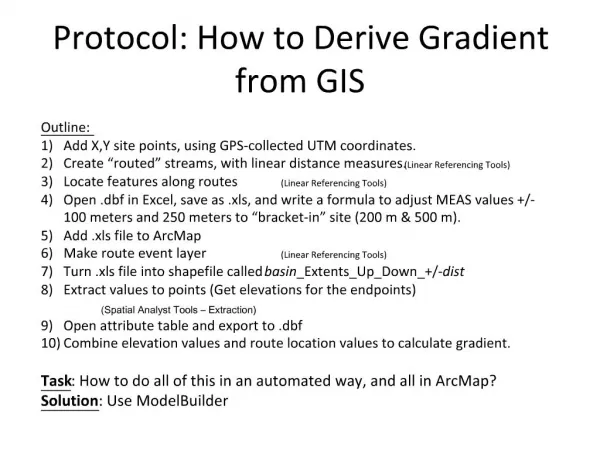
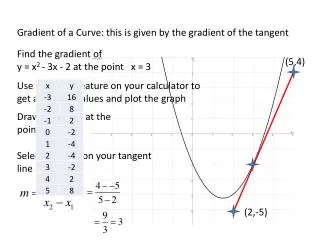
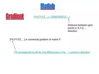
1. Protocol: How to Derive Gradient from GIS


More Related
Audio
Live Player