Download
1 / 15
160 likes | 536 Vues
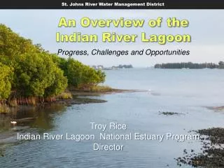
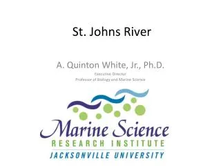
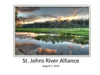
US Army Corps of Engineers. Upper St. Johns River Basin Project. A joint project between the St. Johns River Water Management District and the Jacksonville District, U.S. Army Corps of Engineers. Hector Herrera Basin Program Manager St. Johns River Water Management District.

E N D
US Army Corps of Engineers Upper St. JohnsRiver Basin Project A joint project between theSt. Johns River Water Management Districtand the Jacksonville District, U.S. Army Corps of Engineers Hector Herrera Basin Program Manager St. Johns River Water Management District
A Jewel in Florida’s Watery Crown • Project is situated ineast-central Florida just inland from Florida’s Space Coast. • The project is semi-structural in design, relying on reclaimed floodplains to function as nature intended. • The project footprint consists of 150,000 acres (237 sq. mi.) and includes over 150 miles of flood protection levees and dozens of water conveyance structures.
Why Do We Need the USJRBP? • In the late 1800’s and early 1900’s, steam shovels and survey rods opened Florida’s vast watery interior. • Efforts to drain the headwaters of the St. Johns marshes began in earnest in the mid-1940’s. • Following devastating hurricanes in south Florida, Congress authorized flood control in the upper reaches of the St. Johns in 1948.
Reclaiming the Upper St. Johns River Marsh By the early 1970’s, 82% of the river’s floodplain had been removed for agricultural development.
A Look Back • 1948 - Congress authorized the Central & Southern Florida Flood Control Project in response to catastrophic flooding • 1966 - US Army Corps of Engineers and C&SF FCD start construction of a highly structural flood control project • 1972 - Construction was halted due to environmental concerns after passage of the National Environmental Policy Act • 1977 - Project sponsorship was transferred to SJRWMD; District undertakes comprehensive redesign based on a semi-structural design concept • 1988 - Construction of the current Upper St. Johns River Basin Project began
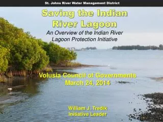
Project Goals • Flood Damage Prevention • Water Quality Improvement • Hydro-period Restoration • Habitat, Fish & Wildlife Enhancement • Reductions in massive freshwater flows to theIndian River Lagoon estuary • Increased Public Recreation Opportunities
Prescription for the River’s Cure • A semi-structural design concept to allow water levels to mimic the natural hydrologic regime. • Returning farm and pasture fields to shallow marshes. • Construct large, off-line retention reservoirs to treat agricultural runoff. • Introduce fire as a marsh management tool to re-establish diverse wetland plant communities.
Water Management Areas • Provide stormwater storage • Contain agricultural discharges so that high quality wetland habitat may be preserved • Provide water quality treatment • Provide irrigation water for agriculture Retention Areas/ Detention Areas • Provide stormwater storage Marsh Conservation Areas • Provide stormwater storage • Preserve wetland habitat Restoration Areas • Recreate historic wetlands • Provide wildlife habitat • Increase floodplain storage • Increase recreational opportunities How the Project Works
What’s Been Done? • Construction and operation of 95% of the Federal andSJRWMD-constructed project elements • Canal plugging of C-40 and parts of borrow canals along western side of the marsh • Hydrologic restoration internal to Ft. Drum MCA • C-54 Retention Area/T.M. Goodwin Waterfowl Area • NRCS WRP restoration projects at Sixmile Creek, Broadmoor marsh and Moccasin Island • Acquired additional lands within Blue Cypress WMA • Reconstructed the Lake Washington Weir • Acquired most of the 10-yr floodplain of the St. Johns River between US 192 and SR 46 • Kenansville Lake Drainage Improvements • Restoration and reconnection of 318 acre citrus grove known as Banjo Groves
What’s Left & When? • Three Forks Marsh Conservation Area • EIS completed in September 2002 • Construction started in 2008 • Construction suspended in 2009 to resolve cultural resource issues • Anticipate construction completion in 2011
What’s Left & When? • Fellsmere Water Management Area • Interim flooding of 4,000 acres to be completed in 2008 • Purchased an additional 6,000 acres in 2008 • Flooding of 10,000 by 2015
Benefits of the USJRBP • Provide reliable flood protection • Improve water quality and habitat • Reduce fresh water discharges to the Indian River Lagoon • Restore and enhance wetland habitat • Increase public recreational opportunities • Provide low flow augmentation to downstream reaches of the St. Johns River
USJRBP Accolades • Second largest wetland restoration project in the country • Winner of the 2008 International Thiess Riverprize • Waterfowl populations have gone from approx. 2,000 birds in 1970 to over 42,000 in 2000 • Nationally renown large mouth bass fishery • Home to over 160 rare or listed species of plants and animals