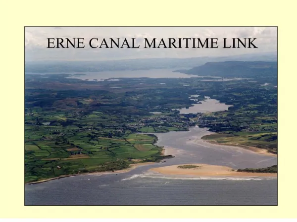

erne canal maritime link
E N D
Presentation Transcript
1. ERNE CANAL MARITIME LINK
5. Benefits Accruing
Generate 361 FTE jobs in water-based businesses and support services
Increase visitor numbers by 20% over ten years � worth �2.1 million annually
Increase market share of local tourism for Ballyshannon and Belleek
Development can function as a regeneration catalyst through integration with planning and investment framework for the local area Socio-Economic Assessment
6. Six Navigational Obstacles
Belleek Bridge and Weir
Cliff hydro station & tail race
Cathaleen�s Falls hydro station
Tail race, Cathaleen�s Fall Bridge & Ballyshannon Bridge
Tidal Erne Estuary
Sand bar at Tullan Strand
7. Obstacle 1: Belleek Bridge & Weir
9. Obstacle 2: Cliff Hydro station and tail race
12. Obstacle 6: Sand bar at Tullan Strand �Ballyshannon Bar Mouth Feasibility Study�
Recommended Option: new channel with training walls (�11m capital cost)
13. Recommended Alternative Route using Dry Boat Lift
(Obstacles 3 to 5)
16. Recommended options and costs:
Belleek Bridge and Weir: Diversionary Channel and Bridge Lock (�8M)
Cliff Hydro Station: Deep Lock with Vertical Lift Gate (�5M)
Dry Lifts at Lakeside Centre and Mall Quay (�6M)
Marinas at Mall Quay and Lakeside Centre (�2M)
Parallel Training Walls at Tullan Strand (�11M)
Dredging of channel etc (�1M)
17. Enviromental Impact Assessment
EIA was required in accordance with Schedule 5 of the Planning and Development Regulations 2001
The proposed development requires work to an inland waterway over a length exceeding 2.0km
Current Status:
Preliminary Environmental Impact Statement (EIS) issued in July 2006 to assist with funding application.
Currently liaising with An Bord Plean�la regarding scope of assessment prior to submission of planning application.
19. Landscape
The impact on landscape charter of each structure was evaluated using criteria developed by the Landscape Institute.
Belleek Bridge - Slight or No Impact
Cliff Generating Station - Substantial Impact (Positive)
Dry Boat Lifts: Assaroe Lake - Slight or No Impact
Erne Estuary - Substantial Impact
Tullan Strand & Estuary - Slight or No Impact
Scheme would not be out of character with the area considering the existence of the hydro stations.
Landscape Architects Conclusion
The project will have a positive and beneficial impact on the Landscape Character. Most of the proposed structures are in isolated sites away from major residential areas. There will be localised disruption during construction of each structure. The bridge crossing for the dry lift over the River Erne will have the greatest impact with site traffic accessing and leaving the site on to (old) N15 road.
Enviromental Impact Assessment
20. Surface Water
The River Erne is Ireland�s second largest river system - river area of 3,950 square metres and estimated total storage of 194 million cubic metres
Impacts during construction stage associated with:
Silting � from surface run-off and dredging of the estuary
Storage of chemicals � fuels and oils stored on site
No impacts during operational phase anticipated, as surface water run-off will comprise rainwater / storm water
Mitigation Measures
Monitoring of the suspended solids in the watercourse
Run-off from work area will be monitored and intercepted prior to entering the watercourse
All contractors will be trained in use of pollution prevention equipment and given emergency contact information
All chemicals and fuels on site to be stored within bunds
Enviromental Impact Assessment
21.
Geology / Hydrogeology/Geotechnology
The Ballyshannon Limestone formation is a regionally important aquifer
Rockhead near surface is considered suitable as a bearing stratum.
Site Investigation would be required, suitable foundations are likely to be Pad or Strip.
Impact during construction phase would be minimal as no groundwater will be abstracted during the site works and no discharges are intended to the soil or groundwater
There are not expected to be any operational impacts
Mitigation measures
Not intended to store hazardous materials during construction
All construction workers will be trained in handling substances and in the use of pollution prevention equipment
Enviromental Impact Assessment
23. Noise and Vibrations
Greatest impact will occur during the construction phase. Construction noise may exceed recommended limits occasionally
Vibration during construction may impact buildings <10m from piling locations.
Structural assessment may be considered prior to piling in these locations
Noise Survey for Wildlife undertaken: Construction noise would not be detrimental to wildlife and fish populations.
Target exposure levels set for plant associated with lifts and locks to ensure that installation housing provides required level of sound attenuation
Considered that noise during the operational phase will be insignificant
Mitigation measures
Use of new and well maintained plant machinery meeting EC guidelines
Constructions works should be timed to minimise impact upon migrating fish and birds during breeding periods Enviromental Impact Assessment
24. Ecological Assessment
Based on findings of field and desk study
Main potential impacts are dredging related and impacts associated with construction of structures including walls and channels. These sediment losses could affect flora and faunain the estuary and disturb birds, mammals and migratory fish. There would be a localised impact on habitats, loss of marginal woodland and disturbance of mammals
Scheme may have beneficial impacts for the migration of salmon and eels within the Erne catchment
Mitigation Measures
Restriction of dredging and river channel works so as not to coincide with fish or bird migrations
Dredging works should be undertaken with an agreed code of practice
Detailed assessment to take place of dredging and dump sites
Minimisation of the construction zone
Appointment of a landscape architect
Enviromental Impact Assessment
25.
Archaeology
Field inspection and desk study undertaken
County Development Plan does not indicate protected structures within the areas of proposed development. However, the area is considered archaeologically important.
Estuary Area has high potential to contain prehistoric archaeology and shipwreck remains, of which 22 are recorded. Dredging may have adverse impact on unrecorded deposits and artefacts.
Mitigation Measures -Further Investigation recommended:
Archaeological testing and monitoring by a licensed archaeologist suggested for each of the construction sites
Photographic record of bridge at Belleek
All ground disturbances should be monitored by a suitably qualified archaeologist.
Underwater archaeological assessment recommended in river area affected by boat lift adjacent to the Lakeside Centre and at the river crossing at Belleek.
Full provision should be made for resolution of any archaeological feature or deposits that may be discovered.
Enviromental Impact Assessment