Download
1 / 10
100 likes | 327 Vues
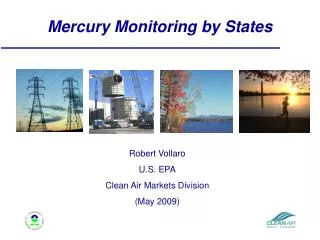
Increased Monitoring by States. Over the last 12 years, states have monitored fish in more and more of their waters. Where they find high levels of contaminants, they issue fish consumption advisories.

E N D
Increased Monitoring by States • Over the last 12 years, states have monitored fish in more and more of their waters. Where they find high levels of contaminants, they issue fish consumption advisories. • As a result, increases in advisories result primarily from increased sampling of previously untested waters by states and tribes and are not necessarily due to increased levels or frequency of contamination. • At the same time, EPA develops - and states implement - environmental regulations designed to reduce pollutant emissions into the waters, and we will continue to work to reduce emissions. • There were more advisories in 2004 than in 2003. This does not mean that contaminant levels in fish are increasing nationwide, but rather that states are doing more monitoring of their waterbodies.
2004 Advisory Listing The 2004 NLFA database lists 3,221 advisories in 48 states, the District of Columbia, the U.S. Territory of American Samoa, and 3 indian tribes. The number of waterbodies under advisory represents: • 35% of the Nation’s total lake acres (excluding the Great Lakes), or approximately 14,285,062 lake acres • 24% of the Nation’s total river miles, or approximately 839,441 river miles • 65% of the Nation’s contiguous coastal waters (excluding Alaska) including 92% of the Atlantic coast and 100% of the Gulf coast • 100% of the Great Lakes and their connecting waters. There were 31 states with statewide advisories in effect in 2004. Indiana reported one new statewide advisory in 2004. In addition, 2.4% of the Nation’s river miles and 18% of the Nation’s lake acres had safe eating guidelines in effect in 2004.
Bioaccumulative Pollutants Although current advisories in the United States have been issued for 36 different pollutants, most advisories involve five primary bioaccumulative contaminants: • Mercury2,436 advisories active in 2004 (up from 2,362 advisories in 2003) • PCBs873 advisories active in 2004 (down from 884 advisories in 2003) • Chlordane 79 advisories active in 2004 (down from 89 advisories in 2003) • Dioxins106 advisories active in 2004 (up from 90 advisories in 2003) • DDT and metabolites67 advisories active in 2004 (up from 52 in 2003). An increase in advisories issued by the states generally reflects an increase in the number of assessments of contaminants in fish and wildlife tissues.
Percentage of Lake Acres/River Miles Currently Under Advisory – 2004
Fish Consumption Advisories for Mercury NOTE: This map depicts the presence and type of fish advisories issued by the states for mercury as of December 2004. Because only selected waterbodies are monitored, this map does not reflect the full extent of chemical contamination of fish tissues in each state or province.
Number of Safe Eating Guidelines by State (2004) • Safe eating guidelines are issued to inform the public that certain species of fish from specific waterbodies have been tested and have been shown to contain low levels of contaminants. Guidelines can also be issued for all waterbodies in a state. • Safe eating guideline data should not be used for: • Characterizing geographic distribution of chemical contaminants • Making interstate or international comparisons. • Safe eating guidelines in the NLFA database are updated as new information is provided to USEPA's National Fish Contamination Program.
Number of Lake Acres Under Advisory for Various Pollutants – 2004
Number of River Miles Under Advisory for Various Pollutants – 2004
Percentage of River Miles and Lake Acres Under Advisory, 1993-2004