Download
1 / 38
380 likes | 1.33k Vues
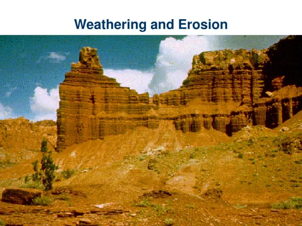
Parks Formed by Stream Erosion and Weathering (part 1) GRAND CANYON NATIONAL PARK ZION NATIONAL PARK Colorado Plateau relatively undeformed rocks surrounded by the highly deformed Rocky Mountains, and Basin and Range Provinces.

E N D
Parks Formed by Stream Erosion and Weathering(part 1) GRAND CANYON NATIONAL PARK ZION NATIONAL PARK
Colorado Plateau • relatively undeformed rocks • surrounded by the highly deformed Rocky Mountains, and Basin and Range Provinces. • The margins of the Colorado Plateau are marked by major volcanic accumulations • The major structures of the plateau include: • broad flexures, • monoclines, • vertical faults, • igneous laccoliths and volcanics • Salt tectonic features.
Stratigraphy of Colorado Plateau From Geology of the Colorado Plateau, 1999, Annabelle Foos, Geology Department, University of Akron
Grand Canyon NP - Vital Statistics • Northwest Arizona • Western Colorado Plateau • ~1,200,000 acres or 1,900 square miles
Native American History • ~1000 BC Evidence of Native American Hunters in caves, artifacts • Basket Making Native Americans • AD 1350 Pueblo culture (~500 sites) • Up to today, still home of three tribes • Navajo (east) • Hopi (east) • Havasupai (west) Photo: NPS
Human History (con’t) • 1540, Don Lopez de Cardenas • 1869, John Wesley Powell lead expedition of 4 wooden boats & 9 men down the Colorado River (again in 1871) • 1893 protected as a Forest Reserve • 1908 TR proclaimed the area a NM • 1919 established as Park
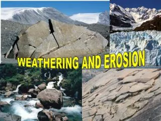
Geologic Features • Stream Erosion • Mass Wasting • Differential Erosion • Unconformities
Stream Erosion • Colorado River is 2nd longest river in US • Colorado River eroded Grand Canyon • Canyon is 217 miles long, 1 mile deep, up to 18 miles wide • Erosion began between ~5 million years ago • PANORAMIC VIEW OF THE GRAND CANYON FROM PIMA POINT ON THE WEST RIM DRIVE, GRAND CANYON N.P. NPS PHOTO.
Stream Erosion Colorado River Erosion mainly vertical VIEW DOWN THE COLORADO RIVER IN GRAND CANYON N.P. FROM NANKOWEAP IN MARBLE CANYON. MIKE QUINN, NPS
Mass Wasting • Movement of material downward due to gravity • Main process involved in widening canyon • Climate is arid; mechanical weathering; talus Photo: Mirsky
Differential Erosion • Responsible for rugged nature of cliffs • Caused by different degree of resistance to erosion • Resistant – cliffs – limestone, sandstone • Less resistant – slopes – shales • Unconformity: Buried erosion surface
Differential Erosion Kaibab SS Coconino SS Hermit Sh Supai Group Redwall Ls Bright Angel Sh Tapeats SS Photo: CD, HTT
Unconformities – PC/C nonconformity Tapeats Sandstone Vishnu Schist
Unconformities – PC/C angular unconf. Tapeats Sandstone Grand Canyon Series
Geologic History – Pre-Cambrian • 2,000 mya marine sediments and volcanic rocks (since metamorphosed into Vishnu Schist) and • 1,700 mya folding, faulting, intrusions(Zoroaster Granite) • 1,000 mya sea transgressed and deposited Grand Canyon Series • Mountain building, then erosion to low hills
Geologic History – Paleozoic • Cambrian – Sea transgresses again • Tapeats Sandstone • Bright Angel Shale • Ordovician, Silurian – no rock record • Devonian Temple Butte Limestone
Geologic History – Paleozoic • Mississippian • Redwall limestone - marine • Pennsylvanian • Supai formation – lower part marineupper part non marine, with reptile tracks • Permian – near shore alternating • Hermit Shale – non-marine, more tracks • Coconino sandstone – dune sand, x-beds • Toroweap formation – marine • Kaibab limestone – top cliff, marine
Geologic History – Mesozoic • Thousands of feet of sediment deposited, but mostly eroded away from GC area • Rock of this age to north (Zion, Bryce), east (Painted Desert, Black Mesa) and remnants near Grand Canyon at Cedar Mt.
Geologic History - Cenozoic • Miocene – Ancestral Colorado River flowed over lowlands with little elevation • Pliocene – beginning of uplift of Colorado Plateau (continues to present) • Mid-Pliocene – Colorado River entrenchment begins ~4-6 mya
Geologic History – Pleistocene to Today • Colorado River cut quickly through Pz sed • Inner Gorge cut more slowly • River only removes material in its channel • Mass wasting delivers sediment to river • Faulted areas form tributary valleys
Zion National Park Cliffs of Navajo Sandstone
Vital Statistics • Southwest Utah • Western Colorado Plateau • 147,000 acres or 230 square miles • 1909 Monument (by TR) • 1919 National Park • Expanded in 1937 & 1956
Later Human History • ~ AD 500 Basket Maker Culture Native Americans • Later, Piute tribe • 1776, Don Lopez de Cardenas • 1872, John Wesley Powell lead expedition and named the area Mukuntuweap • 1909 TR proclaimed the area a NM as Mukuntuweap NM • 1918 name changed to Zion NM • 1919 established as Park
Geologic Features • Stream Erosion & Mass Wasting • Structural Control • Weathering • Arches
Stream Erosion & Mass Wasting • Virgin River has gradient of ~60 ft/mi • Mass wasting widens Zion Canyon • Sapping by springs creates overhangs • Tributaries – less water, left hanging
Structural Control • Rectangular stream pattern – fractures • Columns and Pyramids • Vertical fractures encourage vertical cliffs • Rapid downcutting through soft sandstone leaves deep, narrow canyons • Bedding planes also act as plane of weakness
Structural Control • Rectangular stream pattern – fractures • Columns and Pyramids • Vertical fractures encourage vertical cliffs • Rapid downcutting through soft sandstone leaves deep, narrow canyons • Bedding planes also act as plane of weakness
Structural Control - Columns and Pyramids Cliffs of Navajo Sandstone • Rectangular stream pattern – fractures • Columns and Pyramids • Vertical fractures encourage vertical cliffs • Rapid downcutting through soft sandstone leaves deep, narrow canyons • Bedding planes also act as plane of weakness Great White Throne
Structural Control • Rectangular stream pattern – fractures • Columns and Pyramids • Vertical fractures encourage vertical cliffs • Rapid downcutting through soft sandstone leaves deep, narrow canyons • Bedding planes also act as plane of weakness
Structural Control - Bedding planes also act as plane of weakness Checkerboard Mesa Navajo Sandstone • Rectangular stream pattern – fractures • Columns and Pyramids • Vertical fractures encourage vertical cliffs • Rapid downcutting through soft sandstone leaves deep, narrow canyons • Bedding planes also act as plane of weakness
Weathering • Rock color from iron oxide • Frost wedging • Acid dissolves calcium carbonate cement • Arches – example Kolab Arch Kolab Arch
Stratigraphy of Colorado Plateau From Geology of the Colorado Plateau, 1999, Annabelle Foos, Geology Department, University of Akron
Geologic History • Permian – Kaibab limestone – shallow sea • Triassic – • arid near-shore • Uplift and some volcanic ash • Fossils fresh water fish, clams, snails, amphibians, wood, dinosaur tracks
Geologic History – Jurassic • Navajo Sandstone – arid climate with sand dunes (up to 2000 ft thick) • Forms the White Cliffs • Frosted, fine-grained, quartz sandstone • Cross-bedded • Capped by marine Carmel Formation Navajo Sandstone
Geologic History – Cretaceous and Cenezoic • Cretaceous (End of Mz) – erosion • Lt. Miocene (~13mya) block faulting • Tilted • Uplifted – increased river gradient, rejuvenated stream erosion, carved Zion Canyon