Download
1 / 25
250 likes | 860 Vues
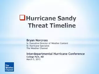
Hurricane Readiness Timeline Tools Paul Hastings ImpactWeather, Inc. (877)792-3225 phastings@impactweather.com Two Basic Strategies of Hurricane Plans: Maintain Continuity of Operations Provide for an orderly, safe, and appropriate shut-in of operations

E N D
Hurricane Readiness Timeline Tools Paul Hastings ImpactWeather, Inc. (877)792-3225 phastings@impactweather.com
Two Basic Strategies of Hurricane Plans: Maintain Continuity of Operations Provide for an orderly, safe, and appropriate shut-in of operations
Characteristics of most successful hurricane plans: Most utilize a phased escalation process Complexity and costs increase with escalation Designed and driven by risk management mindset
Strategic Question: How to objectively trigger escalation from one Phase to the next?
New TropicsWatch tools for 2006 that can serve as communications tools & escalation triggers: HRI – Hurricane Risk Indicator WCS – Worst Case Scenario HSI – Hurricane Severity Index PWI – Probability of Wind Impact
Hurricane Risk Indicator • Alerts you to a possible hurricane threat at your location (within next 6 to 10 days) • Uses a simple on/off indicator • Early warning • For storms before they develop • For storms that will take more than 5 days to reach your area
When is the earliest tropical storm force winds could arrive? Allows you to see how much time you have for different phases of preparation / shutdown Assumes by default: storm movement is directly toward your location Forward speed = maximum forecasted Intensity = maximum forecasted Wind Field Size = maximum quadrant applied to all quadrants Worst Case Scenario
Worst Case Scenario – Graphical Output Arrival times for 25, 39, 58, 74, 100 mph, max winds, and center of storm
What Was Katrina’s Saffir-Simpson Classification at Landfall? Category 3 Hurricane Katrina 3:15PM CDT Sun. Aug. 28
HSI – Hurricane Severity Index Useful in timeline scenarios for factoring in the response by the community to a hurricane threat
Hurricane Severity Index (HSI) A new way for classifying hurricanes that takes into consideration more than just maximum surface winds: • Size (1-25 points) • Examines the total coverage of the 35+, 50+, 65+, and 87+ knot wind fields • Intensity (1-25 points) • Points assigned using the exponential relationship between wind speed and the force exerted on an object The Result: A 50-point scale that better represents a tropical cyclone’s true destructive potential – the Hurricane Severity Index (HSI) Developed by:Chris Hebert and Bob Weinzapfel
Severe DamageLarge Area Saffir-Simpson Category MinimalDamageSmall Area
Same Intensity Saffir-Simpson Category
PWI – Probability of Wind Impact PWI displays the probability of a given location receiving a certain threshold of wind. Probabilities are generated for 5 wind fields: 25 mph 39 mph 58 mph 74 mph 100 mph
Gaussian or “Normal” Distribution Curve 50% 50% Forecast Track in Center 75% Cone Area
72 Hours From LandfallConfidence Average / Larger Cone74 mph Wind Radius Indicated
48 Hours From LandfallConfidence High / Smaller Cone74 mph Wind Radius Unchanged
Probability of Wind Impact – Corpus Christi, TX Rita - Advisory 24 - Valid Fri, Sep 23 9PM CDT - hours before landfall
Probability of Wind Impact – Port Arthur, TX Rita - Advisory 24 - Valid Fri, Sep 23 9PM CDT - hours before landfall
1995 - 2005 185 NS / 90 H / 45 IH / 6 Cat 5
Questions? Paul Hastings ImpactWeather, Inc. (877)792-3225 phastings@impactweather.com
![Romanticism [792-794]](https://cdn0.slideserve.com/1448821/slide1-dt.jpg)


![640-792 Exam Dumps - Preparation with 640-792 Dumps PDF [2018]](https://cdn4.slideserve.com/7922501/cisco-640-792-exam-dt.jpg)
![640-792 Exam Dumps - Get 640-792 Dumps PDF [2018]](https://cdn4.slideserve.com/7922572/cisco-640-792-exam-dt.jpg)