Download
1 / 36
360 likes | 706 Vues
FHWA Road Weather Management Program Overview and Update. Roemer M. Alfelor Office of Operations Federal Highway Administration I-80 Corridor Coalition Meeting January 26, 2010. Road Weather Management. Day-to-day operations to manage the system under all types of weather

E N D
FHWA Road Weather Management Program Overview and Update Roemer M. Alfelor Office of Operations Federal Highway Administration I-80 Corridor Coalition Meeting January 26, 2010
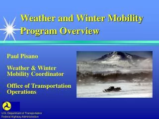
Road Weather Management • Day-to-day operations to manage the system under all types of weather • “Anytime, anywhere road weather information” is the program’s mission • This includes current and predicted information about weather’s affect on roads… • … and the decision support tools to aid road users and operators to make effective decisions, e.g., • When to pre-treat roads for snow & ice control • When to post traveler advisories (fog, floods, rain, snow, etc.)
Weather Impacts on Transp. System • Safety • Approx 1.6M weather-related crashes, 673K injuries, 7K fatalities per year • Mobility • About 25% of non-recurring delays on freeways is due to weather • Congestion costs about $9.5B/yr. for 85 urban areas • Productivity • Weather-related delays add about $3.4B/yr. to freight costs • Environment • Chemicals used for anti-icing affect watersheds, air quality and infrastructure
RWM Program Highlights • The Clarus Initiative • IntelliDriveSM & Weather • MDSS • Weather Responsive Traffic Management • ITS Strategic Plan
What is the Clarus Initiative? • A database management system for all surface transportation weather observations in North America • One database removes borders • Provides advanced quality checking for both atmospheric & pavement data • Includes extensive metadata • Easy access via web portal & subscription • Once development completed, transfer to NOAA for operations
Clarus Development Milestones Connection Incentive Program Proof of Concept Evaluation Quality Checking Task Force System Design Description Regional Demo Completed RFA ConOps Deliverables Detailed Req Task Force Hi Level Req Task Force Update QCh Algorithms Begin Clarus Initiative Critical Design Review ICC #1 Oklahoma City Metadata Task Force Phase 3 RFP Posted NOAA/NSWOS FOC NOAA/NSWOS IOC ICC #2 Las Vegas Regional Demo Phase1 QCh Algorithm Development Regional Demo Phase 2 Regional Demo Phase 3 2005 2008 2004 2006 2007 2009 2010 2011 ICC #8 TBD RFA Solicitation ICC #6 Reno, NV ICC #5 Kansas City ICC #3 Salt Lake City Award RFA for ConOps ICC #4 Washington DC Proof of Concept Site Visits Award System Design Contract Concept of Operations Published Proof of Concept State Selection Regional Demo Phase 3 Awarded ICC #7 September, Charlotte, NC Hi Level Requirements Document Regional Demo Eval Task Awarded Begin Clarus Concept of Operations “Where the Weather Meets the Road” Multi-state Regional Demo ConOps Design PoC Transition to NOAA
Clarus System Data Flows Environment Canada RWIN Server State DOT GPS/AVL State DOT RWIS Server VII Probe- Based Data State DOT RWIS Server State DOT RWIS Server Collector Services • Observations • Metadata • Quality Flags Quality Checking 7 Day Data Cache Web Portal Metadata Cache The Clarus System Nationwide Data Management System for Surface Transportation Environmental & Pavement Condition Observations
Participation Status for Clarus as of July 31, 2009 Canadian RWIN Participation Local DOT Participation City of Indianapolis, IN McHenry County, IL City of Oklahoma City, OK NY State Thruway City of Denver, CO Washington, DC Clarus Connection Status Pending (4 States, 2 Locals) Considering (6 States, 1 Local) Connected (32 States, 3 Locals, 3 Provinces) Partially (2 States) Sensor & Station Count 1,897 Sensor Stations (ESS) 42,149 Individual Sensors
Clarus Regional Demonstration5 Use Case Scenarios • Enhanced Road Weather Forecasting Enabled by Clarus • Seasonal Weight Restriction Decision Support Tool • Non-winter Maintenance & Operations Decision Support Tool • Multi-state Control Strategy Tool • Enhanced Road Weather Content for Traveler Advisories State Transportation Agency Partners
What is IntelliDriveSM? • IntelliDriveSM is a suite of technologies and applications that use wireless communications to provide connectivity: • With and between vehicles • Between vehicles and roadway infrastructure • Between vehicles, infrastructure and wireless consumer devices . . . In order to achieve strategic goals in Mobility, Safety,and Convenience. 11
Vehicle-based Probe Data Accelerometer Data (steering & yaw) Windshield Wiper State & Speed Barometric Pressure GPS Position, Heading, Elevation & Vehicle Speed Brake Status & Boost Headlight Status External Air Temperature Anti-lock Braking System Vehicle Traction Control Vehicle Stability Control Tire Pressure
RWM Research Objectives • To determine the value of vehicle probe data in improving road weather services • Can vehicle-based data tell us the road weather conditions? • Is the probe data of sufficient quality? • What are the minimum # of samples and minimum sampling period per road segment to get valid results? • To develop a Vehicle Data Translator (VDT) • Parse and filter probe data • QC probe data • Disseminate quality checked probe data (‘weather’ elements) • Generate statistically valid weather & road condition information per road segment
Initial Focus of Weather Research • Air temperature • Barometric pressure • Precipitation occurrence (yes, no) • Precipitation intensity (none to heavy) • Precipitation type (liquid, frozen) • Pavement condition (slippery yes/no) • Fog (likely, not likely)
Maintenance Decision Support System MDSS is a winter maintenance decision-support system that combines: • Advanced weather prediction • Advanced road condition prediction • Rules of practice for anti-icing and de-icing The system generates winter treatment recommendations on a route-by-route basis.
MDSS Participation State DOT Participation in Maintenance Decision Support System (MDSS) 2000-2009 US & Intl Stakeholders who participated in Annual Meetings Ontario Ministry of Transportation City & County of Denver CO. Environment Canada New York State Thruway Authority City of Grand Prairie Texas Austrian Road Authority Dallas Area Rapid Transit E-470 Highway Authority Colorado City of Virginia Beach DPW McHenry Cnty IL, Division of Transportation
MDSS Updates • Switched road temperature forecast model to METRo (Model of the Environment and Temperature of Roads) • Integrated support for fixed & mobile camera imagery • New alerting system for near term road weather hazards • Provide an archive playback for forecasts & treatment recommendations
MDSS Updates • Incorporating AVL animation & playback support • Improved Graphical User Interface • Web-based access to updated software • Federal Prototype Release 5.1 available (software & documentation) • Open System/Open Source available to any interested party
MDSS Outreach Update Publication #: FHWA-JPO-08-059 EDL Number: 14439
FHWA – City of Denver MDSS Benefit/Cost Annual snow budget ~$4.3M 2007/2008 savings ~$250k (5%) Preliminary B/C ratio 4:1 monetary only from crew costs materials not included LOS benefits, harder to quantify
Weather Responsive Traffic Management • Goals: Develop strategies and tools to help agencies effectively manage traffic and highway operations during inclement weather. • WRTM Strategies: • Advisory • Control • Treatment
WRTM Activities • Integration of Weather in TMC/TOC • Weather and Traffic Flow Studies
Weather Integration in TMC/TOC • Objectives: • Document existing practices, needs, opportunities and challenges associated with TMC weather integration • Assist TMC’s with their weather integration activities • Progress to Date: • Completed a State of the Practice Study on TMC Weather Integration(2006) • Developed a Weather Integration Self-Evaluation and Planning Guide (2008) • Manual and Electronic Versions • Downloadable from FHWA Website • Worked with 2 TMC’s (Sacramento and Milwaukee) in evaluating the guide and developing Wx integration plan. • Currently working with 6 TMC’s
Major Elements of the Guide • TMC team evaluates their needs and opportunities for enhanced weather integration • Identify weather conditions • Understand weather impacts • Identify TMC needs for weather information • An electronic version of the Guide sorts through the information provided by the TMC and identifies potential integration strategies • TMC develops a practical weather integration plan to implement those strategies
Next Steps • Working with the Sacramento RTMC to implement their plan • Working with 6 TMC’s to conduct self-evaluation and develop integration plans • Louisiana (4 TMC’s) - Wyoming (Cheyenne) • Colorado Springs - Redding, CA • Kansas City • Evaluate and Update the Guide
Weather and Traffic Flow Studies • GOALS • Analyze and quantify how various weather events impact traffic flow (macro & micro levels) • Improve existing knowledge and practices on managing traffic flow under adverse weather conditions
Empirical Study on Weather & Traffic • Develop weather-sensitive traffic flow models using empirical weather and traffic data • Progress to date: • Completed and published in 2007 • Developed capacity and speed adjustment factors for rain and snow • Final report available from FHWA website
Microscopic Analysis of Weather and Traffic • Analyze car following, lane changing and gap acceptance behavior during inclement weather, and develop models to incorporate in existing micro-simulation tools • Progress to Date: • Final Report for Phase 1 completed and available from FHWA website • Car following – developed models (snow), calibrated on arterial • Gap Acceptance – developed models for intersection (rain) • Lane Changing – theoretical model exists, no data for calibration • Follow-on work to develop new models and validate existing ones
Incorporating Weather Impacts in TrEPS • Traffic Estimation and Prediction Systems (TrEPS) • Update existing dynamic traffic assignment models (real-time & off-line) to account for weather effects • Progress to Date: • Completed and published on FHWA website • Literature on traffic response to weather and Wx responsive traffic management strategies • Review of DynaSMART and DynaMIT models - parameters that can be adjusted for weather • Incorporated weather impacts in DynaSMART-P
Human Factors Analysis of Weather Advisory and Control Information • Review, evaluate and recommend strategies for improving existing road weather messages and dissemination methods • Progress to Date: • Identified traveler requirements for Wx information and reviewed current practices • Reviewed and proposed methodology for evaluating the effectiveness of Wx information and dissemination methods • Developed research plan, including framework for road weather message design tool • Development of design tool in progress
Other WRTM Activities Data Mining and Gap Analysis for WRTM • Conduct a comprehensive search, analysis and documentation of data that exists for traffic and weather analysis • Collect additional field data to develop traffic models Developments in WRTM Strategies • Update state-of-practice review on WRTM strategies • Identify potential improvements in WRTM strategies using recent knowledge/models/information (e.g., signal control, advisory messages, ramp metering, …) • Conduct field testing and evaluation of advanced WRTM strategies Weather Module for the Traffic Analysis Tool (TAT) Program
Contact Info: Roemer Alfelor FHWA Office of Operations (202) 366-9242 roemer.alfelor@dot.gov http://ops.fhwa.dot.gov/Weather/index.asp