Download
1 / 22
220 likes | 424 Vues
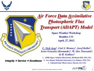
A ir Force D ata A ssimilative P hotospheric Flux T ransport (ADAPT) Model. Space Weather Workshop Boulder, CO April, 27, 2012. C. Nick Arge 1 , Carl J. Henney 1 , Josef Koller 2 , Irene Gonzalez-Hernandez 3 , W . Alex Toussaint 3 , & H . Godinez 2

E N D
Air Force Data Assimilative Photospheric Flux Transport (ADAPT) Model Space Weather Workshop Boulder, CO April, 27, 2012 C. Nick Arge1, Carl J. Henney1, Josef Koller2, Irene Gonzalez-Hernandez3, W. Alex Toussaint3, & H. Godinez2 AFRL/Space Vehicles Directorate, Kirtland AFB, NM, USA Los Alamos National Laboratory, Los Alamos, NM, USA National Solar Observatory, Tucson, AZ, USA
Carrington Global Solar Maps Motivation: The global solar photospheric magnetic field distribution serves as primary input to all coronal and solar wind models. Time • “Traditional” Carrington maps typically: • Remap line-of-sight full-disk magnetograms into heliographic coordinates with the assumption that the magnetic field is radial. • Employ a “solid body” rotation rate of 27.2753 days. This blurs feature position & time as additional images are included in the synoptic map. • Weight the merged data to minimize the spatial blurring. For example, cos4, to give more weight to the central meridian. Carrington rotation 1 starts from November 9, 1853.
Air Force Data Assimilative Photospheric Flux Transport (ADAPT) Model • ADAPTcombines the National Solar Observatory (NSO) solar photosphericmagnetic field flux transport model with rigorous data assimilation methods developed at Los Alamos. ADAPT Method Old Method • Result: Improved, high quality “snapshots” of the Sun’s global magnetic field as input for coronal and solar wind models
Flux Transport Model Overview: The ADAPT flux transport model (Arge et al. 2009 & 2010) is based on Worden & Harvey (2000), which accounts for known flows in the solar photosphere. The modified Worden & Harvey (WH) model used with ADAPT includes: (1) Differential rotation (2) Meridional flow Ppole=36 d Peq=25 d (3) Supergranular diffusion (4) Random flux emergence (5) New observation data assimilation (6) An ensemble of solutions representing the model parameter uncertainties
Data Assimilation Overview: • The ADAPT data assimilation method used with the Warden-Harvey model is the Los Alamos National Laboratory (LANL) data assimilation framework which is an efficient and flexible data assimilation code using either an ensemble least squares or Kalman filter technique. Ensemble Least Squares (EnLS) estimation method: • Method used during initial testing and development. • Takes into account both model and data errors. • Does not consider spatial correlations. Ensemble Kalman filter (EnKF) method: • Recursive algorithm that automatically takes into account past correlations between different regions of the photosphere. • Incorporated a Local Ensemble Transform Kalman Filter (LETKF) into the model given the unique properties of solar magnetic field observations.
Ensemble Kalman Filter (EnKF) vsLocal Ensemble Transform Kalman Filter (LETKF) Ensemble Kalman Filter (EnKF) Local Ensemble Transform Kalman Filter (LETKF) Sample ADAPT map with the standard EnKF implementation (top image). The effects of the spurious correlation are clearly visible (particularly at the poles) in the small spatial scale mixed polarity noise. The bottom image is an ADAPT map using the new LETKF implementation.
The Inclination of the Sun’s Axis to the Ecliptic Impacts Measurements of the Photospheric Field The Sun’s rotational axis is inclined 7.25°to the ecliptic. 7.25° Sun Earth March (North polar field not observed) September (South polar field not observed) The Polar Fields are NOT observed for extend periods of time. Coronal models are very sensitive to the values of the polar fields.
Polar Field Comparison Comparison between the observed mean polar magnetic field values from Mount Wilson Solar Observatory (MWO) magnetograms [dots] with 1-sigma error bars and ADAPT [lines] mean ensemble values.
WSA Model Schatten Current Sheet Model PFSS Model 5-30 Rs Solar Wind Model (e.g., WSA 1D Kinematic model, ENLIL, HAF, LFM-Helio) (5-30Rs to 1AU) 2.5 Rs Source Surface Outer Coronal Boundary
STEREO EUVI Observations Compared with WSA Coronal Hole Predictions Using SOLIS & ADAPT Maps NSO/SOLIS ADAPT 2009/10/15 STEREO/EUVI 2009/10/22 STEREO B STEREO A ADAPT Derived Coronal Holes ADAPT STEREO/EUVI STEREO B STEREO B STEREO A STEREO A STEREO A STEREO B STEREO B STEREO A
WSA Model Results for CR2089 Using ADAPT as the Model Driver WSA Solar Wind Predictions vs. Observations (STEREO B) Solar/Coronal Evolution Coronal Field Photospheric Field (ADAPT) Using ADAPT Maps ADAPT Using Traditional NSO Maps NSO Coronal Holes Arge, C. N., J. G. Luhmann, D. Odstrcil, C. J. Schrijver, & Y. Li, Stream structure and coronal sources of the solar wind during the May 12th, 1997 CME, JASTP, 66, 1295–1309, 2004 Arge, C. N., C. J. Henney, J. Koller, W. A. Toussaint, J. W. Harvey, & S. Young, Improving Data Drivers for Coronal and Solar Wind Models, in ASTRONUM 2010, ASP Conference Series, 44, 99, 2011
Incorporating Far-side Observations into ADAPT Far-side data assimilation requires a realistic estimation of the: magnetic field strength and uncertainty. position & uncertainty (i.e., how reliable is the current result for this lat. & long.) • Without far-side data, space weather forecasting models are reliant on the persistence& recurrence of past observations. • We are now in the process of incorporating far-side observations into the ADAPT model. Using Helioseismology to detect far-side Active Regions NSO/GONG Far-side Map
Forecasting Solar Indices Developed a new method to forecast the solar 10.7 cm radio flux using solar magnetic flux transport with ADAPT. Correlations of .97 & .95 are found for 1-day & 3-day empirical model forecast. Method can be expanded to forecast other space weather parameters, e.g. EUV & TSI. Preliminary results published in Space Weather Journal. ADAPT 1-day (diamond) & 3-day (plus-sign) F10.7 forecast values, from ADAPT global magnetic maps, compared with the adjusted F10.7 (solid line). Data shown for April through June 1999. Henney, C. J., W. A. Toussaint, S. M. White, & C. N. Arge, Forecasting F10.7 with solar magnetic flux transport modeling, Space Weather, Feb. 2012.
Simulating an Earth-directed CME using the WSA+Enlil+cone model Ensemble CME Arrival Time Predictions (Note ~100km/s discrepancy between observed and modeled background solar wind ) • Propagation of the CME through the background solar wind (ecliptic view) Arrival of CME to Earth Arrival of CME to Earth Radial speed Radial speed Spread in predicted arrival times is ~13 hours Spread in predicted arrival times is ~13 hours Density Density Bmagnitude Earth-directed CME • WSA/Enlil+conemodel results (colors) for the solar wind radial speed, density, and magnetic field magnitude compared to observations (black). Bmagnitude blank Density (cm-3) Lee, C. O., C. N. Arge, D. Odstrcil, G. Millward, V. Pizzo, J. M. Quinn, & C. J. Henney, Ensemble modeling of CME propagation, Solar Physics, Apr. 2012.
Summary & Next Steps • Tested and using ADAPT maps • in coronal and solar wind models (e.g., WSA, WSA+Enlil+Cone, & MAS). • to forecast F10.7. • ADAPT can reproduce the long term behavior of the Sun’s polar magnetic fields. • Incorporating helioseismic far-side active region data into the ADAPT model. • Modified ADAPT to use a Local Ensemble Transform KalmanFilter (LETKF). • testing this more thoroughly. • parallelizing the code so that it runs more quickly when using LETKF. • Investigate & characterize the large spatial scale magnetic flows (e.g., meridional flow rates) over solar cycle time scales. • Validate ADAPT by comparing • model evolved fields with observed fields over different time scales (i.e., days, months, & years). • modeled (e.g., WSA) coronal holes & solar wind with (disk/in situ, respectively) observations. • Test ADAPT maps in time-dependent models of the corona and solar wind. • Partnering with NSO to host ADAPT for the purpose of making GONG & SOLIS ADAPT maps readily available to the community.
Acknowledgements & References Acknowledgements: • This work is partially supported by the AFOSR and NASA. The SOLIS/VSM magnetogram data used here were produced cooperatively by NSF/NSO and NASA/LWS. The EUVI data were produced by an international consortium of NRL (USA), LMSAL (USA), GSFC (USA), RAL (UK), UB (UK), MPS (Germany), CSL (Belgium), IOTA (France), & IAS (France). STEREO is a project of NASA.
Data Assimilation with EnLS • New observations are data assimilated using an ensemble least-squares (EnLS) estimation method:Xa= Xf + ω(y – H(Xf) ),whereXa, Xf, ωandyrepresent, respectively, the analysis, model forecast (background), weight, andobservationvalues. The weight, ω, is defined as:ω = σf2/ (σf2 + σy2),whereσf2and σy2are the variances of the model ensembleand observed data respectively. • To account for new active region flux emergence, the model variance is increased, such thatω ranges from 0.7 to 0.9, for spatial regions where: • the observed flux value is greater than 100 Gauss, and • the absolute value of the innovation, | y – H(xf)|, is greater than 5 times (σf+ σy), where H is the observation operator (i.e., zero unless obs).
NSO/SOLIS Need Centered NSO Photospheric Field Earth Need Centered NSO Need Centered NSO EARTH
WSA Coronal Maps for STEREO A & B using SOLIS Updated and ADAPT Photospheric Maps 2009/10/15 NSO/SOLIS ADAPT R = 5Rs R = 5Rs R = 5Rs STEREO A Coronal Field ADAPT R = 5Rs R = 5Rs R = 5Rs STEREO B ADAPT Coronal Field ADAPT
Far-side: ensemble example Realizations from an example (3/17/2011) far-side ensemble: Since the ensemble variance represents the uncertainties, the realizations can be added directly to the normal ADAPT ensemble. Note each far-side “candidate” active region is forced to have a mean of zero.
Abstract Global estimates of the solar photospheric magnetic field distribution are critical for space weather forecasting. These global maps are the essential data input for accurate modeling of the corona and solar wind, which is vital for gaining the basic understanding necessary to improve forecasting models needed for Air Force operations. We are now testing the global photospheric field maps generated by the Air Force Data Assimilative Photospheric flux Transport (ADAPT) model as input to the WSA coronal and solar wind model. ADAPT incorporates the Los Alamos National Laboratory data assimilation methodology with a modified version of the Worden and Harvey photospheric magnetic flux transport model. The ADAPT maps provide a more instantaneous snapshot of the global photospheric field distribution compared to traditional synoptic maps. In this poster, we make a detailed comparison of WSA coronal and solar wind model output with STEREO EUVI disk observations and in situ plasma observations from the STEREO and ACE spacecraft. The current orbital configuration of the two STEREO spacecraft is such that they provide a nearly instantaneous global snapshot of the Sun’s coronal hole distribution. In addition, the STEREO observations along with those from the ACE spacecraft provide three widely spaced ecliptic locations at ~1 AU to sample the solar wind plasma. In combination, these differing observations from multiple spacecraft provide a unique and highly sensitive test of the ability of the WSA model to capture the global coronal hole and solar wind structure. This is done using both ADAPT and standard updated photospheric field maps as input to the model.