Download
1 / 7
70 likes | 221 Vues
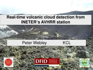
Real-time volcanic cloud detection from INETER ’ s AVHRR station. Peter Webley KCL. AVHRR Real time Volcano Monitoring Project. Objectives Improve geological and geotechnical hazard avoidance capacity Improve capacity for low cost, rapid hazard, risk and vulnerability assessment

E N D
Real-time volcanic cloud detection from INETER’s AVHRR station Peter Webley KCL
AVHRR Real time Volcano Monitoring Project • Objectives • Improve geological and geotechnical hazard avoidance capacity • Improve capacity for low cost, rapid hazard, risk and vulnerability assessment • Development systems for maintaining and improving national geoscience information • Assess the capability of remote sensing for enhancing operational volcano monitoring • Incorporates both geophysical and social science components
AVHRR Real time Volcano Monitoring Project • Accomplishments • Installation of the AVHRR receiving station • Provided the software to allow the INETER staff to capture the data in real time • Designed and installed automated capture and analysis system • Carried out extensive case studies into the application of AVHRR to monitor and detect thermal volcanic activity • Designed analysis system to monitor volcanoes in Nicaragua, Guatemala, El Salvador and Costa Rica • Development of web based interface for data download and thermal monitoring • Multi-National Workshop in Nicaragua during March 2004 • Developments • Thermal fingerprint to detect eruption • E-mail alert system • Assessment of operational use of system • Ash cloud monitoring system
AVHRR Receiving Station • Swath area : 2000 km * 2000km • 6 - 8 satellite passes per day • Data • 5 Spectral Channels • Measuring Reflectance and Temperature • At 1.1 km resolution at nadir • Analysis • Use T4– T5 for ash cloud test • Provide time series of important data
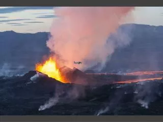
Fuego Volcano • 3763 m elevation (12,346 feet) • Latitude: 14.473°N (14°28'22"N) • Longitude:90.880°W (90°52'49"W) • One of Central America’s most active volcanoes • January 8th– 9th 2004 eruption
Use of Remote Sensing data at Fuego • Initiated on the 8th, CONRED’s Early Warning Alert System passed from Yellow(Fuego’s perpetual state since May 1999 reactivation of activity) to Redin the moment of the eruption. • The local observers were prepared to make evaluations and proceed to safety—without the benefit of an early warning emitted by CONRED. It was the observers that notified CONRED of the dangerous situation—not the reverse. • Both the local observers and CONRED staff agree usefulness • “If the eruption had occurred on a cloudy night, the villagers may not have been able to observe the lava flow and its direction, leaving them without sufficient time to evacuate. In that case, an early warming from CONRED could be critical” • CONRED scientists express desire to work on establishing an activity baseline for Fuego based on observations, seismic record and AVHRR data. • “Could provide a larger window of opportunity for prediction” • “May help alleviate the cloud cover problem experienced both by the observers and the analysts of AVHRR data” • “Re-examination of the AVHRR data for the previous eruptions with recent periods of heightened activity that did not result in eruption may be of benefit”
Overview of Practical • Fuego eruption in January 2004 • Use of ENVI • T4– T5 < 0 method • Ash detection and cloud size and length measurements • Georeferenced image generation