Download
1 / 18
210 likes | 527 Vues
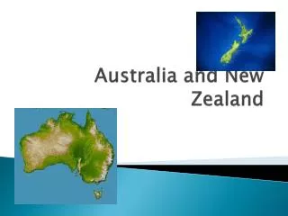
AUSTRALIA and NEW ZEALAND. GEOGRAPHY 200 DR. STAVROS COSTANTINOU. Australia and New Zealand: Location and Size. Australia occupies a peripheral location relative to the world land masses. It is surrounded by ocean. Australia is located between 11 º S and 44º S.

E N D
AUSTRALIA and NEW ZEALAND GEOGRAPHY 200 DR. STAVROS COSTANTINOU
Australia and New Zealand: Location and Size • Australia occupies a peripheral location relative to the world land masses. • It is surrounded by ocean. • Australia is located between 11º S and 44º S. • The distance between the United Kingdom and New Zealand via Singapore and Suez is about 21,400 km. (13,300 mi.); via the Cape of Good Hope, about 20,112 km. (12,500 mi.); and via Panama, about 17,700 km. (11,100 mi.). • In the days of sailing ships the distance of 21,400 km. (13,300 mi.) represented a trip of six months duration. • To the British, the location became a resource and Australia became the dumping ground for social undesirables. The cities of Sydney and Brisbane were originally penal colonies.
Australia: Landforms • Caledonian Remnants: These highland formations extend along the east coast from Cape York to southern Tasmania in a belt from 161 km. (100 mi.) to 402 km. (250 mi.) wide. They seldom reach elevations of 1000 m. (3000 ft.). Their highest summit, the highest point in Australia, is Mount Kosciusko, which attains only 2195 m. (7316 ft.). This is the only area of Australia which does not experience a considerable period of draught each year. • Gondwana Shield: This is a very extensive area that occupies the interior of Australia and is very dry. The Great Australian Desert is part of this area.
Australia & New Zealand : Landforms • Sedimentary Cover (Outside Shield Exposures): This is a low elevation area that covers significant portions of the coastal part of the country and the Murray Basin and Great Artesian Basin, and the Perth Lowland. • Rift Valley: This is an area of rifted valley around the city of Adelaide. • Alpine System: This is a chain of mountains that extends from the North to the South Island of New Zealand, where the Southern Alps reach 3,754 m. (12,316 ft.) in elevation. • Great Barrier Reef: This coral reef stretches fro more than 2,028 km. (1,260 mi.) and parallels the coast of Queensland. It acts as a barrier between the open ocean and the sheltered lagoon between the reef and the coast.
Australia and New Zealand: Climate • On the basis of climate, Australia may be subdivided into four major natural regions: • The humid Eastern Highlands • The tropical savannas of northern Australia • The "Mediterranean" lands of southwestern and southern Australia, • The dry interior.
Australia and New Zealand: Climate • Marine west coast (Cfb) climate predominates in the eastern highlands section of Australia and in New Zealand. South of Sydney and at higher elevations to the north the climate is commonly classified as humid continental, despite the location. North of Sydney higher summer temperatures change the classification to humid subtropical, while still farther north, beyond approximately the parallel of 20 S., hotter temperatures and greater seasonality of rain cause essentially subhumid conditions.
Australia and New Zealand: Climate • Tropical Savanna (Aw). This climatic type is found in Northern Australia, from near Broome on the Indian Ocean to the coast of the Coral Sea. It receives heavy rainfall during a portion of the (Southern Hemisphere) summer season, but experiences almost complete drought during the winter six months, or more, of the year. This highly seasonal distribution of rainfall is essentially the result of monsoonal winds which blow onshore during the summer and offshore during the winter. The predominant vegetative type is savanna (coarse grasses with scattered trees and patches of woodland).
Australia and New Zealand: Climate • Mediterranean or dry summer subtropical Csa). The southwestern corner of Australia and the lands around Spencer Gulf have a Mediterranean or dry summer subtropical type of climate with subtropical temperatures, winter rain, and summer drought. In winter the Southern Hemisphere belt of the westerly winds shifts far enough north to affect these districts, while in summer this belt lies offshore to the south and the land is dry. Agricultural possibilities are limited by the lack of high highlands to catch moisture and supply irrigation water to lowlands.
Australia and New Zealand: Climate • The Dry Interior (BSh) • The huge interior of Australia is a desert, surrounded by a broad fringe of semiarid grassland ( steppe) which is transitional to the more humid areas around the edges of the continent. They extend to the coast in the northwest and along the Great Australian Bight in the south. This area is too far south to get much rain from the summer monsoon, too far north to benefit from rainfall brought by the westerlies in winter, and is shielded from Pacific winds by the eastern highlands.
Australia and New Zealand: Vegetation • Broadleaf evergreen trees predominate in eastern Australia. • Grasslands cover an extensive zone inland from the more humid eastern coastal area. • Desert vegetation covers extensive areas in the interior of Australia. • Mixed broadleaf deciduous and needleleaf evergreen predominate in the Northern Island and a significant section of the northern part of the South Island of New Zealand.
Australia and New Zealand: Soils • Alfisols are found in southeastern Australia, southwestern Australia, and the Arnhem Plateau. • Vertisols are found in an extensive area west of the Eastern Highlands and extending in a northwestern direction in a horseshoe shape. • Aridisols are found in a very broad area extending from the Tropic of Capricorn southward to the coast. • Entisols are mostly found in the areas north of the Tropic of Capricorn.
Australia and New Zealand: Resources • Australia is well endowed in a great array of minerals. Specifically, Australia leads the world in the production of bauxite (37.9%) and lead (17.1%). Among the other important minerals, Australia produces about 11.0% of the world's gold, 7.6% of the world's silver, 3.5%of the world's copper, 3.2% of the world's tin, 6.3% of aluminum, 14.0% of zinc, 9.5% of manganese, 7.1% of nickel, 14.0% of iron ore, 4.3% of cobalt. • About 3% of Australia is classified as cropland with another 3% cultivated pasture. Only 5% is classed as forest and woodland, while almost 60% is classed as natural grazing land and about one-third as complete wasteland. These figures give Australia an arable area only one-eighth that of the conterminous U. S., which is comparable to Australia in size.
Australia and New Zealand: Population • In 2003, Australia had 19,900,000 inhabitants. The population of Australia is primarily located in the coastal areas of the eastern parts of the country. About 85 percent of residents are classified as urban. The aborigines (indigenous Australians) today number about 50,000 as compared to about 350,000 two centuries ago. Since 1901 Australian governments pursued the "white Australia" policy which has resulted in a population that is overwhelmingly white, with emigrants from Britain being the largest number. Large numbers of other Europeans, including Italians, Greeks, Germans, and Eastern Europeans, arrived in the 1960s.
Australia and New Zealand: Economic Geography • Primary production • Wheat production is extensive and highly mechanized. Usually Australia ranks after the U.S. and Canada among wheat exporters. There are two main wheat-growing areas: the main wheat belt is around the port city of Adelaide and the a less important wheat belt has developed inland from Perth. Exports of wheat account for 1/10 of all exports. • Australia has large herds of sheep, 120,000,000 head. This computes to 6.09 sheep per capita of human population. • Australia also has large herds of beef cattle, 26,000,000 head.
Australia and New Zealand: Economic Geography • Manufacturing • Manufacturing in Australia is primarily tied to the local market, which is small. The emphasis is on the processing of food and a large array of industrial consumer goods that are consumed locally, including automobiles, textiles, chemicals, and electrical equipment.
Australia and New Zealand: Political Geography Australia is a federalcountry, in contrast to most European countries which are unitary. The Commonwealth of Australia was established on January 1, 1901 and consists of six states and the federal territories of the national capital and the Northern Territory. The site of Canberra as the capital city was chosen in 1908 as a compromise between Melbourne and Sydney.
NEW ZEALAND New Zealand is located over 2414 km (1500 miles) southeast of Australia. The country has 4,000,000 inhabitants in 2003 and about 85 percent of the population is of European descent. The Maoris (indigenous people of New Zealand) number about 450,000 and several people are of mixed ancestry. New Zealand has a British heritage like Australia and a small market. Great distances from the world's markets promote the desire for emphasizing domestic manufacturing. Like Australia, New Zealand is highly urbanized with 77 percent of the population concentrated in cities which are located on the coast. About 3/4 of all New Zealanders live in the North Island. Nearly all of the Maoris live on the North Island.
NEW ZEALAND • New Zealand consists of two large mountainous islands and several smaller scattered islands. The South Island is somewhat larger than the North Island and together they are larger than Britain. South Island has the Southern Alps with peaks that exceed 3,500 meters (11,700 feet). • The coastal plains of both islands constitute the best agricultural land. In North Island, Auckland with 315,668 (1,000,0000) residents occupies a comparatively low-lying peninsula. On South Island, the largest agricultural area is the Canterbury Plain, centered on Christchurch, which has 360,000 people. This area is the main farming region of the country. • About half of New Zealand is pasture land. Sheep (46,000,000; 11.79 sheep per capita) and cattle (9,000,000) dominate, with about half the island's export revenues coming from wool and meat.