Download
1 / 49
490 likes | 641 Vues
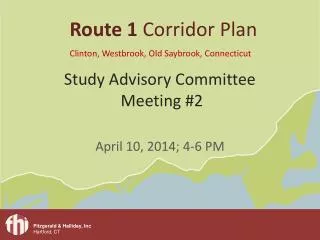
Route 1 Corridor Plan Clinton, Westbrook, Old Saybrook , Connecticut. Study Advisory Committee Meeting #2. April 10, 2014; 4-6 PM. Today’s Agenda. Introductions and background Presentation and discussion: Brief Summary of Existing Conditions Report Corridor Vision

E N D
Route 1 Corridor Plan Clinton, Westbrook, Old Saybrook, Connecticut Study Advisory Committee Meeting #2 April 10, 2014; 4-6 PM
Today’s Agenda • Introductions and background • Presentation and discussion: • Brief Summary of Existing Conditions Report • Corridor Vision • Preferred Land Use Scenario • Focus Areas • Public Design Charrette: date, format, venue • Next steps and next meeting
Where are we now? We are here! Phase 1 (Month 1-5) Phase 2 (Month 1-8) Phase 3 (Month 9-17) Phase 4 (Month 15-20) • Data Collection • Transportation Network • Traffic Analysis • Land Use • Environmental • Previous Planning and Design Efforts • Mobile Visioning • Market Analysis • Preferred Land Use Scenario • Identify Focus Areas • Public Design Workshop • Design Concepts • Analysis/Testing • Simulation/Renderings • Economic Development Strategy • Regulatory Framework • Priorities • Order of Magnitude Costs • Regulatory Framework • Action Plan • Timeline • Public Meeting Existing Conditions Vision, Goals, and Objectives Plan Recommendations Implementation Plan
3 commuter rail stations over 12 miles 8 interchanges with I-95 over 12 miles Route 1 serves a large regional travel shed
Places with good pedestrian accommodation should equate to better safety
Major Transportation Findings • Pockets of routine peak hour congestion on Route 1 • Diversion of traffic from I-95 leads to frequent and unpredictable congestion • Limited town center connectivity with train stations • Generally unsuitable for bicycle travel, despite being a designated bicycle route • High accident rates along Route 1 correlate with Town Center activity, driveway frequency, and highway design (i.e. number of lanes) • Frequent driveways with little access control increases conflict points and adds ‘friction’ to the travel way • Lack of pedestrian accommodations and connectivity with key destinations
Interchange Commercial Interchange Commercial Interchange Commercial Town Center Town Center Resort Marine Town Center
Major Land Use/Environmental Findings Well-formed town centers and clusters of activity with dispersed and variable uses sprawled in between Limited availability of undeveloped land Pockets of retail development in need of revitalization Zoning is fairly traditional (separation of uses) Current zoning will reinforce low-density sprawl development patterns and big-box near interchanges Environmental resources are constraints AND assets
Key Market Findings Increasing demand for multi-family housing TOD-oriented demand should increase with emphasis on ‘place making’ Infill and redevelopment has greater potential than new development (refit and reuse) Town Centers need to become regional destinations to achieve their local vision of vibrant activity nodes
Discussion:Did we see it all? Are there any other major transportation issues you would like to point out? Are there any other land use/enviromental issues you would like to point out? What about the market conditions?
The Corridor from a Regional Perspective Route 1 will be known regionally as a southern New England coastal recreation and retail destination with small-scale and larger national retail shopping and dining opportunities combined with cohesive Town Centers that reflect a sense of vibrancy and a strong year-round community.
The Route 1 transportation network will: • Balance local and regional transportation needs • Provide mobility and safety for all modes of travel – auto, transit, bicycle, and walking • Provide continuity in the transportation network – within and between modes • Provide safe and efficient access to properties along the corridor • Enhance train station areas with better station access and connections to village centers
The land use patterns along Route 1 will: • Emphasize and enhance Town Centers and other activity nodes and focus development in clusters • Preserve lands outside development clusters • Discourage continued sprawl • Preserve and enhance environmental and recreational resources – more open space • Preserve neighborhoods and the unique coastal character and history of the corridor • Promote higher-density mixed-use growth near train stations following Transit-Oriented Development principles
Discussion:How do you like the Corridor Vision? Do you agree with this vision – regionally, transportation, and land use? What would you add? Would you delete anything?
Two Future Land Use Scenarios • Status-Quo: continue current trends • Preferred: reflects • Corridor vision from community • Smart Growth principles • Transect development patterns • Transit-Oriented development
“Smart Growth” Principles Mix land uses Create a range of housing opportunities Create walkable neighborhoods Create a strong sense of place Preserve open space, farmland natural beauty, and critical environmental areas Strengthen and direct development towards existing communities Provide a variety of transportation choices Source: Smartgrowth.org and EPA Office of Sustainable Communities
Transect Development Patterns • Transitions from rural to more densely developed in sequential pattern • Progressive increase in diversity and mix • Eases transitions from various “places” both with density, type, and transportation focus
What is Transit-Oriented Development? Higher density (at least 10 units/acre) Mixed-use Pedestrian friendly Reduced parking Connectivity High quality design Transportation choices No two are alike!
Discussion:Preferred Land Use Scenario (PLUS)? • You think the draft PLUS achieves the various goals including • Corridor vision • Smart growth • A stronger transect land use pattern • What are your thoughts about TOD potential in each Town? • How would you change the PLUS?
Focus Areas Clinton Town Center: Transit-Oriented Enhancement Plan Westbrook Marina District: Multimodal Enhancement Plan Old Saybrook Route 1 Business District: Complete Streets Enhancement Plan
Old Saybrook – Route 1 Business DistrictComplete Streets Enhancement Plan
Reminder: The Plan will Include • Corridor-wide transportation recommendations • Corridor-wide land use and zoning recommendations • Focus area conceptual plans • Implementation Plan • Packaged “Projects” or initiatives • Priorities • OOM Costs/Funding options • Lead responsibility
Design Charrette • June 3rd and 4th • Westbrook Public Library • Working sessions on Tuesday (3rd) • Public Open House Tuesday evening • Interactive stations • Transportation • Land use and market • Focus areas for each town • Design production on Wednesday (4th)
Next SAC MeetingSeptember 2014 Report on design charrette Corridor Plan alternatives discussion Draft focus area concept plans
Route 1 Corridor Plan Clinton, Westbrook, Old Saybrook, Connecticut Study Advisory Committee Meeting #2 April 10, 2014; 4-6 PM