Download
1 / 18
180 likes | 251 Vues
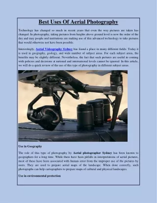
Explore the fundamentals of aerial photography, camera types, recording mediums, platforms, terminology, viewing geometries, distortions, and illumination features in aerial photos.

E N D
Introduction to the Principles of Aerial Photography Some content is from Remote Sensing Core Curriculum module: Introduction to Photo Interpretation and Photogrammetry by John Estes and Jeff Hemphill
Camera components • Similar to an eyeball • Lens focuses light rays onto a recording medium • Recording medium is usually film or a digital imaging sensor (2-D array of detectors) • Focal length is distance between focal plane (film plane) and center of the lens
Camera types • Many different types of cameras developed, especially for military uses • Metric cameras are produced for high precision applications • Large format cameras (> 100mm film size) are common for aerial surveys • Medium format cameras (>35mm – 100mm) are common for mapping small areas and reconnaissance • Small and medium format cameras are common for do it yourself applications
Special considerations for aerial camera systems • Hold large amounts of film or storage space for digital cameras • Film cameras use vacuum film plates to hold film flat against the film plate • Image motion compensation moves camera to compensate for forward aircraft motion • Stabilized mounts compensate for roll, pitch, and yaw of the aircraft • Navigation instrumentation records position and orientation of aircraft • Require aircraft with the appropriate ports in the belly of the plane
RC30 Aerial Camera System Image from Remote Sensing Core Curriculum Introduction to Photo Interpretation and Photogrammetry by John Estes and Jeff Hemphill
Recording media • Film • Black and white • True color • Infrared (color and black and white) • Sensitivity to different wavelengths varies with different types of film • Digital cameras record images using a 2-dimensional array of detectors • Aerial digital cameras are slowly replacing film cameras • All digital systems improve efficiency of processing since most manual tasks can be automated
Platforms • Aircraft are most common • Small fixed wing aircraft are relatively inexpensive but not very stable • High altitude jets are stable but very costly to fly • Unmanned aerial vehicles (UAVs) are growing in popularity • Remote controlled • Autonomous • Terrestrial photos acquired from mountains or other features with a high vantage point
Terms related to aerial photos • Fiducial marks: Reference marks on the corners and/or sides of aerial photos used to define coordinate axes and to locate the geometric center of the photo • Principal point: The geometric center of the photo • Conjugate principal point: The point representing the principal point of an adjacent photo • Photo base: The distance between the principal point and the conjugate principal point
More terms • Nadir: The point on the photo vertically beneath the camera lens at the time of exposure • Isocenter: A point roughly halfway between the principal point and nadir from which tilt displacement radiates
Vertical viewing geometry • Tilt less than ~3° • Scale relatively constant if terrain is not severe • Easier to use for stereo visualization • Direction (angles) can be more accurately measured
Oblique viewing geometry • Oblique: Tilted off of vertical axis • High oblique: horizon is visible • Low oblique: horizon not in image • Covers a larger area • Sides of objects can be seen • Scale decreases toward horizon • Can be difficult comparing to maps or orthorectified imagery due to different perspective
Orthogonal vs. central projection • Orthogonal projection • Each point is placed as if it is viewed from above • Also called a map plane • Central projection • Projection of features in an aerial photograph • Each point on a photo is imaged after reflected light passes through a single point (lens) • Causes features with a height above a base elevation to radiate outward from the center
Central projection: aerial photo Orthogonal projection: map Image from Remote Sensing Core Curriculum Introduction to Photo Interpretation and Photogrammetry by John Estes and Jeff Hemphill
Image distortion and displacement • Distortions • Film and paper shrinkage • Atmospheric distortions • Image motion • Lens distortion • Displacement • Caused by: • curvature of the Earth • tilt • topographic relief and height of features • Makes stereo viewing possible • Allows us to measure heights and make topographic maps
Illumination features in aerial photos • Shadows: Caused by a feature blocking the sun’s illumination from another feature or the Earth’s surface • Hotspot: The area on an aerial photograph where shadows are hidden by the feature casting the shadow thereby causing a bright spot • Specular reflection area: An area on an aerial photograph where the sun’s rays are reflected directly into the camera lens causing a white spot if a highly reflective feature is in this area
Diagram of specular bright spot and hot spot on an airphotoA = specular reflection bright spot; B = hot spot; C = camera; N = nadir; I = illumination source; theta = angle of incidence = angle of reflection Image from Canada Centre for Remote Sensing Glossary of Remote Sensing Terms: http://ccrs.nrcan.gc.ca/glossary/index_e.php?id=3133
What is photogrammetry • The art, science, and technology of obtaining reliable information about physical objects and the environment, through the process of recording, measuring, and interpreting images and patterns of electromagnetic radiant energy and other phenomena.