
Piet Kenabatho , Bertram Swartz, Sivashni Naicker , Marc Leblanc,
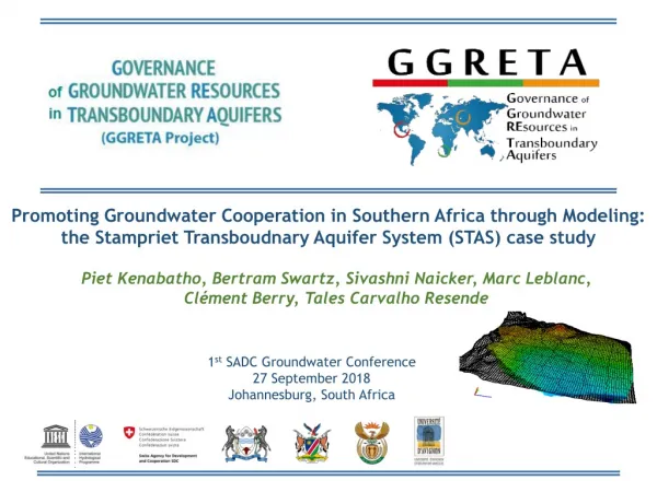
Promoting Groundwater Cooperation in Southern Africa through Modeling: the Stampriet Transboudnary Aquifer System (STAS) case study. Piet Kenabatho , Bertram Swartz, Sivashni Naicker , Marc Leblanc, Clément Berry, Tales Carvalho Resende. 1 st SADC Groundwater Conference

Piet Kenabatho , Bertram Swartz, Sivashni Naicker , Marc Leblanc,
E N D
Presentation Transcript
Promoting Groundwater Cooperation in Southern Africa through Modeling: the StamprietTransboudnary Aquifer System (STAS) case study Piet Kenabatho, Bertram Swartz, SivashniNaicker, Marc Leblanc, Clément Berry, Tales Carvalho Resende 1st SADC Groundwater Conference 27 September 2018 Johannesburg, South Africa
The StamprietTransboundary Aquifer System (STAS) • The STAS lies entirely within the Orange-Senqu River Basin. • The STAS covers a total area of 86 647km² (73% of the area in Namibia, 19% in Botswana, and 8% in South Africa). • The STAS is a large farming area with approximately 1200 farms (mostly in Namibia), out of which 80 are irrigation farms • Groundwater use: 52% irrigation, 32% stock watering, 16% domestic use • No mining and industrial activities • Area lightly populated (approximately 50 000 inhabitants) • Annual groundwater abstraction: 20Mm3 (around 70% in the Stampriet area) • Precipitation: from 150 to 300 mm/yr
The GGRETA project • Governance of Groundwater Resources in Transboundary Aquifers (GGRETA) project: • Funded by the Swiss Agency for Development and Cooperation (SDC) • Implemented by UNESCO International Hydrological Programme (IHP) • Phase 1 (2013-205): In-depth assessment of the STAS • Phase 2 (2016-2018): • Capacity-building modules on groundwater modeling, legal and institutional, and gender issues • Development of the STAS numerical model • Set the baseline for institutionalizing cooperation over the STAS
Background • Main objective:Develop a numerical model for the STAS aquifer to fill existing gaps • Modelling exercise started under FREEWAT platform (open source and free). However, the platform revealed to lack some robustness. • Early 2018: Decision to change the software that is being used to ModelMuse (in cooperation with the University of Avignon) • University of Avignon: Coordinator of the UNESCO-IHP programme on Groundwater and Climate Change (GRAPHIC) http://www.graphicnetwork.net/ • Advantages of ModMuse: • Free software that calls ModFlow(https://water.usgs.gov/nrp/gwsoftware/ModelMuse/ModelMuse.html) • Same software that is being used in the Ramotswa modelling exercise
Timeframe CAPACITY BUILDING PREPARATION OF THE MODEL Objective: Support Policy October 2018 – December 2018 Final simulations and results (participatory approach) September 2018 National trainingstailored to the needs of each country May 2018 – September 2018 Definition of scenarios and preliminary simulations (participatory approach) May 2018: Transient state calibration April 2018: Steady state calibration March 2018: Presentation of advancements + Revision of model geometry February 2018: Start of modelling exercise under ModelMuse
University of Avignon • Collaborating with UNESCO-IHP since 2009 under the UNESCO-IHP programme on Groundwater and Climate Change (GRAPHIC) http://www.graphicnetwork.net/
Definition of the model grid • Active cell size : - 5 000 / 5 000 m - Around 5000 active cell • Area : 117 150 Km² • Aquifers: Kalahari, Auob, Nossob • Aquitards: Rietmond, Mukorob Top view of the STAS grid. Kalahari Rietmond Auob Mukorob Nossob
Boundary conditions Constant Head • CHD North & South - Kalahari : interpolation of piezometricdata - Auob : Aquiferwall + 15 m - Nossob : Aquiferwall + 10 m • East & West boarders: Zero flux limit Zero flux limit Zero flux limit Constant Head
Steady State Calibration • Configuration • Discharge area (5mm/years) • Uniform recharge (4mm/years) • Kx calibration • Aquifer : discretization • Aquitard : homogeneous (1E-6 m/days) • Ky = Kx • Kz = Kx/10
Kx (m/days) Result of the hydraulicconductivityon the stamprietaquifer for the Kalahari, Auob and Nossob for the second configuration.
Steady state simulation results Global RMS (28m) Result of the steady state simulation on the stamprietaquifer for the Kalahari, Auob and Nossobshowing the heads values for the second configuration.
Transient Simulation • Initial condition : • Start with steady state • Time step: • Time start in 1978, time end in 2016 • Discretization : each days (13 879.5), month (456) or years (38) • Storage parameter: • Ss for confined aquifer : 0.001 • Sy for unconfined aquifer : 0.15 • Pumping Rate: • Livestock = Kalahari • Domestic + irrigation = Auob & Nossob • Prosopis = 50L/Day for 1 tree
Transient MODFLOW settings Modflow Package used for the model Time step : eachyears (couldbemodified) 38 years (1978-2015) Newton Solver : made for large areas and unconfinedaquifer Implementation of Ss & Sy
Transient simulation results Global RMS (9m)
Nossobwaterbudget ; Time : 50 years Units : m3/ years Kalahari water budget ; Time : 50 years Units : m3/years Auob water budget ; Time : 50 years Units : m3/ years Scenario 1 • Pumping rate x2 : • Simulation until 2066 • Auob fed by the Kalahari • Nossob fed by Auob Important interactions between aquifers and aquitards
Auob water budget ; time : 50 years ; units : m3/ years Nossob water budget ; time : 50 years ; units : m3/ years Kalahari water budget ; time : 50 years ; units : m3/ years Scenario 2 • Pumping rate x10 : • Simulation until 2066 • Kalahari begins to dry • Auob and Nossob are not fed anymore • Global recharge becomes too little with regards to pumping The STAS dries little by little
Auob water budget ; time : 50 years ; units : m3/ years Nossob water budget ; time : 50 years ; units : m3/ years Kalahari water budget ; time : 50 years ; units : m3/ years Scenario 3 • Recharge decreased by 2 : • Simulation until 2066 • Considerable lack of water in the Kalahari Implications for the Auob and Nossob aquifers
Auob water budget ; time : 50 years ; units : m3/ years Nossob water budget ; time : 50 years ; units : m3/ years Kalahari water budget ; time : 50 years ; units : m3/ years Scenario 4 • 10% increase of prosopis every year: • Simulation until 2066 • Considerable implications for the Kalahari A good management of prosopis is essential
Auob water budget ; time : 50 years ; units : m3/ years Nossob water budget ; time : 50 years ; units : m3/ years Kalahari water budget ; time : 50 years ; units : m3/ years Scenario 5 • Combination of all previous scenarios The STAS dries up quickly and in an irreversible manner
Conclusions and way forward • Considering the existing data and knowledge gaps, simulation results need to be considered with caution. • However, they can already provide interesting pointers for decision-makers. • Current status: good baseline for further developing/improving the model. • How? • More climatic data, • Better defining recharge/discharge area, • Refinement of the grid and geometry of the aquifer. • Way forward: • Simulation of new scenarios, • Trainings to Country Representatives for the utilization/further development of the model.