**MesoWest Updates Meeting: National Mesonet Expansion**
Join us for updates on MesoWest objectives, projects, and capabilities. Learn about the National Mesonet Expansion initiative and the latest advancements in weather observation technology.

**MesoWest Updates Meeting: National Mesonet Expansion**
E N D
Presentation Transcript
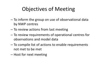
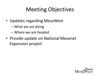
Meeting Objectives • Updates regarding MesoWest • What we are doing • Where we are headed • Provide update on National Mesonet Expansion project
MesoWest Mission Promote and support access, storage, and use of weather observations across the nation
ATMOS MesoWest Team • Staff • Xia Dong: Network analysis • Chris Galli: Programming support • Alex Jacques: Programming support • John Horel: Program management • Nola Lucke: Program management • Judy Pechmann: Relational database • Yan Zheng: Relational database • Students • Alex Hansen • James Judd • Matt Lammers
UU-related Collaborators for the National Mesonet Expansion Project • Mike Splitt, Florida Institute of Technology • Further evaluation of metadata related to wind observations • Mark Albright, University of Washington • Coordination for metadata in Pacific Northwest • Suresh Venkat and Jeff Phillips, CS • Improved data mining query methodologies for identifying high impact weather and quality control • Developing collaboration with SCI Institute staff
Core Capabilities of MesoWest Software • Collect provisional data as they become available from hundreds of sources • Archive the data in relational databases • Provide access to the data via the web and through variety of data pushes and pulls Surface observations received asynchronously from many sources in different formats Web Displays MySql Databases 1997-present Ingest Software QC Processing Metadata Synchronous output in defined formats (csv, xml) via web/LDM to MADIS and other users
MesoWest Contributions to MADIS Red: metropolitan county Blue: micropolitan county Yellow: rural country MesoWest currently provides 5,338 observational stations to MADIS from 80 different networks.
Boundary-layer research weather equipmentMountain Meteorology Group • Research deployments • Six 3-meter weather stations deployed to support field projects • (ASC) mini-SoDAR • Halo Photonics Streamline LiDAR • Two GRAW portable rawinsondes • ASOS ceilometers • Field project data sets PCAPS fig
MesoWest Users • Google analytics • (Sep 1 2009-Oct 28, 2011) • 10 million page views • 463,000 visitors • 207,000 visited 200+ times • 9000 people built profiles
We’ll be asking our customers for feedback via survey monkey over next month • Why do you use MesoWest? • How often do you use MesoWest? • How well does MesoWest meet your needs for access to current and historical weather conditions? • Have you created a profile on MesoWest? If so, has it been helpful? • Have you downloaded data? If so, approximately what is the largest amount you have downloaded at one time? • What do you like about MesoWest? • What features would you like to see in future versions of MesoWest? Please choose as many options as you like and feel free to elaborate on these or others
MesoWest Contributions to National Mesonet Program • Build and expand on existing relationships with our 80+ data providers, ESRL MADIS, and NWS at WFOs and regional levels • Continue to foster access to and stewardship of data and metadata from networks throughout country • Contribute to enhanced services and capabilities of National Mesonet Program and MADIS based on expertise related to relational databases, web-based user interfaces, data mining tools, and network design
Under the Hood Software Developments • Software version control • Bugzilla tracking of software issues • Parallel data bases • Tables for each year-month for grouped wx elements • Fast queries for maps • Tables for each station for all wx elements • Fast queries for specific station and QC • Integration of NDFD and RTMA grids with observations
Western Region HQ Current MesoWest Infrastructure PUBFTP Data Ingest Websrvr University of Utah DBs Websrvr Data Ingest DBs ROMAN DBs Issues • Data ingest on pubftp a single point of failure • ROMAN shifting to Kansas City FS virtual server environment LDM CRONs CGI Web Apps: MesoWest, GLFFC, etc. RAWS/HADS data ingest and 81 non MADIS networks
FS NITC via OpsNet Western Region HQ MesoWest.net Cloud Operations Coming Very Soon PUBFTP Data Ingest Websrvr Websrvr A fully redundant environment for data ingest and other services ROMAN with RAWS data ingest University of Utah DBs DBs Websrvr Data Ingest Real time syncing into Cloud: DB and App replication Websrvr Data Ingest DBs ROMAN ROMAN DBs DBs LDM CRONs CGI Web LDM CRONs CGI Web Apps: MesoWest, GLFFC, etc. RAWS/HADS data ingest and 81 non MADIS networks
Software in Development • Data and image engine API • Contributions to expansion project Observation and Metadata Handling Systems • Efficient CONUS-scale analysis tool for display and QC • Estimating impact of station(s) locally • Estimating impact of mesonets/mesonet types on CONUS-scale analyses • Fast queries for display and QC
Hourly T, TD, Wind CONUS Analyses on 8 processors in ~20 minutes Conus analysis
Median Impact of Wind Speed Observations from Selected Network Categories. 100 Analyses NWS FED+ High Impact RAWS PUBLIC Low Impact
Fraction of Reports in Network Category with Impact In Upper Quartile (Impact >= 75%). 100 Analyses * * * + * * * * * * * * * * * * * * * Equal Stn Impact * * * * * * * Fraction (%) * * * * * Temperature DewPoint Wind Speed A priori error variance assumptions: *
Identifying High Impact WX/QC Tools: (CS partners) Consider each weather station year as a curve: • 26K stations and 145K station-years • station year averages 17K temperature readings • about 50GB of data Question: given interval (November 1 - November 15) • Which k (say k=50) stations had highest average temp? Approach: Aggregate Top-k Queries • Exact: answers in about 2 seconds • Approximate: answers in < 0.01 seconds, very high accuracy uses 100 MB Next question: given query curve, what are k closest curves? Would help with estimation of what to expect for nowcasting as well as QC
Frequency-based Curve Fitting(CS partners) Goal: Build a model for one curve with small number of parameters. • avoid over-fitting • small space for storing model, and fast Take one station (10 years of data): • translate to Fourier domain • take top k (=10) amplitude frequencies = model parameters For window (last 24 hours) find best fit for k frequencies: • fast, robust model Next step: Build model over several years, and nearby days. Seek deviations from distribution model.
Where Are We Going? • Continue MesoWest R&D and transfer to operations • Core activity in department for education, research, and public service • Existing O&M contracts from several customers to support access to weather observations • Improve reliability and functionality for the long-term • To the cloud… • Moving critical operational components of MesoWest to virtual servers • Understand our users • Improve capabilities • Obtaining metadata info from data providers • Metadata handling • QC/QA • Data API engine • User-defined dashboard • Monitoring conditions above 3-10 m • Transferring technology to MADIS • Evaluating contributions of specific stations or networks to the national mesonet • Continued participation in MesoUS Consortium