Download
1 / 20
210 likes | 367 Vues
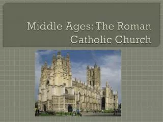
Antique Roman Monuments on the Middle Danube. R eport about the state of the nomination document. Anna Tuhárska Ľubica Pinčíková Monuments Board SR. Danube Limes Project Workshop “Protection strategies, presentation and management principles” 18 – 19 November 2010.

E N D
Antique Roman Monuments on the Middle Danube Report about the state of the nomination document Anna Tuhárska Ľubica Pinčíková Monuments Board SR Danube Limes Project Workshop “Protection strategies, presentation and management principles” 18 – 19 November 2010
1. Identification of the Site • Name of the Property: Antique Roman Monuments on the Middle Danube (as in Tentative List submitted to WHC in 2002) Iža – Kelemantia Rusovce – Gerulata
1. Identification of the Site • Geographic position: Rusovce Iža
1. Identification of the Site • Situation within the territory of Slovakia • Rusovce – Gerulata: suburb part of Bratislava, Region Bratislava, • 48° 5´ N, 17° 00´ E • Iža – Kelemantia: near Komárno, Region Nitra, 47° 45´ N, 18° 15´ E
1. Idenification of the Site • 1.2.1. Iža - „Rímsky tábor (kastel) v Iži - Kelemantia“ • Unifikovaný názov: archeologická lokalita • Bližšie určenie: vojenský tábor – kastel. skúmaný • Číslo Ústredného zoznamu pamiatkového fondu (ÚZPF): 289/1-3 • Objektová skladba: 289/1 - tábor– drevozemný - castrum • 289/2 – tábor – kamenný – kastel • 289/3 - pevnosť • Vyhlásenie za národnú kultúrnu pamiatku (NKP): dňa 23.5. 1990 Uznesením vlády Slovenskej republiky č. 235 • Kraj: Nitriansky • Okres: Komárno • Obec: Iža • Katastrálne územie: Iža • Časť obce: poloha Leányvár • Adresa: cca 2 km juhozápadne od obce Iža na ľavom brehu rieky Dunaj, v jeho 1762,6 – 1762,85 rkm • Parcelné číslo: 1696/2, 1697, 1698/1, 1699, 1701, 1702, 1704/1, 1704/2, 1704/4, 1705/1, 1705/3, 1709/1 • Popis priebehu hranice ochranného pásma: • Územie navrhovaného ochranné pásma sa nachádza 2 km juhozápadne od obce Iža. Východzím bodom hranice ochranného pásma je severozápadný roh parcely č. 1500/4, ktorá nie je súčasťou ochranného pásma a z ktorého hranica navrhovaného ochranného pásma kolmo prekračuje časť parcely č. 1500/3 a kolmo pokračuje smerom na severozápad, kde prechádza parcelami č. 1709/6, 1709/2 a 1907/5, teda časťou telesa starej protipovodňovej hrádze; ďalej hranica pokračuje po severnej strane parcely č. 1709/5 smerom na západ a napája sa na rozhranie parcely č. 1668/31, po ktorej severnej hrane pokračuje smerom na západ a napája sa na parcelu č. 1767, v ktorej juhozápadnom rohu s napája na západnú hranu parcely č. 1759/4 a pokračuje po západnej hrane parcely č. 1709/3, 1709/2, 1709/4 a napája 2 sa na juhozápadný roh parcely č. 1709/1 a po jej južnej a východnej hrane pokračuje k juhozápadnému rohu parcely č. 1705/2, odkiaľ po jej južnej hrane pokračuje k južnej hrane parcely č. 1702, kde sa napája na južnú hranu parcely č. 1500/3 a po jej východnej hrane smeruje k východziemu bodu. • Súpis parciel navrhovaného územia ochranného pásma: • 1709/5, 1709/2, 1709/6, 1500/3, 1705/2, 1709/1, 1709/4, 1709/3, 1759/4, 1759/3, 1759/2, 1767, 1668/31, 1695, 1696/2, 1697, 1698/1, 1699, 1701, 1702, 1704/1, 1704/2, 1704/4, 1705/1, 1705/3, 1709/1 (územie NhNKP) • Príloha č. 2 – Zameranie územia Rímskeho vojenského tábora v Iži
1. Identification of the Site • Maps and plans • Iža – Kelemantia provided by Archeological Institute of the Slovak Academy of Sciences J. Rajtár • Rusovce – Gerulata provided by Bratislava City Museum, J. Schmidtová • Ortophotomaps of both sites – GEODIS SLOVAKIA, s.r.o.
2. Description • Description of the Property • History and Development • Prepared during RP 2-3, by external experts, on the basis of a long time archeological research lead by the authors, • Iža – Kelemantia – J. Rajtár • Rusovce – Gerulata – J. Schmidtová
3. Justification for Inscription • OUV based on WHSFRE Statement of OUV • The Antique Roman Monuments on the Middle Danube, military forts Kelemantia and Gerulatafully illustrate the building effort of the Limes on the frontiers of the Roman Empire, the northpannonian frontier, at the time from the 1st to the beginning of the 4th century AD
3. Justification for Inscription • Criteria • ii) both sites were part of frontier system which provided an environment for gradual and constant cultural exchange between more advanced Roman civilization and nations living in Barbaricum • iii) they bear the testimony of an outstanding civilization which became extinct
3. Justification for Inscription • Criteria • iv) Iža – Kelemantia: • lied on the left bank of the Danube (the only ascertained military fort of the north-pannonian Limes situated on the nothern bank of the Danube, in Barbaricum) • originated as a bridgehead of the legionary fortress in Brigetio • It was one of the vastest Roman building complexes in Barbaricum • It witnesses the long-lasting military presence of the Romans on the north bank of the Danube
3. Justification for Inscription • Criteria • iv) Rusovce – Gerulata: • located in the north of the Roman province of Pannonia, it was the westernmost in line of strong-holds between Carnuntum and Ad Flexum • according to archaeological excavations, Gerulata represent a typical Danubian Roman fortress with four major building phases with associated civil setlement, road and cemeteries • Gerulata is an example of cosmopolitanism of the Roman world
3. Justification for Inscription • Comparative analysis • In the process of preparation by external experts
4. State of Conservation • Present state: both sites protected as national cultural monuments = highest form of protection within the Slovak legal system • Factors affecting the property: development, environmental pressures, visitors and tourism pressures, etc. (analysed in MP, based on consultations with stakeholders)
4. State of Conservation • Iža – Kelemantia: archeological locality with free access, open-air presentation of uncovered walls(archeological findings presented in museum in Komárno)
4. State of Conservation • Rusovce – Gerulata: site is used for museal and presentation purposes (outside presentation of achitecture torsos and exposition of archeological findings in museum building)
5. Protection and Management of the Property • World Heritage Convention • Act on Protection of Monuments and Historic Sites (No. 49/2002) • Nature protection, Building regulation, regional and local spatial planning documents, etc. • Management plan – Draft MP prepared during RP3 by external expert M. Janovská and Ľubica Pinčíková
6. Monitoring • Key indicators: • Intactness of the archeological terrain • Visual assertion of the fortification and its overall appearance in the lanscape • State of natural environment and state of monument´s landcape framework • Adequate forms of presentation of confirmed buildings grounds
6. Monitoring • Administrative arrangement: same as other WHSs in Slovakia, 2-year cycle – technical state of monuments, state of values of territoryresponsible – Monuments Board SR and Regional Monuments Boards in Bratislava and Nitra
7. Next steps • January 2011- consultations with local communities and other stakeholders in order to finish the management plan • June 2011- completing of all Nomination file chapters • Continuously - common layout and editing of Nomination file (different chapters – different authors)
7. Next steps • Gradually, according to the state of completion translation of separate chapters • September 2011- final printing and binding of Nomination file