Download
1 / 21
260 likes | 570 Vues
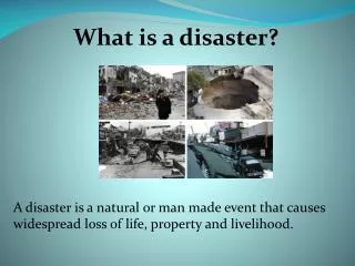
Disaster Risk Mitigation: The Experience of Sri Lanka by . P. Dias Amarasinghe Secretary, Ministry of Disaster Management and Human Rights, Sri Lanka. SRI LANKA. Basic Information. Land Area - 65,525 Sq km Population - 19.6 Million Pop. Density - 309 per km 2

E N D
Disaster Risk Mitigation: The Experience of Sri Lanka by P. Dias Amarasinghe Secretary, Ministry of Disaster Management and Human Rights, Sri Lanka
SRI LANKA Basic Information • Land Area - 65,525 Sq km • Population - 19.6 Million • Pop. Density - 309 per km2 • Literacy rate - 91.8 % • Ethnic Mix - • Sinhalese - 74 % • Tamil - 18 % • Muslim - 7 % • Others - 1 %
Hazard Profile of Sri Lanka: • Major natural hazards - floods, droughts, cyclones, landslides • and coastal erosion. • Other localized hazards - lightning strikes, epidemics and • effects of environmental pollution • Human induced hazards - hazards resulting from • deforestation, indiscriminate coral, gem and sand mining • Tsunami Number of people affected by natural disasters in Sri Lanka 1974-2005
FLOODS IN SRI LANKA • 103 River basins. • 10 rivers are considered as major rivers • Kalu,Kelani,Gin,Nilwala,and Mahaweli are major rivers causing floods. • Sri Lanka has two monsoons-South West (mid May to September) and North East (December to February) • Floods in Sri Lanka are due to excessive rain fall during monsoons. • Highest rainfall recorded is 805mm within 24 hours (1897) • Unplanned urbanization, lack of appropriate waste disposal systems and inadequate maintenance of roads have resulted in storm floods in major cities even during inter-monsoonal rains • Mitigation Measures • Construction of flood protection dams within major river basins ( Kelani, Gin, Nilwala and Kukuleganga). Some of these have been built in the beginning of the 20th Century.
Floods……..Contd. • Diversion of Major rivers such as River Mahaveli and construction of new reservoirs under such diversions. For example, construction of Kothmale reservoir has mitigated floods in Gampola area
CYCLONES • Number of major Cyclone storms that reached the coast of Sri Lanka from 1981 is 16 • November-December period (north east monsoon) is recorded as cyclone season in Sri Lanka. • The average lifetime of Cyclone storms in our region is about 4-5 Days.
DROUGHT • Every Year somewhere in the Country some people are faced with droughts of short duration which are only of local significance. Droughts affecting bigger regions (eg. a province) do occur every 3-4 years. • Severe droughts of national significance occur every 10 years . Severe droughts occurred in 1947-49,1953-56,1965,1974-77,1981-83,1985,1995-96,2000-01. From 1948 as many as 26 droughts have been reported. • Drought mitigation efforts dates back to Sinhalese kings’ days. Mitigation measures were both structural and non-structural……….(contd.)
Drought……….Contd • Kings established irrigation schemes both major and minor for water harvesting for cultivation as well as for bathing and other domestic purposes. • Pre-seasonal cultivation meetings are held with the participation of district/divisional level administrative heads, irrigation specialists and farmers. • Based on the availability of water decision regarding total extent to be cultivated, crops to be cultivated, when to start cultivation, when to start issue of water, etc. are discussed and agreed upon at these meetings. • These systems are still in operation. • Rain water harvesting systems are now popular among people for both upland cultivations and also for domestic purposes. • Diversion of rivers such as River Mahaveli
LAND SLIDES • Badulla, Nuwaraeliya, Rathnapura Kegalle,Kandy,Matale and Galle districts are prone to Land slides. • Human settlement and infrastructures threatened by Landslides. • Reasons for increase – Unplanned intensive cultivation, non engineered construction, deforestation, neglect of land and every increasing human intervention. • Landslide mitigation work started in 1990 with assistance from UNDP and UNCHS.
COASTAL EROSION • Sri Lanka has a coastline of 1585Km. 50-55% of the coastline is prone to erosion • Indiscriminate sand and coral mining, improper sighting or designing of coastal structures have contributed largely to increased erosion levels. • About 175000-285000 sq. meters of coast line are last each year. • Mitigation activities commenced in 1986 with the implementation of Coastal Erosion Management Plan of 1986.
Other Measures • Building guidelines in respect of flood prone areas, areas prone to cyclones and highwinds, and landslides have been developed and are being discussed among professionals before introduced to local authorities. • Guidelines for protection of buildings and safety from lightning strikes have also been developed. • Disaster risk mitigation is being mainstreamed by incorporating plans and strategies into the next ten year national plan.
The Tsunami devastation resulted in the recognition of the need for comprehensive disaster risk management, rather than post disaster relief or better response
Prior to 2005, Sri Lanka had no legal framework for disaster management Disaster Management Act. No. 13 of 2005 was ratified on 13 May 2005, to provide a legal framework for disaster risk management in Sri Lanka National Council for Disaster Management (NCDM) Under the Chairmanship of H.E. the President Disaster Management Centre (DMC) As the focal institute for disaster management
Development of hazard zonation maps for vulnerable regions - in progress City of Galle – (assistance UNU, ISDR) Balapitiya
School programs • School programs include: • Awareness creation • Identification of evacuation sites • Identification of a team of first responders • Mock Drill • Disaster management included in school curriculum • Several universities have also incorporated disaster management into relevant courses.
Initiative for Disaster Risk Management A framework to identify and Coordinate multi-stakeholder efforts in the next 10 years a holistic strategy a Road Map Towards building a safer Sri Lanka
Initiative for Disaster Risk Management • Priority projects identified under seven thematic areas: • Policy, institutional mandates and Institutional development. • Hazard, Vulnerability and Risk Assessment • Tsunami and Multi Hazard Early Warning System • Preparedness and Response Plans • Mitigation and integration of DRR into development planning • Community based Disaster Risk Management • Public Awareness, Education and Training Government of Sri Lanka is committed to implement the Road Map proposals.