Community Information Database (CID) cid-bdc
290 likes | 485 Vues
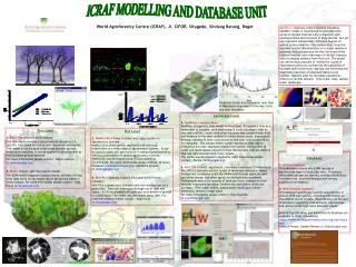
Community Information Database (CID) www.cid-bdc.ca. Presented by: Carl Sauriol Rural Research and Analysis Rural and Co-operatives Secretariat March 2010. Objectives. Provide background on the CID Brief tour of the new CID homepage

Community Information Database (CID) cid-bdc
E N D
Presentation Transcript
Community Information Database (CID)www.cid-bdc.ca Presented by: Carl Sauriol Rural Research and Analysis Rural and Co-operatives Secretariat March 2010
Objectives • Provide background on the CID • Brief tour of the new CID homepage • Describe features of the new CID and show how to use the CID • how to use, print, and export the CID maps, tables, and graphs • how to access and download data about communities and regions • Describe future plans for the CID
What is the CID? • The CID was developed by the Rural Secretariat in collaboration with provinces, territories, other federal government departments and community groups. • The CID is a free Internet-based tool which provides communities, researchers, and governments with access to consistent and reliable social, economic, and demographic data for all communities and regions across Canada. • The CID helps quickly capture downloadable socio-economic and demographic data for specific communities or multiple geographic regions from interactive maps, tables, and charts. • The CID reduces the amount of time and resources required to obtain and analyze community level data. • The data – around 700 indicators - is mainly sourced from Statistics Canada’s 1996, 2001, and 2006 Censuses of Population.
Improvements • Frequent feedback received on the first CID was positive but also indicated a need for improvements: continued challenges using the CID; printing maps was difficult; and exporting data for all of Canada was complicated as users had to download data for each province and territory individually. • Over the last year, the RS developed a new and improved CID in collaboration with provincial, territorial, and community partners. • The new CID contains 2006 data in addition to 1996 and 2001, an expanded list of available data-about 700 indicators, and new features including national level maps, improved map printing, ability to export maps, ability to load data and create your own maps, community and regional snapshots and detailed reports.
Selecting communities using the Polygon and circular selection tools
Who uses the CID • community groups; • private or non-profit community organizations; • municipal, provincial/territorial, and federal governments departments; • businesses; • researchers and practitioners; • libraries; • universities and community colleges; and • research organizations
Uses of the Site • measure, assess and compare community performance; • identify key socio-economic aspects and trends at the community level; • compare information and analysis over time and among communities; • analyze data across a number of layers to identify possible linkages • provide information and analysis essential for community development, planning, and research, and developing project proposals, policy and programs; and • support briefings and presentations to federal, provincial and municipal governments
CID Features • search the database from an interactive map to access downloadable data about communities and regions; • generate custom reports; • view detailed community reports and snapshots; • view data in maps, tables, charts/graphs; • download data into spreadsheets or text files for further manipulation; • load user data to create maps and save map files; • upload data from other map sites (WMS); • bookmark maps; and • print maps and definitions
Recap – data contained in the CID • Infrastructure • Economic Sectors • Environment and Sustainability • Health • Crime • Gross Domestic Product (GDP) • Businesses and Organizations • Community Benchmarks • Community Type (Rural, Urban) • Population • Language • Migration and Mobility • Immigration and Citizenship • Aboriginal Peoples • Education • Employment and Work • Income • Families • Housing
Summary and next steps • The CID has over 700 community and regional level socio-economic and demographic indicators • The CID presents data in maps, tables, and charts • Data can be selected and downloaded for further analysis • You can make your own maps • Obtain community snapshots and detailed reports • The key advantage of the CID is it reduces the amount of time and resources required to obtain and analyze data about communities and regions. The CID can be used to inform policy and program development and for research. Planned CID improvements: • Data - from OGDs and other sources and Features – improved detailed reports, new levels of geography (watershed) • Knowledge dissemination – demos and presentations, training, web content – tutorials and training modules • Collaboration and Partnerships – partner with organizations that can provide on the ground support to CID users
Summary and Next Steps, continued New Data (April 2010) • Census of Agriculture • Co-operatives • Resource-dependent communities • Census Rural Population • Canadian Community Health Survey • Amenities (National Parks & National Historic Sites) • Census data by rural/urban, MIZ, health regions • Census data by SAC type New Features (April 2010) • Community Profiles • Improved Searching • Street Mapping (NID) • Graphs by rural/urban, MIZ • Health Regions Geography Improvements (April 2010) • Detailed Report • Scorecard