Download
1 / 39
390 likes | 669 Vues
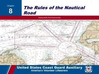
RULES OF THE ROAD & AIDS TO NAVIGATION (ATON). Why Rules and ATONs?. To avoid collision: most common accident is collision with another vessel To provide safe route on water: usually second most common is collision with a fixed object To provide position (location) on water

E N D
RULES OF THE ROAD & AIDS TO NAVIGATION (ATON) • Why Rules and ATONs? • To avoid collision: most common accident is collision with another vessel • To provide safe route on water: usually second most common is collision with a fixed object • To provide position (location) on water • To warn of danger or obstructions
INTERNATIONAL • Convention on the international regulations for preventing collisions at sea 1972 (COLREGS) developed by the Inter-governmental Maritime Consultative Organization (IMCO). • Effective July 15, 1977 • Became the International Maritime Organization (IMO) which adopted amendments in 1981 & 1989. • INLAND • These Rules replaced all prior Inland Rules, i.e., Inland Rules, Western Rivers Rules, Great Lakes Rules, respective Pilot Rules and parts of the Motorboat Act of 1940. • Effective adoption date was December, 1981, except for Great Lakes which was March, 1983.
Rule 2 Responsibility “Rule of Good Seamanship” • Contributory negligence applied to owner, captain and/or crew. • Requirement to depart from the rules to avoid danger. • Also known as the “General Prudential Rule” or the “Rule of Special Circumstance”. • Rule 5 Look-out • Every vessel shall at all times maintain a proper look-out by sight and hearing in order to make a full appraisal of the situation and risk of collision. • Rule 6 Safe Speed • Speed that allows proper and effective action to avoid collision. • Visibility • Traffic density and characteristics. • Maneuverability, draft. • Background clutter. • Weather, wind, current, navigational hazards
Rule 7 Risk of Collision • Use all available means to determine risk of collision. • If any doubt, consider risk exists. • Mandatory Radar use is required, if equipped. • No assumptions based on scanty information. • Steady bearing/closing range = risk of collision • Rule 8 Action to Avoid Collision • Must be positive and done in ample time. • Rule of good seamanship. • Readily apparent, use large gross actions! • Leave no doubt what your intention is!
The most important rule is to avoid collision no matter who is in the right. How do you know you are on a collision course? Constant bearing, decreasing range Make any course change of at least 60 degrees so its obvious to other vessel
ENCOUNTERING OTHER VESSELS • RULE 13 OVERTAKING - Vessel that is passed by another from a position more than 22.5 degrees abaft of it’s beam is the overtaken vessel. The overtaking vessel should not see the green or red navigation sidelights. • If in doubt whether overtaking or crossing, always assume overtaking. • Overtaking vessel will keep clear of overtaken vessel until finally well past and clear. • But be careful! White only could also indicate a vessel at anchor or a vessel under oars.
RULE 14 HEAD ON - When two power-driven vessels are on reciprocal courses, so as to prevent collision, vessels will steer to starboard so each shall pass on the port of each other. At night, vessels in a head-on situation should observe masthead light(s) in a line and one or both sidelights.
RULE 15 CROSSING - A vessel which has another vessel on her starboard side shall keep out of the way of the other and if necessary, avoid crossing ahead of the other vessel. On the Great Lakes and Western Rivers, a vessel crossing a river shall keep out of the way of an ascending or descending vessel.
Rule16 Action by Give-way Vessel • Every vessel which is directed to keep out of the way of another shall so far as possible take early and substantial action to keep well clear • Hierarchy of Actions • Readily apparent course change in ample time • Slow down • Stop • Reverse engines • Rule 17 Action by Stand-on Vessel • Maintain course and speed as much as practical. • When it becomes obvious that risk of collision is imminent, whatever action that is necessary is allowed to avoid collision (rule 2). • Power-driven vessels, in taking action to avoid collision shall avoid altering course to port.
Rule 18 Responsibilities Between Vessels • (R.O.W. Pecking Order) • Privileged • Not under command (NUC) • Restricted in ability to maneuver (RAM – dredging, mine sweeping) • Constrained by draft • Fishing/trawling (not trolling) • Sail or manually powered boat • Power-driven • Seaplane • Burdened
RULES 20 – 31 LIGHTS AND SHAPES Sidelight starboard 112.5 Sidelight port 112.5 Masthead 225 22.5 22.5 Stern light 135 ARCS OF VISIBILITY
Overtaking Vs. Crossing Light Zones • Crossing - from 22.50 degrees abaft of beam forward to bow • Your green zone is your danger zone – you must give way! • You see red – stop (give-way, burdened) • You see green – go (stand-on, privileged) • Overtaking - within 135 degrees of stern zone.
If you see: • you are looking at the port side of a sailboat • you are looking at the starboard side of a sailboat • means you're seeing somebody's stern, but you don't know whether it's power or sail. • indicates the port side of a power driven vessel (note that the two lights won't necessarily be lined up as shown here) • means you're seeing the starboard side of a power driven vessel (note as above).
RULES 34 MANUEVERING AND WARNING Whistle - Any sound signaling appliance capable of producing the prescribed blasts and complies with annex III. Short blast - A blast of about 1 second duration. Prolonged blast - A blast of 4 to 6 seconds duration. Inland Signals of intent with appropriate reply required One short - I intend to leave you on my port side Two short - I intend to leave you on my starboard side Three short - I am operating astern propulsion International Signals of action One short – I am altering course to starboard Two short – I am altering course to port Three short – I am operating astern propulsion 5 short blasts – Danger, I do not understand, I disagree 1 prolonged blast – approaching an area of obscured visibility, leaving a dock, in restricted visibility Inland Rules require the other vessel to answer with the same signal if in agreement
Navigation Systems • IALA (International Association of Lighthouse Authority) • System A Eastern Hemisphere • System B Western Hemisphere, Japan, Korea & Philippines • U.S. Marking System • Intracoastal Waterway • Western Rivers
LATERAL MARKERS Lateral markers indicate the sides of channels. Green colors and lights should be on your port sidewhen traveling toward the channel and returning from open waters. Red colors and lights should be on your starboard sidewhen traveling toward the channel and returning from open waters. Shapes of buoys, numbers and letters play key roles in the lateral system. Generally, green port side buoys in the main and secondary channels are "can" or square-shaped markers and odd-numbered. Red starboard side buoys in these channels are "nun" or triangular-shaped markers and even-numbered. Remember:You will never see a NUN 69
Red and White vertically striped buoy markers, some topped with a white light or red top mark, indicate mid-channels or fairways. These “safe water” markers may be passed on either side as long as other, safe navigation rules are followed. Red and Green buoys and lights indicate primary channels. If the green horizontal band is on top, the primary channel is the starboard. If the red band is on the top, the primary channel is to the port side. This marker indicates the primary channel is on the starboard.
Intracoastal Waterway CLOCKWISE NORTH TO SOUTH 96 17
Western Rivers • The Mississippi River and it’s tributaries • Western Rivers differ from the U.S. Marking system as follows: 1. The conventional direction of buoyage is from themouthto head of navigation. Local terminology describes aids as Right or Leftdescending bank (RDB or LDB) 2. Aids are notnumbered or lettered 3. Safe water & isolated danger marksare not used
Western Rivers • Left Descending Bank Marks: • Color: Red • Shape: Triangle • Light: Red • Characteristic:Group flashing, i.e. FL (2) 5s, FL (2) 6s
Western Rivers • Right Descending Bank Marks: • Color: Green • Shape: Square • Light: Green • Characteristic:Single Flashing, i.e. Fl 4s, or Fl 6s
Western Rivers • Crossing Marks: • Show where traffic is to move from one side of the bank to the other. Upbound takes the points, Downbound takes the bends.
REGULATORY MARKERS Regulatory markers are white with black letters and have orange, warning borders in different shapes. INFORMATION CONTROLLED DANGER EXCLUSION
Other Markers Mooring buoys are white with a blue horizontal band and can be anchored to in public waters. It is unlawful to moor, anchor or attach any boat to other buoys, beacons, light marker, stake, flag or other marker used as a navigational aids. Inland waters obstruction markers are white with black stripes. You should not pass between these buoys and the shore. Navigational markers also may be black and/or white, red and/or white, numbered or lettered, indicating locally-placed or outdated navigational systems. Yellow buoys indicate special markings such as traffic separations, international boundaries, anchorage areas, dredging, fish net area, etc
Oh no, please don’t call on me REVIEW How do you determine if your vessel is on a collision course with another vessel? How do you determine which vessel has the right-of-way during daylight using sight, lights and sound? …. at night using sight, lights and sound? What is the type of navigation system used in your area of operation? Identify by sight different types of navigation aids