Download
1 / 7
70 likes | 237 Vues
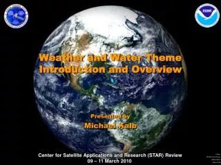
Weather and Water Theme Introduction and Overview. Presented by Michael Kalb. Weather & Water Research Areas from 5-Year Research Plan. Improve weather forecast / warning accuracy & lead-time Improve water resource forecasting capabilities

E N D
Weather and Water ThemeIntroduction and Overview Presented by Michael Kalb
Weather & Water Research Areasfrom 5-Year Research Plan • Improve weather forecast / warning accuracy & lead-time • Improve water resource forecasting capabilities • Improve NOAA’s understanding and forecast capability in coasts, estuaries and oceans • Provide information to air-quality decision makers and improve NOAA’s national air quality forecast capability • Science & Technology Infusion
Weather & WaterPriority Research Activities Improve Weather Forecast and Warning Accuracy and Amount of Lead-time Improve predictions of high-impact weather (fire weather, hurricanes, heavy precipitation, floods ) Advance data assimilation and transfer of research and technology into operations through testbeds Improve understanding of hurricane force extra-tropical cyclones, supporting W&W and C&T objectives Link larger-scale global circulation fluctuations to local severe weather outbreaks Increase knowledge of space environment and advance solar & geomagnetic prediction models MW Products from NOAA/METOP/NPOESS Satellites (FuzhongWeng) IR Temperature and Water Vapor Sounding (Chris Barnet) Satellite wind products (Jaime Daniels) Using the GOES Sounder to Nearcast Severe Convection (Bob Aune) Retrieved GOES Vertical Temperature & Moisture Profiles and Real-Time Products (Gary Wade) Validation of sounding products - NOAA Products Validation System (Tony Reale) Precipitation and flash flood monitoring (Bob Kuligowski ) Improving Hurricane Intensity Forecasts (Mark DeMaria) Fire Monitoring (Ivan Csiszar & ShobaKondragunta) • Oral Presentation • Poster Presentation • Operational / Prediction 3
Weather & WaterPriority Research Activities Improve water resources forecasting capabilities Leverage satellites to observe precipitation, snow water content, and soil moisture, and incorporate satellite information to fill gaps in ground-based radar Research and develop MW remote sensing of snow and ice to improve estimates of drought severity, regional water supplies, soil moisture, and snowmelt flood forecasting Improve multi-sensor precipitation algorithms using digital radar mosaics and dual-polarimetric variables. Improve Hydrologic Prediction Services to monitor and predict snow levels, snow-melt runoff, soil moisturewhich can precondition run-off rates. Soil moisture monitoring (Jerry Zhan) Precipitation and flash flood monitoring (Bob Kuligowski ) Land surface temperature (Bob Yu) • Oral Presentation • Poster Presentation • Operational / Prediction 4
Weather & WaterPriority Research Activities 5 • Improve NOAA’s understanding & forecast capability in coasts, estuaries, & oceans • Supportocean, coastal, and Great Lakes observing system networks to improve accuracy, resolution, and coverage in nation’s ports, bays, estuaries, and open oceans. • Developenhanced sensors and monitoring techniques forobserving coastal regions from existing and new satellite sensors • Improve understanding through research integrating erosion, flood, riverine, hydrodynamic, wind, ocean circulation, storm surge, and related processes • Advanced Clear-Sky Processor for Oceans (ACSPO) (John Sapper) • Improved Cloud Mask and Quality Control for SST Retrievals (Boris Petrenko, & Sasha Ignatov) • Physical Retrieval Algorithms (Andy Harris & Eileen Maturi) • New Approach to Calibration of Broadband IR Sensors on NOAA Satellites (Jon Mittaz & Eileen Maturi) • Blended POES/GOES Ocean SST Products (Eileen Maturi) • In situ SST for satellite Cal/Val and Quality Control (Feng Xu & Sasha Ignatov) • NOAA/NESDIS Operational Satellite OSVW Products (Paul Chang) • Impact of Satellite OSWV data on NWS Operations (Khalil Ahmad) • Improved High Wind Retrievals from ASCAT Wind Vector Measurements (S. Soisuvarn) • Multi-platform satellite surface wind analysis for tropical cyclones (John Knaff) • Water Quality & Optical Property Characterizations for China’s Lake Taihu (Menghua Wang) • Marine environmental responses to a Land Reclamation project in South Korea (S-H Son, Menghua Wang)
Weather & WaterPriority Research Activities 6 • Provide Information to Air Quality Decision Makers and Improve NOAA’s National Air Quality Forecast Capability • Provide Air Quality decision makers with tools & information with health / economic consequences • Advancemodel development, regional AQ assessments, and improved tools to monitor long-term trends. • Develop new approaches to more accurate and timely prediction of O3 and particulate matter • Develop air quality assessments of tropospheric O3 and particulates to support forecasts, policies & planning • Support regional assessments to characterize atmospheric processes that control pollution transport & transformation • Air Quality Products from NOAA Operational Satellites (ShobaKondragunta) • Impacts of background O3 production on Houston & Dallas Air Quality during TexAQS field mission (Brad Pierce) • Fire monitoring (Ivan Csiszar & ShobaKondragunta)
Oral Presentations ATMOSPHERIC SOUNDINGS • MW Products from NOAA/METOP/NPOESS Satellites (Fuzhong Weng) • IR Temperature and Water Vapor Sounding (Chris Barnet) • Using the GOES Sounder to Nearcast Severe Convection (Bob Aune) • Satellite Wind Products (Jaime Daniels) OCEAN REMOTE SENSING & SST • Advanced Clear-Sky Processor for Oceans (ACSPO) (John Sapper) • Blended POES/GOES Ocean SST Products (Eileen Maturi) OCEAN SURFACE SCATTEROMETER WINDS • NOAA/NESDIS Operational Satellite OSVW Products (Paul Chang) PRECIPITATION AND TROPICAL STORMS • Precipitation and flash flood monitoring (Bob Kuligowski) • Improving Hurricane Intensity Forecasts (Mark DeMaria) LAND SURFACE • Soil moisture monitoring (Jerry Zhan) AIR & WATER QUALITY • Air Quality Products from NOAA Operational Satellites (Shoba Kondragunta) • Water Quality & Optical Property Characterizations for China’s Lake Taihu (Menghua Wang)