Download
1 / 23
230 likes | 380 Vues
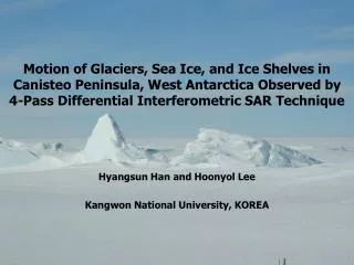
Motion of Glaciers, Sea Ice, and Ice Shelves in Canisteo Peninsula, West Antarctica Observed by 4-Pass Differential Interferometric SAR Technique. Hyangsun Han and Hoonyol Lee Kangwon National University, KOREA. Contents. Introduction Study Area and Data Method

E N D
Motion of Glaciers, Sea Ice, and Ice Shelves in Canisteo Peninsula, West Antarctica Observed by 4-Pass Differential Interferometric SAR Technique Hyangsun Han and Hoonyol Lee Kangwon National University, KOREA
Contents • Introduction • Study Area and Data • Method • Analysis of Differential Interferogram • Conclusion
Introduction • Importance of POLAR REGION • Glaciers, Sea Ice, and Ice Shelves are closely related to the Global Warming and Sea Level Rising • The motion of glaciers and the degradation of sea ice and ice shelves in the Antarctic are being accelerated • Large changes have been observed in the West Antarctica • Usefulness of Synthetic Aperture Radar (SAR) for the polar research • SAR is not affected solar radiation or atmosphere conditions • Differential SAR interferometry technique is useful in extracting the surface displacement of glaciers, sea ice, and ice shelves
Introduction • Objective • Extraction of interferometric phases from ERS-1/2 tandem pairs of Canisteo Peninsula, West Antarctica • Analysis of the motion of glaciers, sea ice, ice shelves, and their kinematic interactions by using 4-pass DInSAR technique
Study Area Canisteo Peninsula near Amundsen Sea in West Antarctica (100 km×100 km) Radarsat-1 mosaic image of the Antarctic
Study Area Range Azimuth Canisteo Peninsula near Amundsen Sea in West Antarctica (100 km×100 km) Center Location : 73˚ 57´ 46˝ S / 101˚ 53´ 26˝ W Ice shelves and small islands around the peninsula Several glaciers of different size on the coastal area Crevasses between the peninsula and ice shelves Ice shelf Ice shelf Canisteo Peninsula Amundsen Sea Geocoded ERS-1 SAR image of the study area (1995/10/21, 100 km×100 km)
ERS-1/2 SAR Data Range Range ERS-1 SAR 1995/10/21 Azimuth Azimuth ERS-2 SAR 1995/10/22 Range Range Azimuth Azimuth ERS-1 SAR 1996/03/09 ERS-2 SAR 1996/03/10
ERS-1/2 SAR Data *Bperp: Perpendicular baseline *Ha: Height ambiguity
Method • SAR Interferometry (InSAR) • Using the difference of phases between two or more SAR images • Widely used to extract topography and deformation of surface • Differential SAR Interferometry (DInSAR) • Extracting displacement of surface by removing topographic phases • 2-pass (accurate DEM is nedded), 3-pass, and 4-pass DInSAR • Application: measuring displacements by earthquake and volcano, ground subsidence, motion pattern of glaciers and ice shelves, etc.
4-Pass DInSAR • For the 2-pass DInSAR • An accurate DEM is needed • Radarsat-1 Mapping Project (RAMP) DEM is the best for the Antarctic • RAMP DEM is not accurate enough to apply 2-pass DInSAR • The horizontal resolution of 400 m in the study area • Use of 4-pass DInSAR technique • 4-pass DInSAR can extract surface displacement without DEM • Use of two interferograms • One interferogram is used to estimate the topographic phases (topo-pair) to be subtracted from the other interferogram containing the phases of deformation (diff-pair)
Interferogram Generation Generation of SLC image Offsets estimation Co-registration Generation of multi-look interferogram Estimation of interferometric baseline Generation of earth-flattened interferogram
Decision of topo-pair and diff-pair • October 21-22, 1995 • Perpendicular baseline: 40 m • Height ambiguity: 243.2 m • The springtime of the Antarctic • Many changes occur over the surface • March 9-10, 1996 • Perpendicular baseline: 152 m • Height ambiguity: 63.9 m • Interferogram well shows topographic phases • Weaknesses and limitations • More changes occur in March than October due to the high temperature • Some phases of deformation in the topo-pair interferogram • A gap of 5 months between two pairs Diff-pair Topo-pair
Erath-Flattened Interferogram The earth-flattened interferogram extracted from diff-pair The positive fringes on glaciers and sea ice Many circular fringes on ice shelves No fringes on some sea ice due to large movement of sea ice during a day Some topographic phases
Erath-Flattened Interferogram The earth-flattened interferogram extracted from topo-pair The topographic phases are well displayed No interferometric phases in the sea Some fringes by surface displacement
Differential Interferogram The differential interferogram The major parts of topography were removed Fringes by deformation were shown in the differential interferogram One fringe (from purple to yellow, cyan, and purple again) represents the change of 2.83 cm from radar to ground
Analysis of Differential Interferogram Interaction between glaciers and sea ice The largest glacier in Canisteo Peninsula Glacier moves toward the sea ice The sea ice shows up rise interferometric phases The pushing glacier gave repulsive force to sea ice which type is land-fast ice The land-fast ice showed the structure of anticline
Analysis of Differential Interferogram Interaction between glaciers and sea ice Other glaciers in Canisteo Peninsula Glacier rapidly moved to land-fast ice The interferometic phases of the adjoining land-fast ice indicated the up rise of ice surface
Analysis of Differential Interferogram Interaction between glaciers and sea ice Glacier and sea ice indicated the interferometric phase of the same direction Sea ice was moved by the motion of glacier in the same horizontal direction towards the sea The sea ice is similar to the land-fast ice The ice type is the land-fast ice weakly harnessed to sea bottom or pack ice not harnessed at all
Analysis of Differential Interferogram Sea ice motion and type Sea ice showed rapid motion by ocean tide → Pack Ice The land-fast ice indicated a little motion The sea ice type can be classified
Analysis of Differential Interferogram Sea ice motion and type Sea ice showed rapid motion by ocean tide → Pack Ice The land-fast ice indicated a little motion The sea ice type can be classified
Analysis of Differential Interferogram Interferometric phases on ice shelf Many circular interferometric phases on the ice shlef They are observed in both the topo-pair and diff-pair interferogram Seamounts or unidentified islands may be under the bottom of the ice shelf → a cause for the motion on the surface of ice shelf
Conclusion • We revealed dynamic features of glaciers, sea ice, ice shelves and their interactions by applying 4-pass DInSAR to ERS-1/2 tandem pairs • The upwelling sea ice by repulsive force against the fast motion of glaciers is observed • Sea ice showing the motion in the same direction with the glaciers could be land-fast ice weakly connected to sea bottom or pack ice • We could classify the sea ice type and decide a clear boundary between different ice types • The circular fringes on ice shelves were caused by seamounts or unidentified islands at the bottom of the ice shelves • For more detailed analysis, it is necessary to apply numerical analysis and modeling