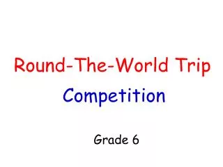
Exploring the BuckyMap: A New Perspective on World Geography
The BuckyMap is an innovative approach to understanding the world’s geography by transforming the traditional flat map. It highlights how conventional projections, like Mercator, distort country sizes—exemplified by the inaccurate portrayals of Britain and India. This method uses an orange peel analogy to illustrate reimagining our globe. By collapsing the world onto an icosahedron, we can accurately depict sizes and shapes of continents. Engage with this interactive experience by creating your own BuckyMap and discovering the real sizes of countries!

Exploring the BuckyMap: A New Perspective on World Geography
E N D
Presentation Transcript
AFRICA ©
Britain ©
Open up ©
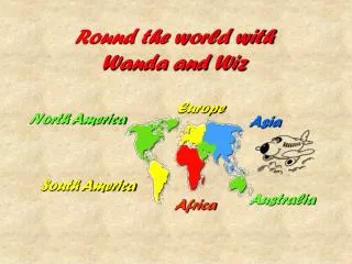
Now look at the map in your booklet We shall call it a Buckymap
Buckymap ©
Which number is South America? 5 4 1 South America 3 6 2 7 ©
Which number is Australia? Australia 5 4 1 South America 3 6 2 7 ©
Which number is Europe? Australia 5 4 1 South America 3 Europe 6 2 7 ©
Which number is North America? Australia 5 North America 4 1 South America 3 Europe 6 2 7 ©
Which number is Asia? Australia 5 North America 4 Asia 1 South America 3 Europe 6 2 7 ©
Which number is Africa? Australia 5 North America 4 Asia 1 South America 3 Europe 6 2 Africa 7 ©
Which number is Antarctica? Australia 5 North America Antarctica 4 Asia 1 South America 3 Europe 6 2 Africa 7 ©