Download
1 / 23
230 likes | 430 Vues
Bill Coulbourne | Applied Technology Council Mike Biggerstaff | School of Meteorology | Oklahoma University Kurt Gurley | Civil and Coastal Engineering | University of Florida Andrew Kennedy | Civil Engineering and Geological Sciences | Notre Dame

E N D
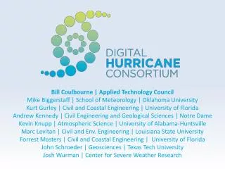
Bill Coulbourne | Applied Technology Council Mike Biggerstaff | School of Meteorology | Oklahoma University Kurt Gurley | Civil and Coastal Engineering | University of Florida Andrew Kennedy | Civil Engineering and Geological Sciences | Notre Dame Kevin Knupp | Atmospheric Science | University of Alabama-Huntsville Marc Levitan | Civil and Env. Engineering | Louisiana State University Forrest Masters | Civil and Coastal Engineering | University of Florida John Schroeder | Geosciences | Texas Tech University Josh Wurman | Center for Severe Weather Research
Discussion Points • Overview of Field Programs • Digital Hurricane Consortium • Real-Time Monitoring of Deteriorating Weather Conditions and Damage • Summary and Conclusions
Introduction • The US weather observing network is coarse and prone to failure during natural disasters • Ascertaining whether a 10 year and a 100 year event has occurred is a challenge • Result = incomplete climate record that can cause • Poor risk coverage decisions • Over or under-designed residential, commercial, utility and transportation infrastructure • Preparedness, response, and resource allocation policies that are not consistent with actual risk
Introduction • As a result, university, government and private researchers began conducting experiments at landfall in the late 1990s • Wind / Rain / Load Monitoring and Damage Assessments • Center for Severe Weather Research • Florida Coastal Monitoring Program • University of Florida, Clemson, Florida International University • Louisiana State University • Texas Tech • University of Alabama at Huntsville • University of Oklahoma • Surge / Waves Monitoring • University of Notre Dame • USGS
Portable Weather Stations ↓ Deployed < 3 minutes FCMP LSU TTU UNF ↑ Deployed < 30 minutes. Withstand 200 mph winds + debris ↑ ↑ For Civil Structures
Portable Doppler Radars CSWR UAH UO CSWR TTU UO ↑ Short Range Radars (K- and X-Band). 4-20kHz ↑ ↑ Long Range Radars (C-Band)↑
Surge and Wave Sensors ND USGS USGS ND
Collective Firsts • Mobile Doppler deployment during Fran (1996) • Tower deployments during Charley/Bonnie (1998) • Real-time data transfer during Isabel (2003) • Radar/tower co-deployment during Isabel (2003) • Large-scale damage assessments during Charley (2004) • Hurricane force pressures captured during Frances (2004) • Offshore surge measurements during Ernesto (2006) • Wind-driven rain measurements during Ike (2008) • Rapid damage assessments during Ike (2008)
End Users • These observations are used extensively by local, state and federal users as well as the private sector • Post-storm • Real-time for a subset of the platforms • Weather Reconnaissance and Forecasting • Local and State: Sea Grant, State Meteorologists • Federal : National Hurricane Center, NWS Weather Forecast Offices, AOML Hurricane Research Division, NWS Ocean Prediction Center. Industry: Ocean Weather, WeatherFlow, Weather Predict, Various Utilities Companies (e.g. FPL, Progress, Dominion Power) • Emergency Management • Local and State: FL Division of Emergency Management, LA Governor's Office of Homeland Security and Emergency Preparedness • Federal: FEMA Mitigation Assessment Teams
End Users • Risk Modeling • Local and State: State of Florida Public Hurricane Loss Model, Florida DEP, Texas General Land Office, FL Inlet Management Districts, County Engineers • Federal : FEMA HAZUS-MH, Army Corps of Engineers Coastal Hydraulics Lab and District Offices • Industry: AIR Worldwide Corporation, Applied Research Associates, EQECAT, Risk Management Solutions, Coastal Planning and Engineering… • Damage Assessment and Recovery • Local and State: Building Officials Association of Florida, LA Recovery Authority, County Emergency Management Programs • Federal: WFO Office of Response and Restoration,FEMA, NIST Building and Fire Research Laboratory • Industry: Institute for Business and Home Safety, Federal Alliance for Safe Homes, Roofing Industry Committee On Weather Issues, Utilities
Digital Hurricane Consortium • The research programs responsible for collecting wind, storm surge, wave, and damage data will begin to mesh these independent deployment activities to form organized campaigns that produce integrated datasets in real-time • Thus the Digital Hurricane Consortium was formed • Entering into an arrangement with the Applied Technology Council to • Coordinate and seek opportunities with federal agencies • Key role is to operationalize science in the disaster environment
Planned Activities • Adaptable campaign strategies tailored to the size of the wind field, translation speed, track (re)curvature, coastal geography, risk of flooding, model consensus, user needs, etc… • Optimized coordination between portable radars and instrumented tower programs • Real-time multi-Doppler wind field production; standardization via tower data
Streaming DHC Data to Govt. Users MADIS Surge Sensors IOOS/RCOOS DHC Home Command Center Wind, Surge,Wave Obs. NOAA Gateway Govt. Labs & Universities WWW NAWIPS AWIPS II PortableWeatherStations DHC Field Command Center Doppler Wind Fields NHC alternative WFO Mobile DopplerRadars primary State EOC FEMA Local EOC
Wind vs. Damage • Couple the high-resolution wind field and surge/wave measurements with • Video monitoring • Rapid damage assessments (≤ 36 hrs) • Comprehensive damage assessments (> 36 hrs) and the load scenario for buildings and infrastructure can be unambiguously defined • Brings us the final component the Digital Hurricane Consortium, damage documentation • Led by the wind engineering faculty who are on the ground immediately after landfall…
Damage Assessments • Immediate canvassing essential for determining damage “footprint” to initiate larger scale surveys • FCMP, RMS and FLASH conducted rapid damage assessments after Hurricanes with • Gustav: 900+ in 1.5 days • Ike: 300+ in 8 hours • Quite reasonable for a team of two to survey 20 properties an hour
Summary • High-resolution 2D wind fields are coming • Multiple Doppler radars will collect velocity data at < 500 ft • Velocity field will be further adjusted to building heights using (3 sec gusts in airport terrain at 33 ft) using land use land cover data and tower measurements underneath • Reconstruction of site-specific sequences of wind, surge, wave and rain will be possible • Radars can see gust fronts moving onshore through cities • Lessen/remove the need to depend (wait) on wind field models to determine loads on buildings and infrastructure
Implications for Emergency Management • Quantum leap in situational awareness • Coupled with loss model (even rules of thumb), immediately identify heavily impacted areas • Load data + damage assessments → evidence of what works and what doesn’t • Programs are very nimble → deploy sensors at critical facilities, bridges, etc. • Provide instant answers to critical questions: • When can first responders redeploy? • Are road conditions safe for evacuation?
Implications for Surge Modeling • Access to real-time wind field production • New coordination with offshore/onshore sensor deployments • Increased observation density • Shear stress estimates for short fetch lengths in bays, estuaries… • Pressure gradient fields • Sea-to-land-to-bay/river/etc: internal boundary layer formation; changes in force balance (friction, coriolis and centrifugal forces) • Anemometric estimates of drag coefficients (CD → z0)
Implications for Forecasting • Real-time monitoring of decaying weather conditions at landfall • Verification of intensity forecasts • Observe small-scale features (e.g. MCV, BL rolls, tornadoes, etc.) • Tracking storm features may allow for 5-10 minute nowcasting
Thank your for your time and attention Questions: Contact Forrest Masters, University of Florida