Download
1 / 31
320 likes | 585 Vues
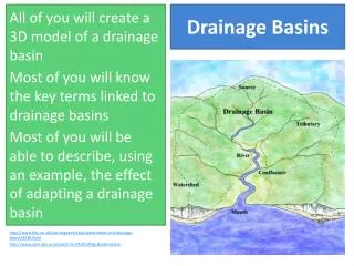
Watersheds a.k.a. Drainage Basins and Stormwater Management. What is a watershed ?. Watershed: a region or regions drained by, or contribute water to a stream, river, lake, or other body of water. What does that mean? Is PAHS inside of a watershed? YES !. PAHS. PAHS. Delaware River.

E N D
What is a watershed? • Watershed: a region or regions drained by, or contribute water to a stream, river, lake, or other body of water. • What does that mean? • Is PAHS inside of a watershed? • YES! PAHS PAHS Delaware River Atlantic Ocean 1 2
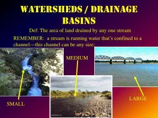
Watersheds and Drainage basins • Similar to a sink, any water that falls in the basin… • “drains” to lower elevations • The “drain” is typically a larger body of water like a river or stream, lake then finally • ocean
A more basic definition • Land on which water falls by precipitation or snow melt and drains in a downward sloping direction
Properties of a Watershed • Involve infiltrated groundwater discharge and surface water in the form of runoff • Transport water all over the Earth’s surface • Include diverse environments: urban, suburban and rural- lawns, forests, farms, parking lots, buildings, skyscrapers, etc. • Human activities have a great (usually bad) impact on them 4
Purpose of the Watershed • Provides a surface for runoff and infiltration • Temporary water storage • Transports the water to a larger body
Topography is Important! • Topography is a measure of elevation and the lands shape: (a measure of how high or low the land around is.) If you are at the top of a hill of the hill, where will the rain water go? • DOWN! • Have you ever seen a creek at the very top of a hill?
Watershed Divides • The high points that the water runs down from are called divides (Most call them ridges) • A divide is any ridge between 2 streams that splits a watershed • A divide can be a mountain or just a large hill. It can also be a range of hills. • Can you think of an area in Phoenixville that is a divide? The Great Divide (Rockies) in red splits our country into two major watersheds
A hill in Potter County, PA Water drains in 3 different directions from the top of this hill- hence the water will supply 3 different watersheds Kimberton Hills Divides French Creek from the Pickering Creek Watersheds
Watershed Borders • We will be determining which watersheds you live in by looking at the divides and whether your house lies between two divides. • Why are the divides the boundaries of the watersheds? • They are high elevation points 8
Associated Terms • Headwater- source of a river; where it first originates • Mouth- where the river finally drains • Upstream- moving against the downward direction of the water • Downstream- moving with the downward direction of the water • Confluence- where two rivers, streams,etc meet • Divide- area of high elevation/topography that separates one waterbasin or watershed from another • Tributary-smaller branch of a river or stream
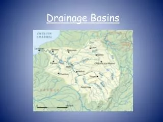
Pennsylvania • All drain to the Atlantic Ocean Pennsylvania is separated into 104 large watersheds. • These 104 can be separated even more into thousands of large (and small) watersheds/drainage basins. • There are 6 major watersheds/basinsin or part of PA Selected watersheds in Pennsylvania
PA Watersheds • Look at the map of PA. • Which watershed do we live in according to this map? • Delaware Watershed • Does anyone recognize those boundaries? 11
Pennsylvania waterbasins Watersheds typically mark mountain or rivers so they often also mark town, county and even state boundaries! 11a
Susquehanna / Chesapeake Basin • Largest watershed in PA • Contains the Susquehanna River (largest river in Pa) and the top of the Chesapeake Bay • Headwaters are in New York’s Otsego Lake • Mouth is the Chesapeake Bay • Notice it falls between two divides, the one in Pittsburgh and the Appalachian.
Delaware Basin • Yippee! This is our watershed. • Third largest watershed in Pennsylvania • Headwaters are in Hancock, NY • Ends in the Delaware Bay by Philly
Delaware River has its head (the beginning of the river) located in New York State. Its mouth is in the Delaware Bay towards Philly and NJ It’s delta (triangle wedge of sediment dropped when the river slows) often clogs the bay The Schuylkill River and Lehigh Rivers are the largest in this basin and both tributaries of the Delaware More about the Delaware Basin
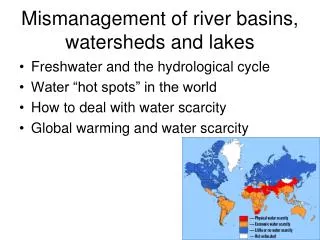
Why do we care about watersheds? All life depends on the soil, water and air in that watershed. If the water is polluted or not cared for then the ecosystems and life in them will perish! 15
The Delaware Watershed covers parts of PA, NJ, NY, and DE. 15 million people drink this water (5% of US population) Much of this basin has been un-dammed and is therefore in good condition! Who drinks our water?!?
What is the big deal? Acid Mine Drainage Spinach E.coli Outbreak Mercury and Cadmium Levels Hormone Levels Other Pollution If it falls on the watershed it will likely end up in drinking water or the ocean! 17
Can we manage water runoff? • Yes, through Storm water management. Runoff on a 90% impervious surface! 18
Stormwater Settings • Rural: • Open, unpaved, more free land and vegetation. • Ex. farmland • and forests
Stormwater Settings • Urban: • More developed and “citylike” • A lot of asphalt and concrete, moreimpervioussurfaces
Water Balance Rural Urban If you pave and decrease infiltraton, RUNOFF INCREASES!
Urbanization Stormwater Problems • More asphalt, less infiltration
Urbanization Stormwater Problems • Often urban runoff is dumped straight back to rivers and lakes without treatment
Urbanization Stormwater Problems • Impervious city aqueducts and levees don’t allow infiltration, they aid runoff to supposedly prevent flooding.
Surface runoff • Picks up pollutants • “hotspots” ex. gas stations • Often flows right into streams • Increases flooding
Surface runoff out of the urban area it is often faster and has more volume • This increases streambank erosion and fills runoff with choking cloudysediment!
Urbanization of a Floodplain Increased runoff of Urban areas actually causes more frequent floods Predevelopment Postdevelopment
Flooding can often be prevented with good stormwater management practices and development planning