Christopher Columbus: Maps and Voyages of Discovery
40 likes | 165 Vues
Explore the early maritime maps that shaped the adventurous spirit of Christopher Columbus. Discover how these navigational tools illustrated safe sailing routes for sailors, avoiding dangerous rocks and sandbanks. Learn about the world as Columbus perceived it around 1490, which fueled his ambition to embark on voyages of exploration. His dream to discover new lands led him to believe in the possibility of reaching Cathay by sailing west. Join us on this historical journey to understand the maps and visions that inspired a legendary sea captain.

Christopher Columbus: Maps and Voyages of Discovery
E N D
Presentation Transcript
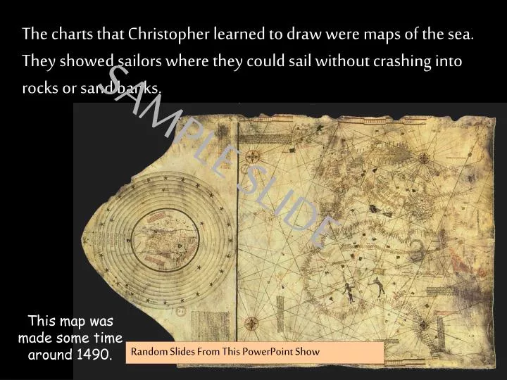
The charts that Christopher learned to draw were maps of the sea. They showed sailors where they could sail without crashing into rocks or sand banks. SAMPLE SLIDE This map was made some time around 1490. Random Slides From This PowerPoint Show
Christopher Columbus studied hard at school and dreamed of going to sea. He wanted to be a brave sea captain and to set out on voyages of discovery. SAMPLE SLIDE Random Slides From This PowerPoint Show
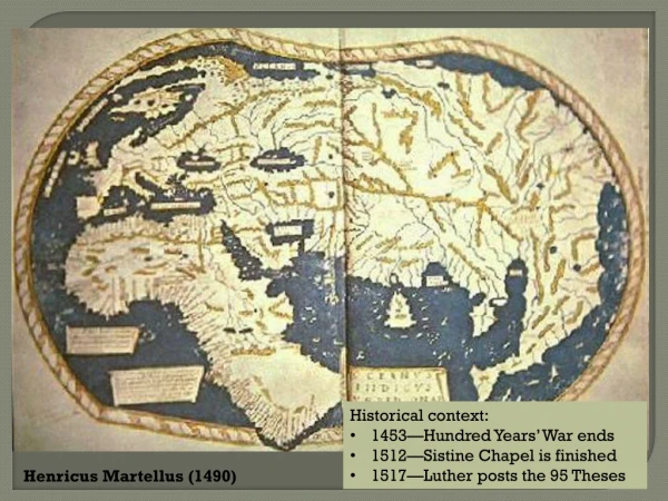
N W E S SPAIN This is what Columbus thought the world looked like and why he was so convinced he should go west to find Cathay. SAMPLE SLIDE Random Slides From This PowerPoint Show
www.ks1resources.co.uk KS1Resources.co.uk If your back button doesn’t work……… to return to your last webpage CLICK HERE www.graphicsfactory.com www.clipart.com


![⚡Read✔[PDF] Time Was](https://cdn7.slideserve.com/13156089/slide1-dt.jpg)