Download
1 / 21
210 likes | 353 Vues
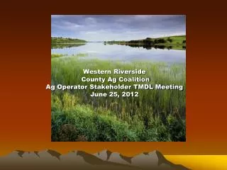
Western Riverside County Ag Coalition Ag Operator Stakeholder TMDL Meeting June 25, 2012. What is a TMDL?. TMDL=Total Maximum Daily Load The TMDL process has 3 steps : 1. Identify quality limited waters Lake Elsinore and Canyon Lake 2. Establish priority waters

E N D
Western Riverside County Ag CoalitionAg Operator Stakeholder TMDL MeetingJune 25, 2012
What is a TMDL? • TMDL=Total Maximum Daily Load • The TMDL process has 3 steps: 1. Identify quality limited waters Lake Elsinore and Canyon Lake 2. Establish priority waters 3. Develop TMDLs-nutrients • Pollutant sources may include: 1.point sources 2.nonpoint sources 3.naturally occurring sources
Lake Elsinore TMDL • Lake Elsinore is listed on the Clean Water Act Section 303(d) list as impaired due to excessive levels of nutrients (hypereutrophication), algae blooms and fish kills • Beneficial uses identified as impaired are warm freshwater aquatic habitat and body and non-body contact recreation • Affected water quality objectives – algae, dissolved oxygen, and total inorganic nitrogen
Canyon Lake TMDL • Canyon Lake is listed on the Clean Water Act Section 303(d) list as impaired for excessive nutrients (N & P) and high bacteria (No bacteria TMDL) • Designated beneficial uses for Canyon Lake are municipal and domestic supply, agricultural supply, groundwater recharge, contact and non-contact recreation, warm freshwater habitat, and wildlife habitat
Who is WRCAC? • WRCAC=Western Riverside County Agriculture Coalition • Formed in 2004/non-profit status December of 2004 • Formed by interested stakeholders to address Ag and Dairy environmental issues: CAFO permit, salt offset issues in groundwater, TMDL and other issues • Single voice of representation at TMDL Task Force meetings for agricultural and dairy stakeholders • Has been successful in obtaining many grants to offset stakeholder costs and continues to seek grant funding for matching funds
Who are the stakeholders ? • TMDL Task Force began informally 2002 • 1st Formal Task Force Agreement (TFA) finalized in March of 2007. Note: Current TFA finalized at June mtg. • Task Force stakeholder allocations first collected for FY 2005-2006 and every year thereafter • Allocations are based on WLA % in San Jacinto Nutrient Management Plan • Ag and Dairy represent about one-third * • Stakeholders include: EMWD,EVMWD, • All cities (MS4 Permittees), Riverside County Flood Control, SJWA, US Forest Service and many others • *Aerial mapping demonstrates lower % since adoption
WRCAC TMDL • WRCAC received grant in 2006 to implement TMDL with Dairy and Ag operators • Aerial mapping of the San Jacinto Watershed completed* • Dairy and Ag on separate TMDL collection cycles and calculated differently • Dairy TMDL –Calculated per cow-2 cycles complete 100% compliance both cycles • Ag operators identified by mapping: 2007 & current 2010 • Ag operators calculated on per acre basis/year *Significant baseline data
What are your options? • Join WRCAC to become part of the coalition by paying the WRCAC membership fee and your TMDL allocation fee. This current cycle covers July 1, 2010 thru June 30, 2013. One year in arrears, current ending June 30,2012 and next fiscal year. • Or you can deal as an individual entity directly with the RWQCB to address your portion of ALL activities and costs for the period of 2010-2013. • IF your cumulative acreage is LESS than 20 acres-you are not in the TMDL. See me after the meeting.
Join WRCAC • As a member of the WRCAC coalition, you are obligated to pay a membership fee and stakeholder allocations (as determined by the TMDL Task Force) to WRCAC who then pays the Task Force. • WRCAC pays allocation to the LESJWA Task Force and participates in all meetings representing Ag and Dairy • Task Force as a group meets requirements of TMDL • There are some “group” tasks and some Ag or Dairy specific tasks.( i.e. Ag Nutrient Management Plan) • WRCAC has submitted draft AgNMP. Final comments and plan to RWQCB July 30, 2012.
Do it yourself ? • Contact RWQCB with your plan • Must meet the following: • Watershed wide nutrient water quality monitoring plan (QAPP, Annual reports, plan preparation, implementation and lab costs) (see RWQCB letter) • Ag NMP –plan and implementation • Other requirements of TMDL Note: the TMDL Task Force has spent more than $1.5 million to date on this TMDL
Why 3 years of Stakeholder Fees? • Ag operators owe past due allocations from 2010-2011. • Current year allocations are for July 1st of 2011 to June 30th of 2012. • We will also collect for the 2012-2013 year. • We “bundle” the years together using aerial mapping data on acreage and ownership. It would be cost prohibitive to collect every year and track the changes in ownership. Between 2007-2010 mapping, there was an estimated 32% change in ownership in agricultural parcels. • We wait for “free” fly over data of the SJ watershed rather than paying for custom data. Every 3 years seems to work. • Cost to do the mailing-certified postage, printing, staff time, phone calls, etc. • We may bill 2013-2014 separately. Depending on several factors and accuracy of aerial mapping data at the time.
Why Should I Join WRCAC? • WRCAC attends meetings and represents dairy and agricultural operators as one voice • The TMDL is very complex. • WRCAC deals directly with RWQCB on agriculture specific issues • Less expensive and more efficient working as a coalition • WRCAC members will benefit from seeking grant funds to meet specific ag/dairy project needs and potential TMDL Task Force matches.
What’s the next step? Join WRCAC. Packets include: -Membership Form -Invoice -Exemption Application -Other reference material Remember, to meet compliance requirements you must Be a member of WRCAC AND pay the allocation fee!
Fees • IMPORTANT!!!!! • Please issue TWO checks: • Both are made out to WRCAC-however one is for membership and one is for the allocation fee. • Both FEES are based upon your acreage • If you are a dairy, your membership has already been paid in the dairy cycle. Your dairy under the CAFO permit has already paid the appropriate fees to meet compliance. This is ONLY for associated agricultural forage crop land use not part of your permit.
But I don’t have Ag land! • WRCAC has an exemption process you may want to consider. • Do you have land that has not been used for agriculture in the past 5 years and will not be used in the future for agriculture? • Example: You have 100 acres. 60 acres are non-useable but zoned agriculture. 5 acres is my home and yard. The remaining acres is citrus. You may submit an application for exemption (fee required) for 65 acres and upon approval of exemption only be held responsible for 35 acres. • I thought my land was vacant but when I went to see it it is being farmed without my approval? Land owner is the responsible party-but please call us and we will assist you.
Land is Being Developed? • Land has been purchased for development; currently leased for ag. The landowner is responsible for TMDL costs. • Many owners are revising contracts with leasees to address TMDL costs. • Land is being developed and construction permit has been obtained. This land would then be shifted into urban TMDL acreage upon verification. • Past allocations must still be paid by the owner. • Due to the economy, considerable acreage that was being prepared for development actually reverted back into active agricultural activity.
Future • Ag waiver process in the entire Santa Ana Watershed starting with the San Jacinto Watershed is being developed. Monitoring will be specific to agriculture and coordinated with TMDL effort to avoid duplication. • Ag NMP Implementation plan submitted 12/31/11. • Comments received back from RWQCB and response due to RWQCB July 30,2012 • Implementation of AgNMP • Search for grants and matching $$$$$ • Implementation project funding/added to ag budget for 2010-2020
Questions • You may direct questions directly to the Santa Ana Regional Water Quality Control Board-if you choose to not join WRCAC and set up a meeting to meet TMDL requirements • Questions can be referred to : WRCAC--- Pat Boldt at mpboldt.53@gmail.com or to Bruce Scott at bruce@sbdfarms.com RWQCB---Hope Smythe at hsmythe@waterboards.ca.gov