Download
1 / 46
460 likes | 560 Vues
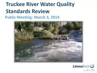
Water Quality Model Updates to Support Truckee River Nutrient WQS and TMDL Reviews. December 14, 2011 Laura Weintraub. Review of Model Update Approach. Goal: develop best possible tools given reasonable time, information, and funding

E N D
Water Quality Model Updates to Support Truckee River Nutrient WQS and TMDL Reviews December 14, 2011 Laura Weintraub
Review of Model Update Approach • Goal: develop best possible tools given reasonable time, information, and funding • Due diligence to ensure models work well for recent time period • Model update steps: • Extend models to run through 12/2008 • Document changes to models and databases, results of model confirmation • Disseminate information to the focus stakeholder group • Original calibration reports (Systech 2007, LimnoTech 2008) • Model update report (LimnoTech November 28, 2011)
Model Linkage – Observed Conditions Climate Soil Types WWTPs Pollutant Land Use Loads Watershed Water Quality Water Management Practices Model Model Quality Water Reservoir Releases Quantity WARMF TRHSPF
Recent WARMF Enhancements (post-calibration) • Model Version Update (October, 2008) • Received from Systech • Finer spatial resolution, general database update and recalibration • Temperature improvements (Systech) • Bedrock heat transfer, river ice formation, warming from river friction
Limited WARMF Model Changes • Adjusted initial soil moisture reflects start of new time period • Set breakpoint for updated land use / land cover • Pre-2002 simulations: old GIS layer circa late 1990’s • Post-2002: updated GIS layer circa 2006 • Adjusted organic carbon and nutrient soil concentrations post-2002 • Rapid land use change; model does not completely capture impacts with just surface loading changes • Consistent with findings of Chalk Creek study (JBR, 2010) • Directly specified reservoir releases (historical data) rather than modeling reservoir operations
Summary of WARMF Results • Flow • Strong model performance at Truckee River at Sparks (upstream boundary for TRHPSF): r2 = 0.87 • Moderate performance at North Truckee Drain and Steamboat Creek • Day to day variability is small compared to Truckee River • Although variability not captured well, model accurately describes average flows • Nutrients • Model predictions fall within range of uncertainty of observed data for large majority of years • Results consistent with previous calibration
Known Limitations in WARMF Performance • Snow melt peaks under-predicted during wettest years • Does not impact critical low flow periods • Summer residential irrigation not captured (potable / reuse water) • Little impact to summer flows in Truckee River downstream of confluence with Steamboat Creek and NTD • Remaining underprediction of spring streamflow temperatures • Sensitivity analysis showed only minor changes to DO with higher temperatures during this non-critical late winter / early spring period Above limitations do not preclude the use of the model for intended need
Recent TRHSPF Enhancements (post-calibration) • Organic labile nutrient representation • New state variables for org. labile nitrogen and organic labile phosphorus • No longer derived indirectly from BOD and phytoplankton stoichiometry • Directly accounts for settling and decay • TRHSPF linkage with WARMF • Upstream and tributary boundary conditions from WARMF • Provides capability to evaluate Truckee River response to changes in watershed activity • Implemented discrete segment for Gilpin Spill bypass • Model accounts for potentially “depleted” segment between Derby Dam and Gilpin Spill return
Limited TRSHPF Model Changes • Flow balance corrections • Truckee Canal and Gilpin Spill flow based on USGS gages • Known limitations in gage accuracy • Truckee Canal flows adjusted to prevent negative Truckee River flows for periods of obvious mismatch – “error” sent down the canal • Addressed occasional model instability when model segment flow dropped to “zero” • Applied minimal “floor” segment volume (100 ft3) • Holds back minimal flow in segment during unstable timestep • Result: adjustment to flow out of segment < 0.05 cfs
Prediction of Annual Nutrient Loads • Noted limitations in WARMF-predicted snow melt peaks • Important to adequately predict total annual loads from Truckee River to downstream water bodies • Compared with load estimations from data • Results within range of uncertainty of LOADEST results for majority of years
Summary of TRHSPF Results • Flow • R2 ranges between 0.85 to 0.88 for all stations • Rating of “very good” • Nutrients • Model predictions fall within range of uncertainty of observed data for large majority of years • Observed error statistics consistent with original calibration • Dissolved Oxygen • Time series plots and observed error statistics consistent with original calibration
Summary of Model Update • Confirmation of WARMF and TRHSPF for 2000-2008 period • Model updated to reflect rapid regional growth through 2006 • Both models are ready for use to support the third-party WQS and TMDL review efforts • Third-parties welcome comments and questions from Focus Stakeholder group
Next Technical Steps in WQS Review Process • Solicit feedback from stakeholder group on modeling tools • Submit comments by January 4, 2012 • Construct / run a set of scenario runs • Establish representative low flow • Link flow management model with WQ models • Vary N and P concentrations DO response • Document any recommendations for revised WQS • Submit report to NDEP for WQS Review
Model Database Updates: WARMF Land Use / Land Cover • Old Land Use / Land Cover (LULC) data reflective of late 1990’s • Rapid growth and development through 2006 • New LULC reflective of recent growth • Combination of several datasets • 2006 National Land Cover Dataset (NLCD) – underlying base layer • 2010 Washoe County / Truckee Meadows Regional Planning Agency – developed parcel data supersedes NLCD data • Site-specific additions based on “parks” layer /Google Earth: ski resorts, golf courses, parks, animal feeding operation
New 2006/2007 layer for import to WARMF (increased development)
TRHSPF Modifications for Gilpin Spill • Truckee Canal return flow 7.5 miles downstream of Derby Dam • Allows for fine tuning of TCID diversions and safety control to return water to river quickly
Gilpin Spill in TRHPSF • Return flow at Gilpin Spill is ungaged • Typically 40-50 cfs is returned, capacity of 2700 cfs • 7.5 Mile Reach between Derby Dam and Gilpin Spill • Historically as low as 3 cfs • Recent USGS flows higher flow conditions • TRHSPF previously only diverted “Net” Truckee Canal diversion flow (no bypass from Gilpin Spill) • No additional depletion in stretch just below Derby • Need to accommodate possible depleted conditions in WQS/TMDL analysis
Gilpin Spill in TRHSPF “Improved” • Model Gilpin Spill explicitly • Calculate diversion and return based on USGS flows • Add a model segment to represent Gilpin Spill “bypass” • Assume water quality in the return is the same as Derby Dam TCIDtot= TR near Tracy – TR below Derby TCIDnet = Truckee Canal near Wadworth Gilpin Spill = TCIDtot - TCIDnet