Download
1 / 8
80 likes | 91 Vues
Explore how Ambee's fire data contributes to early fire detection and rapid response. Learn how advanced technology enhances firefighting efforts and community safety. Read the latest insights on the Ambee blog.<br>

E N D
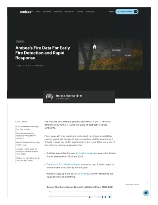
APIs Industries Products Resources Climate Company Login GET APIFOR FREE Forestfire Ambee’sFireDataForEarly FireDetectionandRapid Response July15,2023 6minread BarshaSharma CONTENTLEAD CONTENTS Firewasoneofhumanity’sgreatestdiscoveries.Itstillis.Theonly differencenowisthatitisalsothecauseofdestructionacross continents. Earlyfiredetectionthrough firedataanalysis Enhancingemergency responsewithpredictive analytics Fires,especiallyman-madeandunchecked,havebeendevastating, causingsignificantdamagetolives,properties,andtheenvironment. Climatechangehasaddedsignificantlytothisissue.Herearesomeof thestatisticsthatmayemphasizethis: Remotefiremonitoringusing wildfiremaps Ambee’scutting-edgefire intelligencetohelpachieve yourtargets Wildfiresaccountedforover$3.2billionindamageacrosstheUnited States,justbetween2022and2023. Findingtherightplaceforall yourfiredataneeds TheAnnual2021WildfiresReportstatesthatover7millionacresof wildlandwereconsumedbyfirethatyear. Humanscauseasmanyas85% ofwildfires,withtheremaining15% causedbylavaandlightning. Welcome to Ambee!
APIs Industries Products Resources Climate Company Login GET APIFOR FREE Source:InsuranceInformationInstitute AmongotherstatesintheUS,Californiahashadthemostwildfiresand thelargestnumberofacresburnedoverthepastfiveyears.In California,wildfiresburned8.7millionacresfrom2018to2022.Alaska hadthesecondmostwildfires,whichburnednearly6.5 millionacres. Source:ValuePenguin Theseinstancesshowcasetheimportanceofearlyfiredetection systemsandrapidresponsestrategies.Webelievethatwildfiredatacan playamajorroleinassistingstakeholdersindoingjustthat.Thanksto advancementsintechnologyandtheavailabilityoffiredata,itisnow possibletoleveragetheseresourcesforearlyfiredetectionandrapid response.Herearesomeoftheapplicationsoffiredataforthiscause. Earlyfiredetectionthroughfiredataanalysis Analyzingfiredataenablesexpertstoidentifyfire-proneareas,predict firebehavior,anddetectfireincidentsatanearlystage.Sophisticated algorithmsandmachinelearningtechniquesenableustoprocesslarge volumesofdataandidentifypatternsindicativeofpotentialfires.This earlydetectionempowersemergencyresponderstointerveneswiftly, preventingfiresfromescalatingandspreadinguncontrollably. Satellitesequippedwithadvancedimagingsensorsactasavaluable resourceformonitoringfiresfromspace.Thesesatellitescandetectthe presenceofactivefires,measuretheirintensity,andmaptheirextent, especiallyinareaswheremanualinterventionisimpossible. AtAmbee,wecombineandcalibratedatafrommultiplesources,oneof whichissatellitedata.WerecentlydidadeepdiveintoGOESvs. SentinelSatelliteBandChannels.Readthisblogtofindoutmoreabout whichsatellitesourceweprefertomapburnedareasofhistoricalfires.
Byintegratingsatelliteimagerywithotherdatasets,suchasweather conditions,airqualityreports,andlandcoverdata,acomprehensive pictureoffireriskandspreadcanbegenerated.Thisinformationaidsin efficientresourceallocationandenablesfireagenciestoplantargeted responsestrategies.AddedGeographicInformationSystems(GIS)based riskmodelstothiswillhelpestablisharelationshipbetweenvegetation, climate,andtopographywithwildfires.Thiswillcertainlyhelp stakeholderscalculateandmaptheprobabilityoffireanditsspread. APIs Industries Products Resources Climate Company Login GET APIFOR FREE Enhancingemergencyresponsewithpredictive analytics Firedatacanbecombinedwithhistoricalrecords,weatherforecasts, andgeospatialinformationtodeveloppredictiveanalyticsmodels. Predictiveanalyticsenablesauthoritiestobebetterpreparedand respondmoreeffectivelytovariouscrisissituations.Byleveraging advanceddata,predictiveanalyticscanhelpanticipateandforecast emergencies. Oneexamplewheredatawasusedtopredictfireriskandprioritizefire inspectionswaswhenthefiredepartmentinAtlanta,US,enlisteda localdatasciencegrouptoidentifycommercialpropertiesmissingfrom itsfireinspectionslist.TheycreatedFirebird,abigdatatool,toidentify buildingsthatarelikelytohaveafirehazardintheimmediatefuture. Throughaninteractivemap,Firebirdintegratedandvisualizedfire incidents,propertyinformationandinspections,and riskscorestoinformthedecision-makingprocesses.Since implementation,ithasbeenusedtoaccuratelypredictfires71% of commercialfiresinAtlanta. Ifaminortechnologicaladdition,suchasFirebird,totraditionalfire detectionstrategiescancreatesuchahugeimpact,imaginetheresults ifimplementedonalargerscale. Predictiveanalyticsassessvariousvariablessuchasweather conditions,vegetationdensity,andhistoricalfirepatternstodetermine areasathighriskofignition.Byidentifyingthesehotspots,authorities can: Enhanceandoptimizeevacuationplans Byanalyzinghistoricaldata,weatherpatterns,vegetationdensity,and topography,predictiveanalyticscanpinpointareaspronetowildfires. Thisinformationaidsindevelopingevacuationplansthatprioritize vulnerablecommunitiesandensuretimelyevacuations.Predictive modelsalsoconsiderreal-timedata,firebehavior,roadnetworks,and populationdistributiontodeterminethemostefficientevacuation routesandtiming.Thishelpsauthoritiesavoidcongestionandenables thesafeevacuationofresidents. Effectivelyallocateresources Predictiveanalyticscananalyzehistoricalwildfiredata,fuelloads, weatherconditions,andterraintopredictthepotentialintensityand spreadofwildfires.Thisinformationassistsinallocatingfirefighting
resources,suchasfireengines,aircraft,andpersonnel,toareaswithresources,suchasfireengines,aircraft,andpersonnel,toareaswith thehighestriskorgreatestneed.Thesemodelscanalsoestimatethe demandforresourceslikefireretardants,water,andfirefighting equipment.Thisenablesagenciestostrategicallypositionandreplenish supplies,ensuringefficientutilizationduringfirefightingoperations. APIs Industries Products Resources Climate Company Login GET APIFOR FREE Implementriskmitigationstrategies Withthehelpofpredictiveanalytics,stakeholderscandevelopearly warningsystemsforwildfires.Thesesystemsprovidetimelyalertsto authoritiesandcommunities,allowingthemtotakeproactivemeasures suchasimplementingfirerestrictions,initiatingcontrolledburns,or issuingevacuationorders.Theycanalsosimulateandpredictthe behaviorandspreadofwildfirestohelpanticipatefiremovements, prioritizeresources,anddeviseeffectivecontainmentstrategies. Remotefiremonitoringusingwildfiremaps Remotefiremonitoringusingfiremapsisacrucialcomponentof modernfirepreventionandmanagementstrategies.Firemapsprovide real-timeinformationaboutthelocation,intensity,andspreadof wildfires. Theprimaryadvantageofremotefiremonitoringisitsabilitytodetect firesearly,evenininaccessibleregions.Satellitesensors,drones,or camerascandetectthepresenceofheatsignatures,smokeplumes, andchangesinvegetationcover,allowingauthoritiestoidentify potentialfireoutbreaksbeforetheyescalateintolarge-scaledisasters. Inarecentstudy,aforest'sfireriskwasassessedusingadvanceddata forearlyfiredetection.Thestudyfocusedonapineforestin Thessaloniki,Greece,pronetowildfires.Thesystemwasevaluated usingrealandsyntheticimagesconvertedtomapsandachievedahigh detectionrateof91.6% forrealfires.Thismethodshowspromisefor monitoring,protecting,anddetectingsuburbanforestfiresin Thessaloniki. Suchoverlayingfiremapswithinformationonairquality,weather conditions,andvulnerableareas,emergencyresponderscanprioritize theireffortsandmakeinformeddecisionsondeployingfirefighting teams,aircraft,andequipment.Thesefiremapsareupdatedinnear real-time,providingadynamicviewoftheevolvingfiresituation.This informationcanbesharedwithmultiplestakeholders,includingfire departments,landmanagementagencies,andlocalcommunities, facilitatingcoordinationandcollaborationinfiresuppressionefforts. Remotefiremonitoringalsoaidsinpost-fireassessmentandrecovery. Bycomparingpreandpost-fireimagery,researchersandlandmanagers canevaluatetheextentofdamage,assessecologicalimpacts,andplan restorationactivities.Thisinformationhelpsinunderstandingthelong- termeffectsofwildfiresandimplementingstrategiestoreducefuture firerisks. Ambee’scutting-edgefireintelligencetohelp achieveyourtargets
APIs Industries Products Resources Climate Company Login GET APIFOR FREE AtAmbee,wehavenearreal-timedetectionofwildfiresandmonitoring. Welookatmultiplesatellitedatasourcesandgroundstationsources andcombinethemtogivefirelocationsevery5mins.Using geostationarysatellitesforanyregionmakesthedetectionoffires quickerandmoreaccurate. Letmeexplainhow– Geostationarysatellitesofferseveraladvantageswhenitcomestofire hotspotdetectionandmonitoringinanyregion.Thoseare: Dedicatedcoveragetoensurethatfirehotspotsareconsistently monitoredwithoutanycoveragegaps. Nearreal-timedatathatallowsimmediatetrackingandmonitoringof firehotspots.Thisinformationcanbeinvaluableforearlyfire detection,rapidresponse,resourceallocation,firebehavior assessment,firespreadprediction,andappropriateresponse strategiesimplementation. Firedetectionalgorithmsleveragecontextualinformation,suchas spatialpatternsandrelationshipsbetweenneighboringpixels,to improvetheaccuracyoffiredetection.Byconsideringthespatial context,algorithmscanreducefalsepositivesandrefinefirehotspot identification. However,thealgorithmemployedbypolar-orbitingsatellitestodetect wildfiresisdifferent.Theyanalyzetheobservedreflectancevaluesto distinguishfiresignalsfrombackgroundnoise.Theyleveragethe uniquespectralsignaturesoffiresincombinationwithcontextual information.Andtoremovefalsepositivesfromtheirdetections,they groupadjacentpixelswithhighfireactivityandconsiderspatialpatterns todifferentiatefiresfromotherthermalanomalies,suchashotsurfaces orindustrialemissions. Hence,usingacombinationofbothsatellitesources,alongwith governmentstationreports,Ambeeprovidesfirelocationsevery5 minutes.WithaddedtechcapabilitiesofourproprietaryAIandML algorithmsandmergingdatafromvarioustypesofsatellites,weensure ourdataisreliableandaccuratewithoutanyfalsenegatives. Findingtherightplaceforallyourfiredataneeds Harnessingfiredataforearlyfiredetectionandrapidresponsehas immensepotentialtosavelives,protectproperty,andminimizethe devastatingimpactoffires.Ambeeleveragesthepowerofsatellite imagery,IoTdevices,artificialintelligence,andpredictiveanalyticsto providethemostaccuratefiredata.Usingthis,emergencyresponders cangainvaluableinsightsintofirebehavior,enablingproactive strategiesandtimelyinterventions. Ambee’sforestfireAPIprovidesuserswithcriticalinformationonthe location,intensity,andsize,amongotherparameters.Thisalsoincludes comprehensiveairqualitydatathatcanhelpdetectthelingeringeffects oftoxicair.SomeofournewparametersalsoincludetheFireRiskIndex andburnedAreapolygoncoordinates,whichcanbehighlybeneficialto
analyzetheburntlocationswithgreaterdepth.Ambee’sforestfireAPIisanalyzetheburntlocationswithgreaterdepth.Ambee’sforestfireAPIis availablegloballyandhasanhourlyrefreshrate. Industries Products Resources Climate APIs Company Login GET APIFOR FREE ReadaboutAmbee’senhancedfireAPIhere.Ifyou’drathertryitout yourself,signupforourAPIdashboard. Ambeealsoprovidesaproductdedicatedtoforestfires.Getacomplete pictureofthistoolandtheintentbehinditsdevelopmentinthisblog: TheDevastatingRisksofGlobalWildfires:HowCanTechnologyHelp? Ambee'svisualizedfiredatainwildfireriskanalyticstool ExploreAmbee’sFireRiskAnalyticsToolforyourself! Ifyouhavesomequeriesorquestions,getintouchorleaveacomment below! Likedwhatyoujustread?Shareitwithafriend. EMAILID Havequestions? Getintouch! EnteryourEmailID MESSAGE Writeyoumessagehere SUBMIT
APIs Industries Products Resources Climate Company Login GET APIFOR FREE RelatedPosts Forestfire DataVisualization Engineering Forestfire DataVisualization Insurance Forestfire Ambee’sHistoricalWildfireData: EverythingYouNeedToKnow Enhancedfiredata?Ambee’snew andimprovedforestfireAPI DeepDiveIntoGOESandSentinel SatelliteBandChannels:Features andApplications BarshaSharma BarshaSharma 4 minread 4 minread RomaJain 3 minread Forestfire AirQuality Forestfire TheDevastatingRisksofGlobal Wildfires:HowCanTechnology Help? HowOrganisationsCanUseAir QualityandFireDatatoTackle Fire-RelatedIssues BarshaSharma BarshaSharma 3 minread 5 minread PoweryourClimate ActionswithAmbee TALKTOUS
Products APIs Industries DownloadApp APIs Industries Products Resources Climate Company Login GET APIFOR FREE C6 Pollen Marketing&Advertising Ambeeapp AirQuality Pharma&DigitalHealth E&CDevices Weather Banking&Finance DevicesAPI ActiveForestFire Logistics&SupplyChain SevereWeather SmartCities Aboutus NDVI RetailandConsumerGoods PrivacyPolicy Termsandconditions Contact GHG RefundPolicy NaturalDisasters Pricing AllRightsReserved©DatairTechnologyPrivateLimited. BuiltatParallel