Download
1 / 13
130 likes | 283 Vues
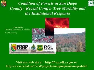
Vegetation and Fuels Mapping An Interagency Approach A Briefing to the Fire plan Steering committee June 4, 2009. The California Department of Forestry and Fire Protection. Mark Rosenberg: California Department of Forestry and Fire Protection. Vegetation and Fuels Mapping. Outline

E N D
Vegetation and Fuels MappingAn Interagency ApproachA Briefing to the Fire plan Steering committeeJune 4, 2009 The California Department of Forestry and Fire Protection Mark Rosenberg: California Department of Forestry and Fire Protection
Vegetation and Fuels Mapping Outline • Standard interagency products • Current Status • Work In Progress
Vegetation and Fuels Mapping Powerful Monitoring Tool • Map Hazardous Fuels • Track Forest Health Trends • Assess cumulative impacts • Model Wildlife Habitat • Estimate Timber, Biomass and Carbon Stocks • Examine the effectiveness of existing policies • across jurisdictions • Design Fuels Reduction Strategies • Provides opportunities for agencies to look • across jurisdictions and programs
Vegetation Derived Fuels and the Fire Plan Input Data Fire Plan Use Level of Service FUELS LAYER Fuel Rank
Cooperative Strategy Vegetation and Fuels Mapping 5 Panel Project Areas Statewide 5-year Cycle YR 1 - Imagery Acquisition YR 2 - Change Detection YR 3 – Vegetation Updates YR 4 – Inventory YR 5 - Trend Analysis • Baseline Vegetation Map • Inventory Link • Change Monitoring • Vegetation Map updates • Trend analysis
Cooperative Mapping Approach • Make use of existing vegetation data • Cost effective • Avoids redundancy • Promotes ownership and acceptance of data and analysis • Encourages collaboration • Define a consistent spatial base (polygons) • Independent of map attributes • Stand based • Objective delineation of landscape features • Hierarchically add thematic detail necessary to meet map standards • Specific focus on detailed type and structure attributes • Accuracy assessment • Forest inventories used as independent reference data and as a statistical sample for forest attributes
Vegetation Product Description • Vegetation Type in 2 classification schemes • CALVEG (FGDC Alliance Level) • Wildlife Habitat Relationships • Crown Closure in 10% class breaks • Size (seedling, sapling, pole, small, medium, large, Multi-storied) • Primary and Secondary Attributes in Tree types http://www.fs.fed.us/r5/rsl/projects/frdb/layers/ev_mid.html
Fuels Product Description • Surface Fuels (40 categories) • Ladder Fuels • Crown Fuels (CBD From FIA)
Current Status • Vegetation Data: • 1997-2005 • 1: 100,000 scale & 1:24,000 scale • Fuels Data: Last Fire Plan update in 2004
Current Efforts • Integrate Existing Vegetation Map Products from Other Sources • Leverage existing data and programs (FIA, RSL, FRAP,NLCD) • Link Vegetation maps to Inventory and derive canopy attributes (Forest Vegetation only)
Central Coast Update Map Updates In Progress North Coast Update Integrates Existing Data From Other Sources • North Coast – 2007 • NWFP products • Central Coast – 2001 • NLCD products • Tree Size mapping (2001 Imagery) • Central Valley – 2001 • NLCD products • Tree size mapping Central Valley Update
Collaborative Work in Progress • Task 1: Central Coast Polygon Mapping and Tree Structure Database 2001 (2.3 million acres) • Task 2: Southern Sierra Tree Structure Database 2001 (7.75 million acres) • Task 3: South Coast Polygon Mapping and Tree Structure Database 2001 (200,000 acres) • Task 4: Central Valley Tree Structure Database 2001 (18.5 million acres): • Task 5: North Coast Database Updates 2007 (6.8 million acres) • Task 6: Forest Inventory Database Links 2001-2007 • Task 7: Canopy Fuels Derivation from Inventory:
For More Information FRAP Website: • http://www.frap.cdf.ca.gov/projects/land_cover/index.html USFS RSL Website • http://www.fs.fed.us/r5/rsl/projects/frdb/layers/ev_mid.html • http://www.fs.fed.us/r5/rsl/clearinghouse/gettiles.shtml • http://www.fs.fed.us/r5/rsl/projects/classification/ Mark Rosenberg Fire and Resource Assessment Program California Department of Forestry and Fire Protection (916)445-5366 Mark.Rosenberg@fire.ca.gov