
Abstract
Sea Level Anomaly. Mean Dynamic Topography. T(z), S(z). Sea Surface Temperature. Combination of in-situ and satellite observations to monitor the Ocean State: Application to the North Atlantic Ocean

Abstract
E N D
Presentation Transcript
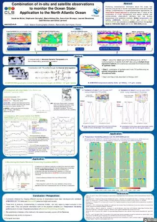
Sea Level Anomaly Mean Dynamic Topography T(z), S(z) Sea Surface Temperature Combination of in-situ and satellite observations to monitor the Ocean State: Application to the North Atlantic Ocean Sandrine Mulet, Stéphanie Guinehut, Marie-Hélène Rio, Anne-Lise Dhomps, Laurent Bessieres, Gaël Nicolas and Gilles Larnicol CLS / Space Oceanography Division, Ramonville Saint-Agne, France Abstract Producing comprehensive information about the ocean has become a top priority to monitor and predict the ocean and climate change. Complementary to modeling/assimilation approaches, an observation based approach is proposed here. It relies on the combination of in-situ (temperature and salinity profiles) and remote-sensing observations (altimetry and sea surface temperature) and statistical methods. Global temperature andsalinity (ARMO3D),absolute height and current fields(SURCOUF3D) are provided at a weekly period from the surface down to 1500-meter depth and for the 1993-2009 periods. Temperature Salinity Global - Salinity Global - Temperature smulet@cls.fr Data Rms difference (% variance) Rms difference (% variance) Rms difference (% variance) Rms difference (% variance) ARIVO climatology From the NCDC center – Reynolds ¼° From the RIO05 [Rio and Schaeffer, 2005] From the SSALTO/DUACS center From the CORIOLIS center T/S Climatology Method • Compute field of Absolute Dynamic Topography and the corresponding geostrophic circulation • Step 1 : extract the ‘steric’ part of SLA (Dhomps et al., 2010) + vertical projection of satellite SLA+SST data using a multiple linear regression method and covariances calculated from historical data synthetic fields • Step 2 : combination of synthetic and in-situ T/S profiles using an optimal interpolation method • combined fields • Step1 and Step 2 fully described in Dhomps, 2010 • Combination with T/S profiles through the thermal wind equation ARMOR3D temperature/salinity fields : [0-1500m] – 1/3° grid - weekly SURCOUF3D geostrophic current fields and absolute height : [0-1500m] – 1/3° grid - weekly Validation • Validation of step 1 over the year 2007 - using independent T/S profiles • Comparison with Argo floats in the Atlantic over 2006/2007 period at 1000m • Validation of step 2 over the years 2002-2008 - using independent T/S profiles Years 2007 (~45 000 profiles) Years 2002-2008 (~3400 profiles) Correlation ● SURCOUF3D (weekly, 1/3°) ▲GLORYS = Mercator-Ocean reanalysis (weekly, 1/4°) Ferry et al., 2010 ♦ Armor3D= velocity field deduced from the thermal wind equation assuming that 1500m is a level of no-motion (weekly, 1/3°) ● ANDRO = drifting velocities from the Argo floats (≈10days, ≈50/100km) Ollitraut et al, 2010 Argo floats coefficient WOA05 Arivo Old New WOA05 Arivo Synth Combined Standard deviation (cm/s) skill score [Taylor,2001]: increases when the standard deviation of the difference decreases and the correlation increases. The score penalizes methods with low variability. Standard deviation (cm/s) • Comparison with current meters from RAPID-WATCH MOC array [Cunningham et al., 2007] in the western boundary current at 25°N in the Atlantic 40m Meridional velocity (cm/s) 26.5°North 76.5°West 40m Zonal velocity (cm/s) Florida Africa 100m SURCOUF3D GLORYS RAPID (current meters) RAPID (T/S + current meter at 100m through the thermal wind equation) SURCOUF3D_v2 Large improvements compared to previous estimate thanks to Arivo climatology + new covariances Contribution of the Argo observing system visible at all depth, 10 to 20 % of the signal variance 400m 100m Application • Good consistencybetweenSurcouf3D and currentmetersfor zonal velocitiesat all depths and for the meridionalvelocitiesfrom the surface to 800m • Surcouf3Ddoes not resolve the current inversion at 1200m because Armor3D istoosmooth. UsingT/S fromRapid, that have a betterresolution, permits to resolve the inversion. • Temperature Variability patterns over the 2004-2008 period: • Synthetic fields, ARMOR3D, SCRIPPS (Roemmich et al., 2009) and SODA (Carton et al., 2008) show very similar patterns for temperature. Salinity patterns in SODA are more noisy (see additional material) . 400m 800m Synthetic fields SODA 2.2.4 ARMOR3D SCRIPPS 800m 1200m 2004 1200m APR MAY JUN JUL AUG SEP OCT NOV DEC JAN FEB MAR APR APR MAY JUN JUL AUG SEP OCT NOV DEC JAN FEB MAR APR 2004 2005 2004 2005 Application 2005 • Moonitoring the Atlantic Meridional Overturning Circulation (AMOC) • Comparison of 3 differentmethods to compute the maximum AMOC strength in the Atlantic at 26.5°N. The first method uses in-situ data from the RAPID-WATHCH MOC array. Surcouf3D uses a combinaison through the thermal windequation of in-situ and remote-sensing observations. GLORYS is a numerical model reanalysis. • Good consistencybetween the threedifferentfields. • High variability • Intercomparison useful for the cross validation of the various datasets as well as for assessing the error on the MOC computation 2006 Transport (SV) 2007 SURCOUF3D GLORYS RAPID 2008 References Conclusion / Perspectives Carton J.A. and B.S. Giese, 2008: A reanalysis of ocean climate using Simple Ocean Data Assimilation (SODA), Monthly Weather Review, 136, 2999-3017. Cunningham S.A., T. Kanzow, D. Rayner, M.O. Baringer, W.E. Johns, J. Marotzke, H.R. Longworth, E.M. Grant, J.J.-M Hirschi., L.M. Beal, C.S. Meinen, H.L Bryden (2007), Temporal variability of the Atlantic Meridional Overturning Circulation at 26°N. Science, 317, 935-938. Dhomps A.L., S. Guinehut, P.Y. Le Traon and G. Larnicol, 2010: A global comparison of Argo and satellite altimetry obsercations, submitted to Ocean Science. Dhomps A.L., 2010: Amélioration des méthodes de combinaison des données Argo et altimétrie pour le suivi des variations à long terme de l’océan. Thèse de l’Université Paul Sabatier, Toulouse III Ferry N., Parent L., Garric G., Barnier B., Jourdain N. C. and the Mercator Ocean team, 2010: Mercator Global Eddy Permitting Ocean Reanalysis GLORYS1V1: Description and Results. Mercator Ocean Quarterly Newsletter #36, January 2010, 15-27 Ollitraut, M. and J.-P. Rannou, 2010: ANDRO: An Argo-based deep displacement atlas. Mercator Ocean Quarterly Newsletter #37, April 2010 27-34. Rio, M. H., and P. Schaeffer (2005), The estimation of the ocean mean dynamic topography through the combination of altimetric data, in-situ measurement and GRACE geoid, Proceedings of the GOCINA international workshop, Luxembourg. Roemmich, D. and J. Gilson, 2009: The 2004-2008 mean and annual cycle of temperature, salinity, and steric height in the global ocean from the Argo Program. Progress in Oceanography, 82, 81-100. • 2 products obtained by merging different sources of observations have been developed and validated: ARMOR3D (3D T/S fields) and Surcouf3D (absolute height and current). • These kind of products, complementary to numerical models, are very useful to depict evolution in the ocean state. They can provide information both on the physical variables (i.e. Temperature Variability patterns) and on ocean integrated parameters (Meridional Overturning strength). • We underlined a limitation of the method in the western boundary current off the Bahamas • Understand why and try to improve it • Compute error bars


