Download
1 / 12
120 likes | 363 Vues
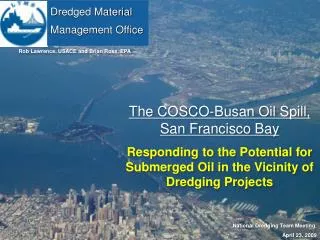
Sediment Transport Modeling to Inform Dredged Material Management 20 April 2010. Megan Kaun San Francisco District (415) 503-6909 megan.m.kaun@usace.army.mil. Building Strong on the Cornerstone of the Southwest. US Army Corps of Engineers BUILDING STRONG ® San Francisco District.

E N D
Sediment Transport Modeling toInform Dredged Material Management20 April 2010 Megan Kaun San Francisco District (415) 503-6909 megan.m.kaun@usace.army.mil Building Strong on the Cornerstone of the Southwest US Army Corps of Engineers BUILDING STRONG® San Francisco District
Topics for Discussion • SF Bay Dredged Material Management Plan (DMMP) . • Information Gaps Important to USACE Dredging Program. • Recent USACE SF Bay Sediment Modeling. • USACE “White Paper” Model Evaluation. • Proposed Modeling Strategy for DMMP.
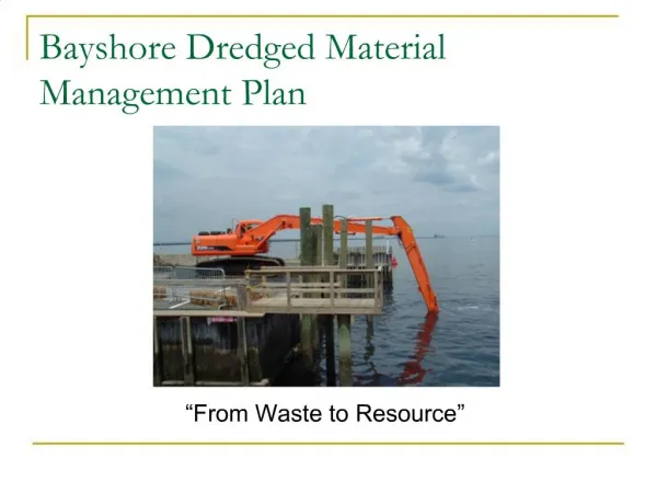
S.F. Bay Dredged Material Management Plan (DMMP) • 20-year management plan for sediments dredged by USACE in SF Bay Region. • 11 Federal Channels • Includes O&M dredging & new work. • Tiered under LTMS program (40/40/20 plan). • Scheduled for 2012 completion. • Sediment modeling “White Paper” presents research options to program managers.
USACE Dredging Program Information Gaps • Changes to navigational dredging requirements as a result of sea level rise and decreasing sediment load. • Increase in annual O&M dredging volumes as a result of new work & deepening projects. • Potential to use sediment as a resource.
USACE SF Bay Sediment Modeling • Deep Water Ship Channels (SF Bay to Stockton and Sacramento) • UnTRIM (3D) • Hamilton Restoration Area, Aquatic Transfer Facility (ATF) • UnTRIM (3D) + Particle Tracking Model (FISH-PTM) • South Bay Shoreline • ADH (2D)
Deep Water Ship Channels:SF Bay to Stockton &Sacramento3D UnTRIM • UnTRIM model used to estimate shoaling based on bottom shear stress in proposed ship channels. • With and without sea level rise conditions. UnTRIM Model Domain
Hamilton Restoration Area, ATF3D UnTRIM + FISH-PTM • UnTRIM model used to calculate 3D velocity field for a given time interval. • Particle tracking (FISH-PTM) used to estimate fate of placed sediment. Predicted deposition patterns resulting from repeated dredged sediment placement (spring tides).
South Bay Shoreline ADH (2D) Coarse Grid Boundary Conditions: (Tide and Surge) Fine Grid Wind (speed and direction)
“White Paper” Model Evaluation • Prefer a Hydrodynamic + Wind Wave model + Sediment Transport (cohesive and non-cohesive) model that has/is: • 3D capabilities to represent “gravitational circulation”, • An unstructured grid to capture complex geometry/bathymetry, • Able to simulate hydraulic structures, • Well documented/tested and supported by scientific community, • Available to apply to SF Bay study area now to include results in 2012 DMMP. • Models considered include: ADH, CMS, DELFT3D, EFDC, MIKE3, UnTRIM, SUNTANS.
Proposed Modeling Strategy, 2012 DMMP • Expand UnTRIM 3D Hydrodynamic model: • Integrate 3D Sediment Transport model (SediMorph). • Link to wind wave model (K-model/SWAN). • Calibrate & verify model: • Hydrodynamic model calibration will be refined, especially in the Central & South Bay. • Wind wave model will be calibrated using wave data. • Sediment transport model will be calibrated to (limited) sediment flux data.
Proposed Modeling Strategy, 2012 DMMP (cont.) • Primary model application: • Identify and assess aquatic locations for potential beneficial use sites. • Proposed beneficial use sites will be screened by DMMP/LTMS team as areas for future pilot studies. • Secondary model application: • Approximate changes to USACE maintenance dredging needs over next 20 years (2035) at selected SF Bay federal navigation channels due to sea level rise and decreased sediment loads.
Questions? • Megan Kaun • megan.m.kaun@usace.army.mil • (415) 503-6909 • Frank Wu • frank.wu@usace.army.mil • (415) 503-6902