
Groundwater Potential Mapping Using Remote Sensing and GIS Techniques
Explore how remote sensing and GIS are leveraged to delineate groundwater potential zones in the Lower Chaouia area of Morocco. The methodology involves mapping lineaments, drainage, soil type, slope, elevation, and lithology data. By integrating various thematic maps and satellite imagery, this study provides insights into groundwater availability for domestic use.

Groundwater Potential Mapping Using Remote Sensing and GIS Techniques
E N D
Presentation Transcript
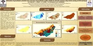
Delineation of groundwater potential zones and zones of groundwater quality suitable for domestic purposes using remote sensing and GIS techniques M. El MOULAT1, A. FEKRI1, A. E. FRYAR2, A. M. MILEWSKI3 and R. GLOAGUEN4 1 Department of Geology, Faculty of Sciences Ben M'sik Casablanca, Morocco. Email: m.elmoulat@gmail.com and ahmedfekri1@gmail.com 2 Department of Earth and Environmental Sciences, University of Kentucky. Email: alan.fryar@uky.edu 3 Department of Geology, University of Georgia, Athens, GA 30602. Email :milewski@uga.edu 4 Institute for Geology, Freiberg University of Mining and Technology, 09599, Freiberg, Germany. Email : gloaguen@geo.tu-freiberg.de Introduction Methodology Results In the area of Morocco known as the Lower Chaouia occurs in a hard rock terrain, especially the Precambrian quartzite and fractured schist. The groundwater resources are poorly known, and the search for water is randomly treated. To overcome this problem, we developed a map of groundwater potential which will guide the mobilization of additional resources to meet the growing demand for water; for irrigation as well as for domestic purposes. Remote sensing, image processing and GIS provide many required data to cover a large area in short time. Thanks to Those efficient tools, various maps have been designed such as the lineaments, drainage, soil type, slope, elevation and the lithology.The groundwater availability is qualitatively classified into five classes (Excellent, good, moderate, poor and nil). Input Data • Existing maps • Digital Soil Map • ASTER • LandSat ETM+ Editing & adjustement Geoprocessing Digitizing Thematicmaps Elevation, lithology, Soil, Slope, Drainage, Lneament. Integration to GIS & Spatial Analysis Objectives • Delineate the groundwater potential zones using relevant data (lineaments, drainage, soil type, slope, elevation and the lithology ), • Develop a GIS model that can identify groundwater potential zones based on the thematic maps applicable across Lower Chaouia. Conclusion Groundwater Potential Map Remotely sensed data from satellite imagery provided information used to identify and outline geology, lineament features, geomorphological and hydromorphogeological conditions. These features served as either direct or indirect indicators of groundwater occurrence. The comprehensive use of GIS resulted in the development of an efficient and effective methodology of spatial data management and manipulation. The integration and analysis of various thematic maps and image data were useful for the delineation of zones of groundwater potential and zones of groundwater quality suitable for domestic purposes.


