CRUISE Tool: Estimating Unimpacted Streamflow in the Connecticut River Basin
The CRUISE tool is an interactive, GIS-based application designed to estimate continuous, unimpacted daily streamflow at ungaged locations in the Connecticut River Basin, excluding the mainstem. It features a user-friendly point-and-click GIS interface coupled with a Microsoft Excel spreadsheet approach. By integrating existing methodologies, CRUISE estimates unregulated streamflow across the basin, making it a valuable resource for managing water resources. Users can select stream reaches of interest and obtain basin characteristics necessary for accurate streamflow calculations.

CRUISE Tool: Estimating Unimpacted Streamflow in the Connecticut River Basin
E N D
Presentation Transcript
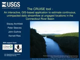
The CRUISE tool - An interactive, GIS-based application to estimate continuous, unimpacted daily streamflow at ungaged locations in the Connecticut River Basin Stacey Archfield Peter Steeves John Guthrie Kernell Ries With support from: The Connecticut River looking north in the early evening, from the French King Bridge at the Erving-Gill town line in Western Massachusetts. Source: http://en.wikipedia.org/wiki/Image:IMG_3758_view_north_from_French_King_Bridge.jpg
Objectives • Develop an easy-to-use, screening-level tool to estimate continuous unimpacted streamflow at ungaged locations in the Connecticut River basin (excluding the mainstem of the Connecticut River) POINT-AND-CLICK GIS USER-INTERFACE COUPLED WITH MICROSOFT EXCEL SPREADSHEET APPROACH REQUIRES SIMPLIFYING ASSUMPTIONS AND FEW PARAMETERS The Connecticut River UnImpacted Streamflow Estimation (CRUISE) tool • Existing tools to estimate daily, unregulated and water-use adjusted streamflow in southern New England had already been developed [Archfield et al., 2010 and Archfield and Vogel, 2010] (aka MA SYE) • This project leverages these existing methods to create the CRUISE tool, which provides estimates of daily, unregulated streamflow across the entire Connecticut River Basin.
Method to estimate daily streamflow Estimate basin characteristics Area = XX.X mi2 Solve the regression equations ln(Q50) = a1 + b1 * (ln(Area)) Estimate flow-duration curve STREAMFLOW EXCEEDENCE PROBABILITY Obtain flow series from reference gage STREAMFLOW TIME Archfield et al. [in review]; Shu and Ourda [2011]; Archfield et al. [2010]; Mohamoud [2008]
The Connecticut River Basin UnImpacted Flows tool Test site available at: http://webdmamrl.er.usgs.gov/s1/sarch/ctrtool/index.html Begin with an overview of the entire basin Locate and select stream reach of interest
The Connecticut River Basin Unimpacted Flows Tool Basin is delineated Basin characteristics are computed and summarized The user can export a shapefile of the delineated basin and obtain the basin characteristics needed to calculate daily streamflow This process balances the flexibility needed to customize the tool to meet the user needs while removing the complex desktop setup process and problems encountered due to version control. The spreadsheet program uses the basin characteristics to complete the calculation of daily streamflow
Demonstration of the CRUISE tool CRUISE website Clark Brook near Buckland, MA Latitude: 42.58917 Longitude: 72.76776
Application of the CRUISE tool • The CRUISE tool was applied to approximately 300 stream locations in the Connecticut River Basin. • These locations were dam locations and/or nodes of ecological interest. • Streamflow data at these nodes are being used in simulation and optimization models of the basin. • Streamflow data is available through the Army Corps of Engineers DSS software Searsburg Dam http://www.hec.usace.army.mil/software/hec-dss/hecdssvue-download.htm
Accessing the node data Shapefile containing the node locations and names (in Massachusetts State Plane) Connecticut - Unregulated Flows - ResSim - 2012-02-17.dss CRUISE from USGS - 2011-10-07.dss
Accessing the node data - DSS Connecticut - Unregulated Flows - ResSim - 2012-02-17.dss
Contact Information Products • CRUISE Website, software tool and user manual • Journal manuscript under revision • Three presentations at technical conferences Please note that streamflows estimated by the CRUISE tool are considered provisional until formal approval by the U.S. Geological Survey. Stacey Archfield Massachusetts-Rhode Island WSC sarch@usgs.gov (508) 490-5072