Download
1 / 24
240 likes | 563 Vues
Comprehensive Hurricane Protection Plan for Coastal Louisiana. Objective. Build Hurricane Resistant Communities in Southeast Louisiana. Past Storms. Betsy ’65. Andrew ’92. Camille ’69. Lake Pontchartrain West Shore. Lake Pontchartrain and Vicinity. Schneider Canal. Donaldsonville

E N D
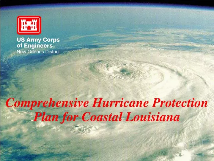
Comprehensive Hurricane Protection Plan for Coastal Louisiana
Objective Build Hurricane Resistant Communities in Southeast Louisiana
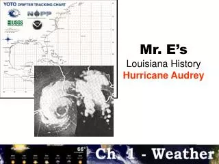
Past Storms • Betsy ’65 • Andrew ’92 • Camille ’69
Lake Pontchartrain West Shore Lake Pontchartrain and Vicinity Schneider Canal Donaldsonville to the Gulf Westbank in the Vicinity of New Orleans Lower Atchafalaya Reevaluation Section 205 Studies New Orleans to Venice Morganza to the Gulf Foundation for a Comprehensive Hurricane Protection System for Southeast Louisiana
Flood Protection • Levees • Floodwalls • Floodgates • Flood Protection System
Main Franklin Pumping Station Channel Lake Palourde Morgan City Intracoastal Patterson Hwy 90 Waterway E. Cote Blanche Bay Wax Lake Outlet Lower Atch. R. Atchafalaya Bay Barrier Plan (Backwater Protection) Levee System Lower Atchafalaya Basin Reevaluation • Name: Mississippi River and Tributaries, Lower Atchafalaya Basin Reevaluation Study Barrier Plan • Purpose: The study is a reevaluation of the existing Atchafalaya Basin Louisiana Project. The purpose is to investigate methods to modify the project in the interest of improving flood protection, navigation, and the environment. • Project Features: The recommended plan is envisioned to include modifications to the Lower Atchafalaya River and Wax Lake Outlet through the addition of structures, levees, channel enlargements, and dredging. The recommended plan is envisioned to include a Barrier Levee from just east of Morgan City, Louisiana to the town of Gibson to prevent backwater flooding from the Lower Atchafalaya River. The Barrier Levee is expected to provide Hurricane Protection to residents north of the alignment. The level of hurricane protection is envisioned to be less than 100 years. • Project Cost: Estimated cost based on the Morganza to the Gulf, Louisiana Reconnaissance Study completed in April 1994 is $170.0 million. • Potential Sponsor: LADOTD, Atchafalaya Levee District, South Terrenbonne Tidewater Management and Conservation District • Project Status: Reevaluation Study is underway and is scheduled for completion in December 2000. Depending on Congressional approval and funding, construction could begin in the year 2004.
Bayou Thibodaux Larose to Golden Meadow Levee Hwy 311 LaFourche Houma Hwy 90 . Chauvin Houma Navigation Canal Lake Boudreaux Hwy 57 Alignment Morganza, LA to the Gulf of Mexico • Name: Morganza, Louisiana to the Gulf of Mexico • Purpose: The study is to determine the feasibility of providing flood protection and improvements to the Water and related land resources in portions of Terrebonne and Lafourche Parishes. • Project Features: The recommended plan is envisioned to consist of a hurricane protection levee around Houma and vicinity. The level of protection is expected to be 100 years. • Project Cost: Estimated cost based on the Morganza to the Gulf, Louisiana reconnaissance study completed in April 1994 is $400.0 million. • Potential Sponsor: LA DOTD, South Terrebonne Tidewater Management and Conservation District • Project Status: The study is scheduled for completion in September 2000. Depending on Congressional approval and funding, construction could begin in the year 2004.
Donaldsonville, LA to the Gulf of Mexico • Name: Donaldsonville, Louisiana to the Gulf of Mexico • Purpose: The study is to investigate the feasibility of providing flood protection and improvements to water related land resources in portions of Assumption, St. James, St. John the Baptist, Lafourche, St.Charles, Jefferson and Plaquemines. • Project Features: The potential recommendation is a project that will reduce flood damage utilizing levees, channel improvements, pumping stations, and water management measurements for environmental restoration. • Project Cost: none • Project Status: Reconnaissance scope studies will be initiated in January 1999. The reconnaissance study will take 18 months at a cost of $500,000. If an economically feasible and environmentally acceptable plan and a non-Federal sponsor is identified, the study would proceed to feasibility phase studies. The feasibility phase studies will take 3 years and construction would begin in 2007. Baton Rouge Lake Pont. Donaldsonville New Orleans Study Area Gulf of Mexico
New Orleans Algiers LA 39 LA 46 Hwy 90 Mississippi River Algiers Lock Gretna Algiers Canal Harvey Lock LA 23 GIWW Levee and Floodwall System Belle Chasse Westbank to East of Harvey Canal Hurricane Protection Hero Canal GIWW Westbank in the vicinity of New Orleans Mississippi River Avondale Harvey Westwego Marrero Hwy 90 Hwy 90 Harvey Lock Levee and Floodwall System Harvey Canal • Name: West Bank in the vicinity of New Orleans, Louisiana Hurricane Protection Project • Purpose: The project will provide standard project hurricane protection to residents in portions of Orleans, Jefferson and Plaquemines Parishes from storm surges from Lakes Cataouatche and Salvador and waterways leading to the Gulf of Mexico. • Project Features: The project consists of about 45 miles of earthen levee, 6 miles of floodwall, a sector floodgate in the Harvey Canal just below Lapalco Boulevard and enlargement of a federal levee along Algiers Canal. • Project Cost: Total project cost is $294.0 million. • Project Sponsor: West Jefferson Levee District and the Louisiana Department of Transportation and Development. • Project Status: Construction is underway and scheduled for completion in FY 2018. Lake Cataoatche LA 45 Bayou Segnette Couha Island Hero Canal Lake Salvador Westwego to Harvey Canal Hurricane Protection Crown Point
JEFFERSON PARISH Tidal Surge Protection BAYOU DE FAMILLIES CROWN POINT ROSETHORNE Lake Salvador FISHER BAYOU BARATARIA BARATARIA GIWW GOOSE BAYOU THE PEN LOWER LAFITTE Jefferson Parish (CAP Projects) • Name: Six Continuing Authorities Program (CAP) Projects in Jefferson Parish on the West Bank Fisher School Basin, Rosethorne Basin, Lower Lafitte, Pailet Basin, Goose Bayou, Crown Point • Purpose: The studies are to determine the feasibility of providing flood protection to developed areas along the Barataria Bay Waterway. The flooding is usually associated with tropical/hurricane storms. The level of protection is less than 100 years • Project Features: A series of ring levees with associated drainage structures and pump stations around developed areas. • Projects Sponsor: West Jefferson Levee District • Project Cost: Total project cost for all six areas is estimated at $31.3 million. • Project Status: Feasibility Study for Fisher School Basin is scheduled for completion in October 1998 and construction is scheduled for FY 2000. Rosethorne feasibility study is scheduled for completion in January 1999. Construction is scheduled for FY 2001. Feasibility studies on the remaining four areas are scheduled to start in January 1999 and are to be completed in FY 2001. Depending on higher authority approval and funding, construction could begin in FY 2003.
Larose to Golden Meadow • Name: Larose to Golden Meadow, Louisiana Hurricane Protection Project • Purpose: The project provides residential and commercial lands along Lower Bayou Lafourche from the 100-year Hurricane surge. • Project features: The project consists of a ring levee approximately 40 miles in length encircling the areas along Bayou Lafourche from Larose to Golden Meadow. Floodgates are located at the upper and lower limits of the project. • Project Sponsor: South Lafourche Levee District • Project Cost: The project cost is $114.0 million. • Project Status: Construction is underway and is scheduled for completion in FY 2007. GIWW Larose to Golden Meadow Hurricane Protection Floodgate Cutoff Bayou Lafourche Golden Meadow Levee and Floodwall System Galiano Floodgate Catfish Lake To Grand Isle
I-12 Hwy 190 Levee and Floodwall System Schneider Canal Hurricane Protection Gause Blvd Gravity Drainage Structure LA 433 Liberty Bayou Slidell I-10 Pump Station Bayou Bonfuca Schneider Canal LA 433 U.S. 11 Southern Railroad Lake Pontchartrain Eden Isles Schneider Canal • Name: Schneider Canal, Slidell, Louisiana Hurricane Protection (Southeast Louisiana Urban Flood Control Project) • Purpose: The project would provide hurricane surge protection for the area of Slidell bounded by the Southern Railroad, Southern Canal, and Interstate Highway 10. The estimated level of protection is a 100 year. • Project Features: The hurricane protection plane includes 6.5 miles of levees, 2.5 miles of floodwall, 8 floodgates, 3 major drainage structures, and a number of small culverts. Pumping stations would be provided at Schneider Canal and W-14 if necessary for restoration of pre-project drainage conditions. • Project Cost: Estimated cost based on reconnaissance report completed in May 1990 is $ 27.0 million. • Potential Sponsor: None • Project Status: In the absence of a local sponsor, no work is being performed on the project.
New Orleans to Venice Hurricane Protection Project Phoenix Reach C Davant Pointe a la Hache MISSISSIPPI RIVER St. Jude Bohemia West Bank City Price River Levee Port Sulphur Reach A T ropical Blend Empire Reach B-1 Buras Venice Reach B-2 New Orleans to Venice • Name: New Orleans-Venice, LA Hurricane Protection • Purpose: The project will provide protection along the east bank of the Mississippi River from Phoenix, Louisiana, and along the Westbank of the river from St. Jude, Louisiana, down to the vicinity of Venice, Louisiana. The project will provide protection from hurricane tidal overflow for 100-year frequency storms. • Project Features: The project consists of 87 miles of enlarged back levees on both sides of the Mississippi River below New Orleans, with associated structures. • Project Sponsor: Plaquemines Parish • Project Cost: The project cost is $244.0 million. • Project Status: Construction is underway and the estimated completion date is FY 2017.
Mandeville Lake Maurepas Lake Pontchartrain Bonnet Carre’ Spillway Lake Borgne New Orleans Lake Pontchartrain and Vicinity Hurricane Protection Floodwall and Levee System Lake Pontchartrain and Vicinity • Name: Lake Pontchartrain, LA and Vicinity Hurricane Protection Project • Purpose: The project is designed to protect residents between Lake Pontchartrain and the Mississippi River levee from surge in Lake Pontchartrain driven by storms up to the Standard Project Hurricane. • Project Features: A new levee north of Airline Highway (US Hwy. 61) from the Bonnet Carre Spillway East Guide Levee to the Jefferson-St. Charles Parish boundary; a floodwall along the Jefferson-St. Charles Parish line; an enlarged levee along the Jefferson Parish Lakefront; an enlarged levee along the Orleans Parish Lakefront; parallel protection (levees, floodwalls, and floodproofed bridges) along three outfall canals (17th St., Orleans Avenue, and London Avenue); levees from the New Orleans lakefront to the Gulf Intracoastal Waterway (GIWW); enlarged levees along the GIWW and Mississippi River-Gulf Outlet (MRGO); and a new levee around the Chalmette Area. The project also includes a mitigation dike on the west shore of Lake Pontchartrain. • Project Sponsor: The Lake Borgne Basin & Levee District, the Orleans Levee District, the East Jefferson Levee District, and the Pontchartrain Levee District are sponsors for the work in St. Bernard, Orleans, Jefferson, and St. Charles Parishes, respectively. • Project Cost: The project cost is $734.0 million. • Project Status: Construction is underway and scheduled for completion in FY 2013.
Hwy 22 Hwy 51 Lake Maurepas Blind River Hwy 61 Levee and Floodwall System Lake Pontchartrain Hwy 55 I-10 I-10 Bonnet Carre’ Spillway LaPlace Illinois Central Reserve Convent I-10 Norco Waterford Vacherie Hwy 61 Lake Pontchartrain West Shore Hurricane Protection Hahnville Kansas City Central Lake Pontchartrain West Shore • Name: Lake Pontchartrain, West Shore Louisiana • Purpose: The study is to determine the economic feasibility of providing increased levels of hurricane protection to residents living west of the Bonnet Carre Spillway and north of the Mississippi River. The level of protection is expected to be standard project hurricane. • Project Cost: Based on the reconnaissance report completed in June 1997, the estimated Project cost is $57.5 million. • Project Sponsor: Lake Pontchartrain Levee District • Project Status: The feasibility study was initiated in April 1998 and is scheduled for completion in July 2001 and construction could be initiated in 2005..
Study For Flood Proofing of Major Hurricane Evacuation Routes Red River Mississippi Texas Louisiana Mississippi River Atchafalya River I-55 I-10 I-12 I-10 I-10 Causeway Hwy 1 GIWW Hwy 27 Hwy 27 Hwy 90 GIWW GIWW Hwy 90 Hwy 46 Hwy 82 Bayou Lafourche Hwy 301 GIWW Hwy 23 Hwy 1 Gulf of Mexico
Lake Pontchartrain West Shore Lake Pontchartrain and Vicinity Schneider Canal Donaldsonville to the Gulf Westbank in the Vicinity of New Orleans Lower Atchafalaya Reevaluation Section 205 Studies New Orleans to Venice Morganza to the Gulf Foundation for a Comprehensive Hurricane Protection System for Southeast Louisiana Major Hurricane Evacuation Routes I-55 I-10 I-10 Causeway I-10 LA 3127 Hwy 308 Hwy 46 Hwy 90 Hwy 301 Hwy 1 Hwy 308 Hwy 90 Hwy 23 Hwy 1
$ 9,686,168,000 Damages Prevented By Lake Pontchartrain Vic Hurricane Protection Project 1983 - 1998