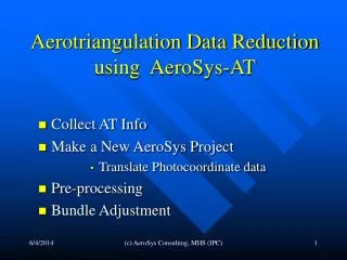
Aerotriangulation Data Reduction using AeroSys-AT
Aerotriangulation Data Reduction using AeroSys-AT. Collect AT Info Make a New AeroSys Project Translate Photocoordinate data Pre-processing Bundle Adjustment . Collect AT Info. Gather Ground Control Point file Convert to AeroSys CTL format How good is your control?

Aerotriangulation Data Reduction using AeroSys-AT
E N D
Presentation Transcript
Aerotriangulation Data Reduction using AeroSys-AT • Collect AT Info • Make a New AeroSys Project • Translate Photocoordinate data • Pre-processing • Bundle Adjustment (c) AeroSys Consulting, MHS (IPC)
Collect AT Info • Gather Ground Control Point file • Convert to AeroSys CTL format • How good is your control? • Get gcp sigma's!, Time = $$ • Plot out in scatter chart PtID,X,Y • Measure AT Data • Softcopy or Analytical Plotter • Export to desired format (ptb, etc.) • Refined vs. Raw • Collect Camera Calibration Info • Focal Length, Xo, Yo, K0, K1, K2, K3, P1, P2, P3 (c) AeroSys Consulting, MHS (IPC)
Make New AeroSys Project • Put data files into designated directory • Measured photocoordinates (*.ptb, etc) • Ground Control (*.ctl) • Project (File) Basename & CTL file • Photocoordinate Format Type • Block Configuration • Camera Information (c) AeroSys Consulting, MHS (IPC)
Translate Photocoordinate Data into AeroSys (*.REF) Format • Verify input format type • Refined vs. Raw • Refined – No Fiducials or Interior Points • Raw – How many fiducials: 4 or 8 • Units – millimeter or microns • Did translation parse OK? (c) AeroSys Consulting, MHS (IPC)
Data Pre-processing • Prepro • Photocoordinate Refinement(REFINE) • Relative Orientation (RELORN) • Strip Formation (STRIPFORM) • Block Formation (BLOCKFORM) • Model Coords to Ground (ESTIMATE) • Photo Resection (RESECT) • Point Intersection (INTERSECT) • Merge data files (MERGE) • Pre-Bundle Data Check (IMAGE RAYS) (c) AeroSys Consulting, MHS (IPC)
Photocoordinate Refinement(REFINE)(raw photocoordinates only) • 2D-Affine transformation from plate coordinates to camera system • Option to remove radial lens distortion • Input = *.PHC, *.CAL • Output = *.REF (c) AeroSys Consulting, MHS (IPC)
Relative Orientation (RELORN) • Makes independent models from adjacent over-lapping photos in each strip • Is direction of flight correct? • Input = *.REF, *.CAL, *.CTL • Output = *.REL (c) AeroSys Consulting, MHS (IPC)
Strip Formation (STRIPFORM) • Connects adjacent independent models together in a strip in model space coords • Minimum 3 common points & photo center • Input = *.REL • Output = *.STP (c) AeroSys Consulting, MHS (IPC)
Block Formation (BLOCKFORM) • Similar to STRIPFORM, but makes a single block of coordinates from adjacent strips in model space • Checks that strips are tied together • Ideal for AB-GPS application with few gcp’s • Input = *.STP • Output = *.BLK (c) AeroSys Consulting, MHS (IPC)
Model Coordinates to Ground (ESTIMATE) • Transforms model space coordinate to object space (ground) coordinates • 2 Options • Strip Polynomial Adjustment Input = *.STP, *.CTL • 2D/3D Hybrid transformation Input = *.BLK, *.CTL • Tie point analysis in log file • Output = *.EST (c) AeroSys Consulting, MHS (IPC)
Photo Resection (RESECT) • Computes the Exterior Orientations of each photo in each strip • Omega, Phi, Kappa, XL, YL, ZL • Input = *.CAL, *.REF, *.EST • Output = *.CAM, *.RST (c) AeroSys Consulting, MHS (IPC)
Point Intersection (INTERSECT) • Computes object space (ground) coordinates for points missed-out during model and strip formation • Input = *.REF, *.EST, *.RST • Output = “updated” *.EST (c) AeroSys Consulting, MHS (IPC)
Merge data files (MERGE) • Merges data files from previous PREPRO step into a first approximation data file for the Aero bundle adjustment • Inputs = *.CAL, *.CAM, *.EST, *.REF • Output = *.AER (c) AeroSys Consulting, MHS (IPC)
Pre-Bundle Data Check (IMAGE RAYS) • Performs space (point) intersections on all object (ground) points from initial approximations • Warning Tool for gross blunders • Input = *.AER • Output = GUI (c) AeroSys Consulting, MHS (IPC)
PREPRO Statistics • *.LOG text files for each step • REFINE • RELORN • STRIPFORM • BLOCKFORM • ESTIMATE • RESECT • INTERSECT • IMAGERAYS • Full Statistics, observations and residuals (c) AeroSys Consulting, MHS (IPC)
Special PREPRO Features • RELORN • Auto eliminate gross misfits • Explicitly remove observation with FLAG = 0 • BLOCKFORM • Reports used and un-used control points • ESTIMATE • Auto eliminate gross misfits • Re-designates bad ground control into check points • Tie-point reporting & Threshold Limits on deltas • RESECT • Auto eliminate gross misfits (c) AeroSys Consulting, MHS (IPC)
Bundle Adjustment • Aero.exe • Input • Prepro Approximations (*.AER) • Cycle • Run • Analyze Statistics • Quick Summary • Model Check • Edit • Output • Adjusted Ground Coordinate (*.XYZ) • Adjusted Orientations (*.ORN) • Other formats (ORI, Itera, Dapor, Z/I, VirtuoZo, etc) (c) AeroSys Consulting, MHS (IPC)
Before we get started … • AeroSys main menu gui • Title bar • Data directory • Project base name • Menu Bar • Button (Icon) Bar (c) AeroSys Consulting, MHS (IPC)
Main Menu Title Bar • Data Directory • G:\AeroTriangulation\Projects\CityofSaintPaul\ • Project Basename • TwinCities • AeroSys file extensions ( * ) (c) AeroSys Consulting, MHS (IPC)
Main Menu Bar • Pull-down Menus • File • Preferences • Translate • Aerial • Bundle • Utils • Help (c) AeroSys Consulting, MHS (IPC)
Main Menu Button Bar • Project GUI • Auto-Prepro • Convert / Translate • Prepro • Aero Bundle (c) AeroSys Consulting, MHS (IPC)
Prepro Functions • Flip-Flop • Add GPS • Legacy Functions • Split • Build • Combine • Refine • RelOrn • StripForm • BlockForm • Estimate • Resect • Intersect • Merge • Image Rays (c) AeroSys Consulting, MHS (IPC)
Prepro GUI (c) AeroSys Consulting, MHS (IPC)
Prepro GUI • Status Info • Options Group Box • Quick Summary • Messages • Operation Buttons • Function Tabs (c) AeroSys Consulting, MHS (IPC)
Prepro GUI • Status Info • Current Status • Which Prepro step • Progress Bar (c) AeroSys Consulting, MHS (IPC)
Prepro GUI • Options Group Box • Different for each step (c) AeroSys Consulting, MHS (IPC)
Prepro GUI • Quick Summary • Lists RMSE residuals (c) AeroSys Consulting, MHS (IPC)
Prepro GUI • Messages • Internal Processing (c) AeroSys Consulting, MHS (IPC)
Prepro GUI • Operation Buttons • GO start processing step • NEXT advance to next step • SKIP skip over processing step • BACK back-up to previous step (c) AeroSys Consulting, MHS (IPC)
Prepro GUI • Function Tabs • Not Enabled, Visual Feedback Only • Use operation buttons to navigate (c) AeroSys Consulting, MHS (IPC)
Set Operating Preferences • File | Preferences | Aerial Auto-Sequence • Run Sequence • Options • Passpoint Prefix • Lens Distortion • Estimate • Check Image Rays (c) AeroSys Consulting, MHS (IPC)
Program Run Sequence • Check Box to enable step • Usually start with RelOrn • End with Aero Bundle (c) AeroSys Consulting, MHS (IPC)
Prepro Options • Delete Passpoint Prefix • Legacy option from JFK’s historical RABATS/BRATS • Required “99” to prefix passpoints • Afterwards stripped-off prefix from the point ID (c) AeroSys Consulting, MHS (IPC)
Prepro Options • Remove Lens Distortion • For RAW photocoords only (c) AeroSys Consulting, MHS (IPC)
Prepro Options • ESTIMATE step (c) AeroSys Consulting, MHS (IPC)
Prepro Options • Pre-Bundle Adjustment Error Checking step (c) AeroSys Consulting, MHS (IPC)
Other Preferences • Default Standard Deviations (c) AeroSys Consulting, MHS (IPC)
Other Preferences • Max residual limits (c) AeroSys Consulting, MHS (IPC)
Other Preferences • Passpoint ID Needed for RelOrn & Poly Strip Adjustment (c) AeroSys Consulting, MHS (IPC)
Other Preferences • Tie point thresholds (c) AeroSys Consulting, MHS (IPC)
Other Preferences • Plug-in to your favorite text Editor (c) AeroSys Consulting, MHS (IPC)
Getting Started … step 1 • Organize your data • Project directory? • Project basename? • Ground control data • sigma's? • Camera calibration on-hand? • Photocoordinate measurements • Exported format (c) AeroSys Consulting, MHS (IPC)
Getting Started …step 2 • Make AeroSys Project • Launch Project GUI (c) AeroSys Consulting, MHS (IPC)
Getting Started …step 2 • Need Info in for these categories (c) AeroSys Consulting, MHS (IPC)
Getting Started …step 2(a.1) Select File | New menu item from Project Info gui Select Data Directory & Enter Project Base Name (c) AeroSys Consulting, MHS (IPC)
Getting Started …step 2(a.1) • Data directory & Project basename are extracted from file chooser (c) AeroSys Consulting, MHS (IPC)
Getting Started …step 2(a.2) • Select Ground Control (*.CTL) file • Click on “2” to get file chooser dialog (c) AeroSys Consulting, MHS (IPC)
Getting Started …step 2(b) • Select Photocoordinate Type Example: PAT-B format, Refined, Unpaired (c) AeroSys Consulting, MHS (IPC)
Getting Started …step 2(b) • Special Settings for ABC32 and ALBANY • Converts Strip & Photo (position) Number into a unique Photo ID Example Strip no.3, Photo no.11 Photo ID no. 311 (c) AeroSys Consulting, MHS (IPC)
Getting Started …step 2(c) • Enter Block Configuration Info (c) AeroSys Consulting, MHS (IPC)