Download
1 / 16
160 likes | 283 Vues
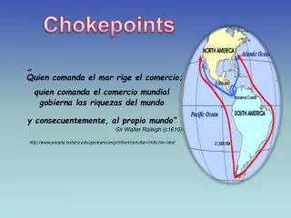
“ Quien comanda el mar rige el comercio; quien comanda el comercio mundial gobierna las riquezas del mundo y consecuentemente, al propio mundo ” -Sir Walter Raleigh (c1610)- http://www.people.hofstra.edu/geotrans/eng/ch5en/conc5en/ch5c1en.html.

E N D
“Quien comanda el mar rige el comercio; quien comanda el comercio mundial gobierna las riquezas del mundo y consecuentemente, al propio mundo” -Sir Walter Raleigh (c1610)- http://www.people.hofstra.edu/geotrans/eng/ch5en/conc5en/ch5c1en.html
4 perspectivas de la geoestrategia del transporte internacional: Conquista. La tecnología del transporte se uso inicialmente para conquistar océanos, territorios y recursos naturales.European powers were the first to improve significantly the maritime technology in terms of speed and offense/defense capacity and were thus able to establish maritime trading roads and colonies all over the world. The railroad was also a mean to achieve territorial conquest, notably in North America (nation building) and in Africa (colonialism). Competencia. El transporte internacional es un medio competido dentro de la economía global.Traditionally, through cabotage regulations, many nations reserved the right to carry national passengers and freight to national transport companies. Although these regulations are still prevalent for air (air freedoms) and maritime transportation (Jones Act), competition has become a prevalent force in shaping modern transportation systems. For several countries, the development of their international transport system has favored exports and transport related activities such as shipbuilding, trade and insurance. Several newly established maritime nations in East Asia, such as South Korea, Taiwan and now China have grown using this strategy. A new form of international transport competition is related to the usage of flags of convenience where a maritime company can significantly reduce its costs by using the fiscal advantages of another country. Cooperación. Aunque el transporte internacional es un medio muy competido, hay intereses comunes que culminan en acuerdos acerca de diferentes aspectos como acceso a infraestructuras o el establecimiento de estándares.By 1792, most countries along the Rhine agreed to free navigation. Canada and the United States started from 1871 a long process of negotiation and projects related to the development of the St. Lawrence Seaway in 1954. International trade within Europe was enhanced by the adoption of a standard over rail gauges (1.435 meters). International air transportation is subject to regulations over security and prices. Furthermore, the emergence of economic blocs such as the European Union and the North American Free Trade Agreement leans on common rules about transport standards and prices. Control. El control de lugares estratégicos es también una parte importante del transporte internacional.As the global economy becomes more interdependent, developed countries are becoming more vulnerable to supplies of freight and raw materials while many developing countries, such as China, are becoming vulnerable to supplies of raw materials and food. For instance, as the United States became more dependent on external supplies of oil, its foreign policy shifted at keeping an eye on strategic locations in oil trade, dominantly in the Middle East.
Principales rutas Marítimas • Principales rutas del sistema de transporte marítimo mundial por donde se efectúa el grueso del comercio, aunque existen muchas otras por lo general costeras. • Estas rutas marítimas son espacios de pocos kilómetros de ancho y son función de los puntos obligatorios de transito (estratégicos) y de restricciones físicas tales como costas, vientos, corrientes marinas, profundidades, bajos y hielo. • Origen y destino de recursos como el petróleo y minerales determinan las rutas marítimas para los graneles. Esos son los insumos que mas se transportan. • A estas rutas se les conoce como chokepoints (cuellos de botella) debido al potencial que tienen de un posible cierre u obstaculización. La disrupción del flujo de petróleo en cualquiera de esa rutas tendría un impacto significante en los precios mundiales del petróleo.
Chokepoints are narrow channels along widely used global sea routes. They are a critical part of global energy security due to the high volume of oil traded through their narrow straits. The Strait of Hormuz leading out of the Persian Gulf and the Strait of Malacca linking the Indian and Pacific Oceans are two of the world’s most strategic chokepoints. Other important passages include: Bab el-Mandab which connects the Arabian Sea with the Red Sea; the Panama Canal and the Panama Pipeline connecting the Pacific and Atlantic Oceans; the Suez Canal and the Sumed Pipeline linking the Red Sea and Mediterranean Sea; and the Turkish / Bosporus Straits joining the Black Sea and the Caspian Sea region to the Mediterranean Sea. In 2007, total world oil production amounted to approximately 85 million barrels per day (bbl/d), and around one-half, or over 43 million bbl/d of oil was moved by tankers on fixed maritime routes. The international energy market is dependent upon reliable transport. The blockage of a chokepoint, even temporarily, can lead to substantial increases in total energy costs. In addition, chokepoints leave oil tankers vulnerable to theft from pirates, terrorist attacks, and political unrest in the form of wars or hostilities as well as shipping accidents which can lead to disastrous oil spills.
La geoestrategia de la circulación marítima de 36 MMBD de petróleo del total de 85 diarios, se compone de 6 Chokepoints principales, con 2 de importancia extremadamente alta: Hormuz y Malacca. • La necesidad de mantener la integridad de esos Chokepoints se incrementa a la par del incremento en la presión de los flujos de petróleo y la creciente piratería • Este es el caso de China en que sus importaciones de petróleo cruzan los estrechos de Hormuz y Malacca y el Mar del Sur de China controlados en su mayoría por los Estados Unidos de Norteamérica. • Fuente: http://www.eia.doe.gov/emeu/cabs/choke.html
Impacto del Canal de Panamá Comunica los oceanos Atlántico y Pacifico, 80 Km. de longitud, estratégico para USA, reduce la travesía de costa a costa en 13,000 kilómetros Para buques de hasta 65 mil TPM. Ideado desde 1534 por españoles, se construyo entre 1904 y 1916. Parcialmente elevado, tiene 32 metros en su parte mas angosta que esta en las esclusas.
Impactos del Canal de Suez • Junto con Panamá, representan los “atajos” mas significantes que el hombre haya construido. • Acorto el viaje por mar entre Londres y Bombay en 41% y el de Londres a Shanghái en 32%. • Conecta el Mediterráneo con el Golfo de Suez y el Mar Rojo a nivel del mar, con 163 Km. de largo evita 6,000 Km. de viaje, al no tener que rodear el Cabo de Buena Esperanza por buques de hasta 120 mil TPM que viajan entre puertos de América y Europa, hacia puertos del Sur de Asia, el este de África y Oceanía. • Reconocida su importancia desde el siglo 13 antes de Cristo, el canal actual planeado por Francia, pero llevado a cabo por Inglaterra, se construyo entre 1859 y 1869 y tiene 60 metros en su parte mas angosta. Entre 1976 y 1980 se adecuo para dar paso a petroleros de hasta 200 mil TPM.
Containership on the Suez Canal • "For over 80 years the Canal was essentially a foreign enclave. The Suez Canal Company, which owned and operated the Canal was an Egyptian cooperation, but practically all the share capital was held abroad. Foreigners controlled the board of directors and constituted the great bulk of the managerial and technical staff. Only a fraction of the profits went to Egypt. In 1949, the Suez Canal Company concluded an agreement with the Egyptian Government establishing new conditions of administration more favorable to the country, including an increased share of the profits and a provision enlarging the countries representation on the board of directors." • "Presumably the agreement of 1949 would forever satisfy the Egyptians. However, in 1956 the Nasser regime seized control of the canal and claimed its sovereign right to govern its use. Thus the Suez canal remains to this day, a national treasure to the Egyptian people, making the country millions of dollars daily."
Strait of Malacca • Estrecho de Malaca, natural. Comunica los océanos Pacifico e Indico es uno de los pasajes marítimos estratégicos mas importantes del mundo porque facilita el movimiento de cargas entre Europa y la costa de Asia con el Oceano Pacifico. Con 800 Km. de longitud, es el estrecho mas largo del mundo utilizado diariamente por 600 cargueros de todo tipo, de hasta 300,000 TPM. Tiene entre 50 y 320 Km. de ancho.
Strait of Hormuz Located between Oman and Iran, the Strait of Hormuz connects the Persian Gulf with the Gulf of Oman and the Arabian Sea. Hormuz is the world's most important oil chokepoint due to its daily oil flow of 16.5-17 million barrels (first half 2008E), which is roughly 40 percent of all seaborne traded oil (or 20 percent of oil traded worldwide). Oil flows averaged over 16.5 million barrels per day in 2006, dropped in 2007 to a little over 16 million barrels per day after OPEC cut production, but rose again in 2008 with rising Persian Gulf supplies. At its narrowest point the Strait is 21 miles wide, and the shipping lanes consist of two-mile wide channels for inbound and outbound tanker traffic, as well as a two-mile wide buffer zone. The majority of oil exported through the Strait of Hormuz travels to Asia, the United States and Western Europe. Currently, three-quarters of all Japan’s oil needs pass through this Strait. On average, 15 crude oil tankers passed through the Strait of Hormuz daily in 2007, along with tankers carrying other petroleum products and liquefied natural gas (LNG). Closure of the Strait of Hormuz would require the use of longer alternate routes at increased transportation costs. Alternate routes include the 745 miles-long Petroline, also known as the East-West Pipeline, across Saudi Arabia from Abqaiq to the Red Sea. The East-West Pipeline has a capacity to move five million-bbl/d. The Abqaiq-Yanbu natural gas liquids pipeline, which runs parallel to Petroline to the Red Sea, has a 290,000-bbl/d capacity. Other alternate routes could include the deactivated 1.65-million bbl/d Iraqi Pipeline across Saudi Arabia (IPSA), and the 0.5 million-bbl/d Tapline to Lebanon. Oil could also be pumped north to Ceyhan in Turkey from Iraq.
Estrecho de Bab el-Mandab The Strait of Bab el-Mandab is a chokepoint between the horn of Africa and the Middle East, and a strategic link between the Mediterranean Sea and Indian Ocean. It is located between Yemen, Djibouti, and Eritrea, and connects the Red Sea with the Gulf of Aden and the Arabian Sea. Exports from the Persian Gulf must pass through Bab el-Mandab before entering the Suez Canal. In 2006, an estimated 3.3 million bbl/d flowed through this waterway toward Europe, the United States, and Asia. The majority of traffic, around 2.1 million bbl/d, flows northbound through the Bab el-Mandab to the Suez/Sumed complex. Bab el-Mandab is 18 miles wide at its narrowest point, making tanker traffic difficult and limited to two 2-mile-wide channels for inbound and outbound shipments. Closure of the Strait could keep tankers from the Persian Gulf from reaching the Suez Canal or Sumed Pipeline, diverting them around the southern tip of Africa. This would effectively engage spare tanker capacity, and add to transit time and cost. The Strait of Bab el-Mandab could be bypassed through the East-West oil pipeline, which crosses Saudi Arabia with a 4.8 million bbl/d capacity. However, southbound oil traffic would still be blocked. In addition, closure of the Bab el-Mandab would block non-oil shipping from using the Suez Canal, except for limited trade within the Red Sea region. Security remains a concern of foreign firms doing business in the region, after a French tanker was attacked off the coast of Yemen by terrorists in October 2002.
Otros pasajes marítimos importantes • Hormuz represents the most important strategic passage in the world, solely because of its access to the oil fields of the Middle East through the Persian Gulf, while Malacca is an active commercial point of transit between the Indian and Pacific oceans. From the Persian Gulf, two major axis of oil circulation service Western Europe and the United States (westbound) and Pacific Asia (eastbound). • Estrecho de Hormuzde importancia estratégica entre los pozos petroleros del Golfo Pérsico, el Golfo de Omán y el Oceano Indico, con los consumidores del oeste de Europa , USA y Japón entre otros. Tiene entre 48 y 80 Km. de ancho. • Estrecho de Bab el-Mandab, entre el Oceano Indico y el Mar Rojo, este estrecho de 40 a 80 Km. de ancho controla el acceso de la navegación marítima al Canal de Suez, de bloquearse también forzaría la navegación alrededor del Cabo de Buena Esperanza. • Estrecho de Magallanes, descubierto en 1530, separa Sudamérica de la Tierra del Fuego, tiene 530 Km. de largo, con un ancho de entre 4 y 24 Km. El canal de Panamá le hizo perder importancia estratégica. • Cabo de Buena Esperanza. en 1497, Vasco de Gama fue el primer europeo en llegar a la India por Mar; la ampliación del Canal de Suez le ha hecho perder importancia. Separa al oceano Atlántico del Oceano Indico.
Bósforo Bósforo, la división entre Europa y Asia, este pasaje tiene 30 Km.; comunica el Mar Negro con el Mar Mediterráneo. Es el antiguo valle del Bósforo sobre una fractura tectónica y se encuentra totalmente en Turquía. Desde la independencia de Ucrania en 1991, retomo importancia internacional para países adyacentes como Ucrania y Georgia, granos y petróleo transitan por aquí de manera notable. Desde el Mar Mediterráneo, corre a través de los Dardanelos para pasar por el Mar interior de Marmara y llegar al estrecho pasaje del Bósforo con 1 Km. en su parte mas estrecha y pasa por Estambul para llegar al Mar Negro.
Gibraltar Península que divide el Oceano Atlántico del Mar Mediterráneo. Con longitud de 64 Km. y ancho de 13 a 39 Km. es paso obligado entre esos dos cuerpos de agua.