Download
1 / 71
720 likes | 881 Vues
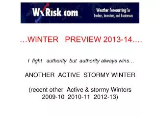
…WINTER PREVIEW 2013-14…. I fight authority but authority always wins… ANOTHER ACTIVE STORMY WINTER (recent other Active & stormy Winters 2009-10 2010-11 2012-13). …REVIEW OF LAST WINTER 2012-13 Two very distinct winters

E N D
…WINTER PREVIEW 2013-14…. I fight authority but authority always wins…ANOTHER ACTIVE STORMY WINTER(recent other Active & stormy Winters 2009-10 2010-11 2012-13)
…REVIEW OF LAST WINTER 2012-13 Two very distinct winters • Very Mild Snowless DEC 1-JAN15: there was lots of talk of another super warm snowless winter like 2011-12 • Total pattern change JAN 20-into April 2010 Much Below Normal temps & Above Normal snow
TEMPS from LAST winter PRECIP from LAST winter
Way too warm in the Western US … too dry over Midwest WAAAY too cold in the East and Deep South but did good with Above Normal southern precip 100% wrong over Western US Good over Midwest GREAT over Northeast & all of Deep South
LAST WINTER MONTH BY MONTH DECEMBER 2012 VERY warm Midwest East coast Deep South NO SNOW anywhere WET Western US DRY Lower Plains Wet over SE and NE US
JANUARY 2013 COLD western US NORMAL over Plains/ Midwest WARM East coast Deep VERY WARM Southeast DRY West coast & New England VERY DRY FL & coastal SE WET Delta & TX Miss Valley
FEBRUARY 2013 VERY DRY western third of CONUS VERY WET much of Plains/Upper Midwest & Southeast coast DRY over TN valley into Northeast COLD almost every where
MARCH 2013 VERY COLD over Upper & Central Plains alll of Midwest All of Deep South COLD Middle Atlantic NORMAL New England VERY DRY western Third of CONUS into Lower Plains & over Ohio valley into New England
MAYBE FARMERS ALMANECS arent very good. They certainly were bad in 2012-13 and 2011-12 FARMERS ALMANECS FOR 2013-14
SO… what did we Learn? Even though the OCT and NOV pattern would seem to indicate that DEC 2013 will be Mild.. the Model data NOV 13 -15 is strongly hinting at MAJOR changes in the overall pattern which supports a colder DEC
EARLY OCT 2013 AO (Arctic Oscillation) was Negative NAO was Neutral/ slightly Negative Deep West coast trough RIDGE over eastern US& over eastern Pacific
OCT 31The AO & NAO both turned strongly positive The Ridges over the Eastern Pacific and over the southeast US were still there
11 NOV 2013 The AO and the NAO both continued to run STRONGLY Positive (dark Blue areas over the Arctic Region and Greenland/ Iceland respectively) Meanwhile the Ridges in the Jet stream (dark red areas) over the eastern Pacific = Very STRONG positive EPO. Winter weather lovers want EPO to be Negative
SO… what did we Learn?The current overall Pattern ( 1st half of NOV) heading into the Winter does NOT favor an early start to the Winter. IF the AO and NAO stays strongly positive for the rest of NOV 2013… (it is not certain that the AO and NAO will stay strongly positive) …IF … the mean trough stays on the West Coast (-PNA pattern ).The atmosphere will HAVE to go through MAJOR changes to bring sustained Winter conditions into the Midwest and East coast
TELECONNECTIONS There are certain specific and defined large scale atmospheric patterns at the Jet stream level. Certain Teleconnection patterns favor weather patterns in other parts of the world. By studying Teleconnections one can “SEE” large scale weather patterns that make certain events more likely to happen…. Such as a East coast snowstorm… or a Midwest heat wave or a Summer drought. And there are also combinations of Teleconnections that can and do exist over the Globe at the same time.
the AO ..what is it ? Again this is pretty basic BUT.. the AO .. Arctic Oscillationis one of these special Teleconnections - large scale atmospheric patterns - that has MAJOR impact on Weather patterns over North America & Europe. When the AO is in the NEGATIVE phase there are numerous or Prolonged cold air outbreaks into the central / eastern CONUS . The chances of the Big winter storms are much higher When the AO is in the POSITIVE phase the bulk of the cold air stays NORTH of the US Canada with only brief cold air outbreaks in the central / eastern CONUS that don’t last very long.
examples of - AO these charts show extreme Negative AO from 2 recent SEVERE winters over the Northeast US 2009-10 and 2010-11.
the NAO ..what is it ? This is pretty basic BUT the NAO – North Atlantic Oscillationis one of these special Teleconnections - large scale atmospheric patterns that has MAJOR impact on Weather patterns over North America & Europe. The Negative Phase of the NAO occurs when there is BULGE or positive ANOMALY in the Jet stream over Eastern Canada or Greenland oror Iceland. This Bulge alters the Jetstream over Canada/ US which allows for older air to come south & a storm track that strongly favors the eastern Third of the country especially from NOV to APRIL .
The POSITIVE Phase of the NAO occurs when there is UPPER LOW or negative ANOMALY in the Jet stream over Eastern Canada or Greenland or Iceland. When this happens the Jet stream cannot plunge southward into the eastern US so there is lack of cold air and weaker winter Low/ storms.
the PNA ..what is it ? The PNA .. Pacific North America pattern.. is one of these special Teleconnections - large scale atmospheric patterns- that has MAJOR impact on Weather patterns over North America There is a CONNECTION between the EPO and PNA. When the EPO is negative … the PNA will often run Positive. When the EPO is Positive the PNA is often Negative . Key word here is “ often “… not always. One can have +PNA with a Neutral or +EPO. BUT a -EPO enhances the power +PNA pattern
the EPO..what is it ? The EPO .. Eastern Pacific Oscillation …is one of these special Teleconnections - large scale atmospheric patterns - that has MAJOR impact on Weather patterns over North America. It is often referred to the Aleutian Island Low. When the EPO is NEGATIVE there is almost always a BIG surface Low on the weather maps in or near or over the Aleutian island. This in turns HELPS to form a RIDGE in the Jet stream over western North America ( the +PNA) . The West coast is sunny warm dry while the eastern US tends to run cool/ cold and SOMETIMES stormy When the EPO is POSITIVE there is BULGE or RIDGE over the Aleutian Islands which in turns strongly favors some sort of Trough or Bend in the Jet stream over the West coast. The western turns cold wet / stormy and the eastern US mild/ dry
Lets look at the current pattern again 11 NOV 2013 That ++EPO is EXTREME & massive. It is more than 2 Stnd Deviations… it is 350dm above the mean for OCT and NOV. Lets look at ALL the OCTOBERS & NOV which featured a MASSIVE ++ EPO like this what did the following DECEMBERS and Winters look like?
ABOUT DECEMBER 2013 Over the past week ALL of the Models have been showing the ++ EPO feature moving NW -- RETROGRADING northwest into eastern Siberia. IF that happens the entire Hemispheric will under go a major change as we Begin the Winter
FORECASTING THE NAO By USING High level winds of MAY & SEPT AL’s FORECAST FOR 2013 DJFM
SO… what did we Learn? even the OCT and NOV pattern would seem to indicate that DEC 2013 will be Mild.. the Model data NOV 13-15 is hinting at MAJOR changes in the overall pattern which supports a colder DEC
NEXT LETS LOOK AT SSTAs WHY? SEA SURFACE TEMPS Research shows that large areas of COLD and WARM SSTAs (Sea Surface Temperature Anomalies) that stay in one general location can and DO affect weather patterns • EL NINO • LA NINA • LA NADA • PDO • AMO? ENSO
ENSO THIS WINTER ?? A COLD ocean water anomalies = La NinaWARM ocean water anomalies = El Nino
ECMWF shows NEUTRAL ENSO thru 1st half of Winter but HINTS at some weak warming / weak El nino Feb & March 2014. IF so this increases chances of extended Winter CFS shows NEUTRAL ENSO thru all of the winter
SCRIPPS shows SOME weak warming / weak El nino over all of the Winter that increases in the Spring. IRI ..of 19 models 18 show NEUTRAL ENSO thru 1st half of Winter but HINTS at some weak warming / weak El nino Feb & March 2014.
The vast Majority of ALL forecasts are calling for “ NEUTRAL ENSO “ this winter. In other words NO EL NINO no LA NINA. But I am not so sure. There is major warming in the subsurface of ENO Regions. The warming is DEEP... 100 to 150 meters down. But it IS increasing AND it is coming to the surface over ENSO region 3 and ENSO regions 1+2. Thus It is POSSIBLE that weak El Nino conditions May appear FEB & MARCH IN 2014
the PDO ..what is it ? The PDO .. Pacific Decade Oscillation… is OCEAN water pattern that refers to a specific type of warm / cold water configuration in the central / eastern North Pacific Ocean. This can and does affect the Jet stream patterns. Note WHERE the cold water/ warm is located: WARM water up against West coast of N America – Cold water in central Pacific Note WHERE the cold water/ warm is located: cold water up against West coast of N America Warm water in central Pacific
-PDO sea surface temp patterns strongly favor-PNA weather patterns +PDO sea surface temp patterns strongly favor+PNA WEATHER patterns +PNA pattern in Winter = Ridge on West coast so Western US =warm & dry. TROUGH is on Eastern US = COLD sometimes stormy -PNA pattern = Trough West coast= stormy cold wet into the Upper Plains & warm dry over eastern US
SO… what did we Learn? The Sea Surface Temperature Anomalies in the central & eastern Pacific are NOT like Autumn 2012. Although OFFICALL the Pacific is still in -PDO … the SSTA “pattern” clearly is similar to +PDO and supports +PNA Teleconnection for at least the 1st half of the Winter 2013-14ASSUMING the SSTA pattern in the eastern Pacific stay like they are currently… then +PNA pattern will be common : a pattern that will supply cold air … and at times arctic air -- into the central and / or Eastern US
SNOW COVER IN SIBERIA / EURASIA (SAI) Research by Dr Judah Cohen of AER shows that in OCT the rate of snow expansion SOUTHWARD... from the Arctic circle towards the Equator strongly correlates to colder than Normal air masses over the Central & eastern US… and Europe especially in the 2nd half of the Winter. SAI- snow Advance Index http://www.nsf.gov/news/special_reports/autumnwinter/model.jsp
SNOW COVER IS SOME WHAT MISUNDERSTOOD Having rapid Build up of early season (OCTOBER) snowfall over Eurasia FAVORS central & eastern US will see either Normal winter or a colder / snowy But it does not guarantee it Moreover there have plenty of cases of having near Normal snowfall over these areas and MILD / Below Normal snowfall over central and eastern Conus.
SIBERIAN SNOW COVER ANOMALIES & EASTERN US WINTERS Most of the time –not ALL- when OCT snow cover in Siberia was Above Normal the Winters that followed featured Normal cold/ snow OR Much colder/ snowier than Normal. LOOK at the 1980s. Year after year MUCH BELOW NORMAL snowfall & those featured Winters in Eastern US were Mild/ Below Norma snowfall. 1983-84 to 1992-93 were the LEAST 10 snowiest years in NYC since 1870
BUT…Keep in Mind what the SAI represents: The RATE of how RAPID SNOW COVER BUILD UP …and how FAST it expands South . These GRAPHS from FSU snow lab need to be Looked at in Greater Detail in SEPT & OCT
1. Note that in late SEPT there was SURGE in snow over Siberia 2. That surge lasted to OCT 15. As you can see Snow cover was WAAAY Above Normal thru early OCT 3. Then in MID OCT snow cover build up STOPPED for 4 -5 days…dropping the overall trend back to the 30 year Mean 4. Then a 2nd surge of snow cover build up developed… which lasted to NOV 1. Then there was ANOTHER Pause NOV 1-7.
SO… what did we Learn? The Siberian snow cover got off to a GREAT start- that actually began in the Last week of SEPT 2013. Except for that “ pause” that lasted 4-5 days in mid OCT... the snow cover build up was MASSIVE—hence 4th highest ever. Thus the SAI would seem to be supportive of -AO and colder snowier winter for central & eastern US & UK/ Europe BUT … some Meteorologists do not agree. WHY?