Argo Float Technology
Argo Float Technology . By Amber Brooks . What’s with the name?. Name reflects Greek Mythology relationship between the vast network of floats and the Jason satellite altimeter mission

Argo Float Technology
E N D
Presentation Transcript
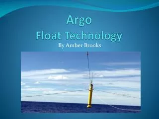
Argo Float Technology By Amber Brooks
What’s with the name? • Name reflects Greek Mythology • relationship between the vast network of floats and the Jason satellite altimeter mission • Years before the Trojan War, Jason set forth on a ship to find the Golden Fleece that would give him air to the throne in Thessaly. • The ship was named Argo after its builder Argus, and the crew was known as the Argonauts.
About Argo • drifting CTD float • Collect data down to a depth of 2,000 meters • allows the globe to continuously monitor temperature, salinity and velocity of the upper ocean on a system • instantly displays data within hours of collection for public and scientific use • network of 3,388, as of May 21, 2009
CAL POLY @ Sea 2008 • Vallejo, CA – Honolulu, Hawaii • 8 floats deployed
Argo Objectives • quantify and describe the upper ocean and climate variability from a smaller scale of months to several years at a time • enhance the Jason altimeter by way of measuring temperature, salinity and velocity with accuracy great enough to calculate sea surface height with great accuracy • provide a base for climate modeling of the ocean-atmosphere and documentation of the decadal variability in climate
Float Mechanics & Subsystems • 3 different float designs • Pacific Marine Environmental Laboratory (PMEL), uses: 1) a 10 day interval where fluid is pumped into an external bladder causing a change in density, resulting in a gradual rise to the surface 2) bladder hydraulics as well as microprocessors that deal with function control/timing, and a transmission system that controls data communication with satellites. 3) weighs approximately 25kg (55lbs), has a maximum operating depth of 2000m (6,561ft) and a crush depth of 2600m (8,530ft)
Float method for data collection • Floats spend most of their lives at “parking depth” or the depth at which they are stabilized by obtaining neutral buoyancy. • Neutral Buoyancy: float’s density is equal to the ambient pressure and a compressibility that is less than sea water • After several days at “parking depth” the float rises to the surface taking 200 pressure, temperature, and salinity measurements, remaining at the surface for 6-12 hours talking to satellites . • Once the transmission is complete, the bladder deflates, returning the float to its original density and it sinks to parking depth for another cycle.
Cal Poly @ Sea Float #4 Above: temp/salinity profile after drifting period Right: Drifting track prior to profiling
Argo data = Superior data • -lack of seasonal bias • efficient automatic • data management within a • 24 hour period • - international collaboration
Float of the Month January 09 AWI-Argo float with WMO ID 7900014 • -deployed at the Greenwich Meridian into the southern limb of the Weddell Gyre in December 2002 • - remarkably long operating time in seasonally ice covered areas is due to a special Ice Sensing Algorithm (ISA) • ISA - prevents the float from surfacing in ice covered waters and hence, protects the float from being destroyed or damaged by the ice. • The float aborts the ascent if the median of the temperature between 20 and 50 m depth is less than -1.79°C, which is almost the freezing point of sea water at the sea surface.
Float of the Month May 2008 APEX float - WMO# 5901809 takes island vacation • -drifted into the Malum Atoll of Papua New Guinea • Scientists feared it would no longer operate • Swept east to west during data communication with satelittes
Data Access • Argo Information center in Toulouse, France manages float information • National data centers then receive the data and erroneous data is flagged and all data is passed on to: • Argo’s two Global Data Assembly centers (GDACS) in Brest, France and Monterey, California. • data is made publically accessible through GDACS by the Global Telecommunication System (GTS), and are updated instantaneously http://argo.jcommops.org/ - free & easy access to data by float WMO#
International Effort • 23 international participants (countries) • Contributions range from a single float to the United States contribution of roughly 50% of the global network. • Mechanisms for funding vary between countries and include over 50 research and operational agencies. • Argo deployments began in 2000 and by November 2007 the array is 100% complete.
Importance of Argo • As more and more becomes known about ocean variability the need for Argo observations will increase. • Technological advance and the global distribution of the array of floats will evolve as instruments and models are improved. • With present severe climate changes and the massive climate role of the ocean, now and into the future, we as a global community will need Argo.