Download
1 / 21
210 likes | 370 Vues
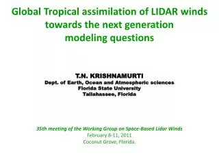
Global Tropical assimilation of LIDAR winds towards the next generation modeling questions. T.N. KRISHNAMURTI Dept. of Earth, Ocean and Atmospheric sciences Florida State University Tallahassee, Florida. 35th meeting of the Working Group on Space-Based Lidar Winds February 8-11, 2011

E N D
Global Tropical assimilation of LIDAR winds towards the next generation modeling questions T.N. KRISHNAMURTI Dept. of Earth, Ocean and Atmospheric sciences Florida State University Tallahassee, Florida 35th meeting of the Working Group on Space-Based Lidar Winds February 8-11, 2011 Coconut Grove, Florida.
Why we need better wind observations: For improved forecasts of heavy rains, floods and dry spells on the time scales of 1 to 10 days. We will have better input for high resolution global and mesoscsale modeling. Hurricane environment will carry a better wind analysis. This helps in the track forecasts. Better understanding of genesis of storms would be possible from a more detailed assimilation of winds at frequent intervals. More detailed wind data sets over the oceans can help in the assimilation of winds for many offshore weather systems that impact coastal and inland severe weather with heavy rains and snow storms. We need more details for precise prediction of such events at high resolutions. We can expect to improve the predictabiltyof coastal severe weather systems. A better knowledge of the entire life cycle of the monsoon is needed, the current lack of wind observations makes it very difficult to analyze all the space time scales in a routine manner.. Events such as the current Pakistan floods need to be predicted a week in advance, those forecasts were only good for about 1 to 2 days in advance. Having a more dense coverage of observations and their assimilation in a comprehensive forecast model can be a important contribution from the wind lidar. 7. Great opportunity for the combined assimilation of wind Lidar TRMM, CLOUDSAT, AMSU-E and AIRS sounders to enhance our ability to improve tropical forecasts at high resolutions. 8. Having a better described tropics will have large impacts on our ability to forecast tropical middle latitude interactions.
THE LARGE ZONAL EXTENT OF THE PLANETARY SCALE MONSOON The longitudinal expanse of the Tibetan High of the northern summer covers the belt of the African and the Asian summer monsoons. Having Lidar winds over this dust aerosol rich region can enhance our ability to describe the monsoon circulations at high resolutions much better.
AUGUST 6 – 10 2010 MODIS AOD This MODIS image carries a composite of the aerosol optical depth during the period of the recent Pakistan floods. This is on a visible channel 550nm and we do not see aerosols over the desert regions of Pakistan and Arabia due to the high surface Albedo. If the lidar can see such regions, we can expect a large number of lidar winds that can describe the circulations to the south and west of Pakistan. For these major flood events, the lidar winds can provide very useful data sets for medium range weather forecasts at high resolution.
Pakistan Floods The cyclonic circulation over the lower troposphere, during the recent Pakistan floods was very poorly covered by the available upper air observations (2 to 3 in number). And those were not adequate to describe and predict this major flood producing event.
August 10, 2010 covered a longitudinal extent from 10E to 140E. Lidar winds can be expected. The upper tropospheric winds during the recent Pakistan flood event lacked adequate winds to describe the upper level divergence related to the details of the Tibetan High. This requires much denser observational coverage of winds.
THERE IS A NEED FOR MESOSCALE WIND OBSERVATIONS TO STUDY THE ABUNDANCE OF TROPICAL CONVECTIVE SYSTEMS 20°N-20°S: Whether radar, ice scattering, or lightning, all show that Total rainfall is not closely related to flash rate or other intensity proxies
Where are the most severe storms? Minimum 37 GHz PCT Minimum 85 GHz PCT 40 dBZ height Likely hail storms Lightning storms Aug, 2008 PMM meeting Fort Collins, 2008 January 19, 2005 Department of Meteorology Seminar Series, University of Utah
The fraction contribution to the total annual rainfall from mesoscale convective systems. After Zipser et al. (2006).
http://www.cpc.ncep.noaa.gov/products/Global_Monsoons/African_Monsoons/African_Monsoons.shtml THERE IS A MAJOR LACK IN OUR UNDRSTANDING OF WIND SYSTEMS THAT ARE ASSOCIATED WITH THE MERIDIONAL MARCH OF THE SEASONAL RAINS OVER AFRICA
BETTER WINDS ARE NEEDED FOR MODELING TROPICAL STRATIFORM CLOUDS AND RAIN The seasonal precipitation radar stratiform rain fraction based on 2.50 grid averages for 1998-2000. Areas with annually averaged rain of less than 0.6 m yr-1 were not included. After Zipser (2006).
Twenty four hour data coverage provided by the GWOS concept for the ISS. Figure courtesy of Simpson Weather Associates.
Design of Experiments • The Nature run data set came from a ECMWF assimilation and forecasts, at a resolution T511, covering the period May 2005. • The precipitation data files of the nature run (Masutani et al. 2006) are extracted at the locations of the orbits of International Space Station (since data is not available we have used NASA’s TERRA satellites orbital data). • These extracted data are then assimilated into a Fraternal Twin which is WRF-ARW model. • OSSE’s are designed to evaluate Global Wind Observing System (GWOS) impacts for NWP.
WRF –ARW Configuration • Model Version: WRF-ARW 3.2 • Number of grid points: 385x275 • Domain: Single Domain • Horizontal Resolution: 20 km • Vertical Levels: 27 • Vertical Coordinates: terrain-following, hydrostatic-pressure vertical coordinate • Projection: Mercator • Model Top: 50 hPa • Initial and boundary conditions: GFS analysis and forecasts (2.5deg x 2.5deg interpolated to model resolution) • Cumulus Parameterization: Betts-Miller-Janjic Scheme • Microphysics: Lin et al scheme • Radiation: Dudhia (shortwave)/ RRTM (longwave) • Planetary Boundary Layer: YSU • Surface Layer: MoninObukhov • Land Surface: Unified NOAH Land Surface Model
Data Assimilation and Experiments • WRF 3-Dimensional Variational Data assimilation Version 3.2 was used for this study • Background error covariance: By NMC method (Parrish and Derber 1992) . The statistics are estimated with the differences of 24 and 48-hour GFS forecasts with T170 resolution valid at the same time for 357 cases distributed over a period of one year. Both the amplitudes and the scales of the background error have to be tuned to represent the forecast error in the guess fields. The statistics that project multivariate relations among variables are also derived from the NMC method. • Experiments done for this study • Assimilating all available wind data : ALL • Assimilating winds only in boundary Layer (Below 850 hPa): BL • Assimilating winds in boundary layer and at 200 hPa: BL+200 and BL2L • No assimilations : CTRL References: Barker, D.M., W. Huang, Y. R. Guo, and Q. N. Xiao., 2004: A Three-Dimensional (3DVAR) Data Assimilation System For Use With MM5: Implementation and Initial Results. Mon. Wea. Rev., 132, 897-914. Huang, X.Y., Q. Xiao, D.M. Barker, X. Zhang, J. Michalakes, W. Huang, T. Henderson, J. Bray, Y. Chen, Z. Ma, J. Dudhia, Y. Guo, X. Zhang, D.J. Won, H.C. Lin, and Y.H. Kuo, 2009: Four-Dimensional Variational Data Assimilation for WRF: Formulation and Preliminary Results. Mon. Wea. Rev., 137, 299–314. Parrish, D.F., and J.C. Derber, 1992: The National Meteorological Center's Spectral Statistical-Interpolation Analysis System. Mon. Wea. Rev., 120, 1747–1763.
Summary • THERE IS CLEARLY A NEED FOR MORE WIND OBSERVATIONS BEYOND WHAT IS CURRENTLY AVAILABLE AT EMC. • TROPICS ABOUNDS WITH MESOCONVECTIVE RAIN PRODUCING SYSTEMS THAT NEED TO BE ASSIMILATED FOR IMPROVED FORECASTS OF MONSOON, HURRICANES AND ITCZ. • WINDS ON APPROPRIATE SCALES ARE CURRENTLY NOT AVAILABLE, FUTURE WIND LIDAR OBSERVATIONS WILL GRADUALLY IMPROVE OUR KNOWLEDGE OF THESE SYSTEMS. • OSSES ARE IMPORTANT FOR ASSESSING THE IMPACT OF FUTURE WIND LIDAR DEPLOYMENTS ON SATELLITES, RESEARCH IN THIS AREA NEEDS TO BE STRENGTHENED. OSSES USING MESOSCALE MODELS AT HIGH RESOLUTION ARE IMPORTANT FOR THE TROPICS. • WE HAVE JUST MADE A START IN THIS AREA OF MESOSCALE MODELLING WITH OSSES AND NOTED THAT FORECAST IMPROVEMENTS MAY BE POSSIBLE IN FRATERNAL TWIN MODELS FROM THE USE OF BOUNDARY LAYER WINDS FROM NATURE RUNS. • DETAILED PLANNING AND SUPPORT FOR SUCH EXPERIMENTATION IS NEEDED.


![Toward The Next [ Next [ Next … ] ] Generation of Meta-Modeling Tools](https://cdn3.slideserve.com/5854127/toward-the-next-next-next-generation-of-meta-modeling-tools-dt.jpg)