Download
1 / 5
50 likes | 174 Vues
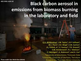
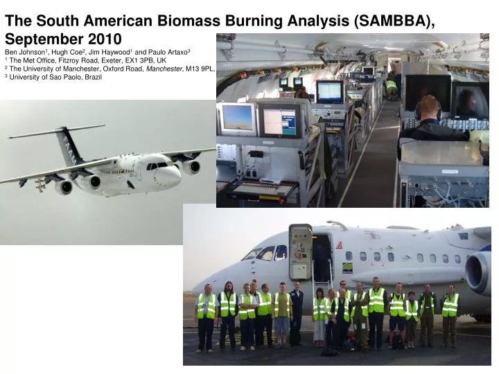
The South American Biomass Burning Analysis (SAMBBA), September 2010 Ben Johnson 1 , Hugh Coe 2 , Jim Haywood 1 and Paulo Artaxo 3 1 The Met Office, Fitzroy Road, Exeter, EX1 3PB, UK 2 The University of Manchester , Oxford Road, Manchester , M13 9PL, UK 3 University of Sao Paolo, Brazil.

E N D
The South American Biomass Burning Analysis (SAMBBA), September 2010 Ben Johnson1, Hugh Coe2, Jim Haywood1 and Paulo Artaxo3 1 The Met Office, Fitzroy Road, Exeter, EX1 3PB, UK 2 The University of Manchester, Oxford Road,Manchester, M13 9PL, UK 3 University of Sao Paolo, Brazil
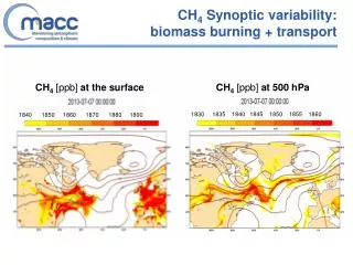
2. Scientific objectives • The overall aim of SAMBBA is to improve our ability (UK, Brazil and worldwide scientific community) to quantify the impact of biomass burning and biogenic aerosols over South America. • To achieve this we must determine aerosol precursors and key processes, assess their influence on the radiative budget, and improve our knowledge of their influence on clouds. Below is a summary of our scientific objectives outlining the strategy to address the overall aim and the fundamental issues detailed above: • Measure the physical, optical and chemical properties of natural and biomass burning aerosol over South America including their mixing state and hygroscopicity. Asses how these properties relate to the emission source (natural emission, forest fire, agricultural fires in Cerrado regions) and its age / development cycle. • Determine the emission rates of trace gases from biomass burning, including volatile and semi-volatile organic compounds. Investigate the formation and evolution of secondary organic aerosol and how this relates to the chemistry of the natural and polluted environment. • Measure the direct effects of natural and biomass burning aerosol on solar radiation and assess how this affects the radiative budget of the region. • Investigate the impact of biomass burning aerosol on cloud microphysics (cloud condensation nuclei, cloud droplet concentration and droplet size spectra) and the suppression of precipitation. • Investigate the transport and vertical mixing of aerosols over South America, including aspects such smoke plume rise and mesoscale atmospheric circulations. • Provide a regional context for measurements made as part of the CLARE 2010, including vertical profiles of insitu measurements and other information that is only achievable via airborne platform. • Provide measurements for the validation of satellite remote sensing products such as those developed to identify active fires, burned areas, smoke plume height, aerosol optical depth and the atmospheric burden of chemical constituents over South America (MODIS, MISR, CALIPSO, SCHIAMACY, AATSR, etc). • Provide observational data for the initialization and validation of modelling studies such as climate models, regional transport models and large-eddy simulations (small-scale cloud studies).
Baseado em Porto Velho com alcance na parte sudoeste da Amazonia
6. Instrumentation on the FAAM aircraft The technical specifications of all instruments on the FAAM aircraft are listed on the website www.faam.ac.uk. Below is a summary of those most relevant to SAMBBA and brief explanations of how these will enable our scientific objectives. Meteorological variables The FAAM aircraft contains a comprehensive set of meteorological instruments measuring all basic atmospheric parameters (pressure,temperature, humidity, winds, turbulence). It also has the facility to launch dropsondes. These are small instrument packages that fall to the ground using a parachute and measure pressure, temperature, humidity and wind. Aerosols The FAAM aircraft also contains a wide range of instruments to characterize the physical, chemical and optical properties of aerosols including number concentration (CN), size distribution (PCASP, FSSP), scattering (3-wavelength nephelometer), absorption (Particle Soot Absorption Photometer), hygroscopicity (humidified 3-wavelength nephelometer). The will infer the black carbon content and mixing state using a Single Particle Soot Photometer (SP2). We also have an Aerosol Mass Spectrometer that will be used to decipher the chemical composition of aerosols and the abundance of various organic and inorganic compounds. We also have an aerosol filter collection system. Clouds Cloud microphysics will be measured by many optical probes (two FSSPs, CDP, 2D-C, 2D-P, CIP-25, CIP-100, CAPS, HVPS). Each measures the size and concentration of cloud and precipitation droplets in different size ranges but with much overlap between probes. Bulk cloud properties of liquid water and total water are measured by NEVZEROV and Johnson-Williams instruments. We also have a Cloud Condensation Nuclei (CCN) counter. Gas chemistry We will make measurements of key trace gases to characterise the chemical environment. These include CO, NO, NO2, NOx, NOy, O3, CO2, SO2, PAN and HCHO (Formaldehyde). In addition a PTR-MS instrument will be on board to measure more complex chemical species including oxygenated hydrocarbons, aromatic hydrocarbons, olefinic hydrocarbons and several others. For an even more comprehensive capability we will also run a bottle system allowing the collection of air samples for detailed inspection by Gas Chromatograph after the flight. Radiation / remote sensing The FAAM aircraft has a wide range of radiometers measuring broad band solar and terrestrial fluxes (up and down) plus high spectral resolution radiometers measuring solar irradiance (up and down) and solar radiance (any direction). We also have a leosphere aerosol lidar that remotely senses aerosol beneath the aircraft. Communication / navigation The aircraft is equipped with a satellite communication system for relaying messages, phone calls and internet access in the air. All navigation data (GPS position, speed etc) is recorded as standard part of the flight data.
Flight patterns • Our proposal is to conduct flights focussing on the following flight patterns: • Investigation of smoke plumes from fires. This would firstly involve flying high above the fire to survey the height, width and optical thickness of the smoke plume using our aerosol lidar and shortwave spectrometer. Secondly we would make passes through the smoke plume at various distances downwind of the fire to measure the properties of the evolving aerosol and trace gas chemistry. At some distance downwind the smoke plume would become indistinct from the background aerosol. • Investigation of regional haze layers. This simply requires flying at low to mid altitudes (below 15,000ft) over regions hazy regions, which are likely to be widespread near Porto Velho in the month of September. It would be important to compare such mean properties with measurements from the Bandeirante and at least once fly side by side together for instrument intercomparison. • Investigation of the impact of aerosol on cloud. This will involve making penetrations of clean clouds near Manaus and polluted clouds near Porto Velho. Learning from experience, when clouds are small and short –lived this is best achieved by performing long straight and level runs to sample clouds. For large and distinctive groups of clouds (e.g. pyro-cumulus) a more beneficial strategy would be to make repeated penetrations of the same cloud over a range of altitudes. During such flight patterns the Bandeirante could make more detailed observations of the aerosol properties below cloud base or investigate plumes of smoke entering the cloud from below. • Radiative closure studies. If possible we aim to gather some measurements in cloud-free conditions so that we can infer the impact of the aerosol on solar radiation. Radiative closure can then be examined by flying a sequence a runs and inter-linking profiles along a fixed track of about 100km. Ideally, this requires completely cloud free conditions, which we are more likely to find to the south-east of Porto Velho. During such patterns the Baneirante would be a useful compliment focussing more time on insitu sampling of the aerosol allowing the FAAM to concentrate most of its time on runs needed for the radiative measurements. • Regional surveys. The aerosol lidar is a powerful tool for mapping the vertical and geographic distribution of aerosol from an aircraft. This requires extensive aircraft patterns at altitude well above the haze layers (e.g. 20,000ft). These kinds of flights will allow us to examine the spatial variability and transport of aerosol. Co-ordination with the Banderiante would be a advantage on some of these flights since the Brazilian plane could provide information on the insitu aerosol size distribution that affects the lidar sensitivity (backscatter to extinction ratio).