SeaDataNet, Pan-European infrastructure for ocean and marine data management By
SeaDataNet, Pan-European infrastructure for ocean and marine data management By Dick M.A. Schaap – MARIS Supported by the European Commission. R elevant international developments.

SeaDataNet, Pan-European infrastructure for ocean and marine data management By
E N D
Presentation Transcript
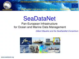
SeaDataNet, Pan-European infrastructure for ocean and marine data management By Dick M.A. Schaap – MARIS Supported by the European Commission
Relevant international developments Sea-Search: Pan-European network for oceanographic and marine data management (2002 – 2005) – focus on metadata EU - INSPIRE Directive – European Spatial Data Infrastructure GEO-GEOSS initiative from the G8 ad-hoc Group of Earth Observations for a Global Earth Observation System of Systems GMES (Global Monitoring for Environment and Security) from ESA and EU Research as European component of GEOSS New EU - Marine Directive with plans for an EMODNET UNESCO – IOC – IODE – Intergovernmental Oceanographic Commission ICES – International Council for Exploration of the Seas
Unified access to distributed data centres • SeaDataNet is a 5 year project, funded by EU via FP6, and has succeeded Sea-Search • SeaDataNet aims to set up and operate an efficient Pan-European distributed infrastructure for managing marine and ocean data by connecting: • 40 National Oceanographic Data Centres (NODC’s), national oceanographic focal points, and ocean satellite data centres, in Europe • these Data Centres are mostly divisions of major national marine research institutes and based in 35 countries, surrounding the European seas • SeaDataNet aims to ensure a comparable quality of data sets and to make data sets easily accessible on-line through a unique portal, while the data sets are stored and managed at the Data Centres.
Participating Countries 49 Partners = 40 Data Centres + ICES + IOC-IODE + JRC + specialists in statistics, products and informatics
Interoperability Interoperability is the key to distributed data management system success. This is achieved in SeaDataNet via: • Adopting the ISO 19115 metadata standard for all metadata directories • Providing XML Validation Services to quality control the metadata maintenance • Using common and controlled vocabularies, including international content governance • Providing standard metadata entry tools • Using harmonised Data Transport Formats for data sets delivery • Using common quality control protocols and flag scale • Adopting of OGC standards for mapping and viewing services • Using SOAP Web Services in the SeaDataNet architecture • Organising training and instruction workshops for transfer of expertise and hands-on training
SeaDataNet portal www.seadatanet.org
Access to Data – Common Data Index (CDI) • The Common Data Index (CDI) is a fine-grained index to individual data measurements (such as a CTD cast or moored instrument record). • CDI XML Schema is based upon the ISO 19115 standard • Common Data Index (CDI) system including a Shopping and Transaction mechanism for direct online data access through file downloads • Using harmonised Data Transport Formats for data sets delivery • Authorisation and Authentication Services, based upon a Central User Register and vocabulary of Data Access Restrictions
Data Policy and implementation • Metadata • free and open access, no registration required • each data centre is obliged to provide the meta-data in standardized format to populate the catalogue services • Data and products services • the general case is free and open access • however user must register once in order to get a personal login - password • Web form to provide necessary information • User agrees with “SeaDataNet User Licence” • After processing, login/password sent by email (email check) • Licence is part of the SeaDataNet Data Policy, that is intended to be fully compatible with the Directive of the European Parliament and of the Council on public access to environmental information, the INSPIRE Directive, IOC, ICES, WMO, GCOS, GEOSS and CLIVAR data principles. • SeaDataNet Data Policy is an overarching policy, respecting any local policy • Each user gets a SeaDataNet Role; while each CDI record has a ‘Data access restriction’ label. The combination of role and access label determines ‘access OK’, ‘access to be discussed’ or ‘access denied’
SeaDataNet CDI V1 – Data retrieval and downloading Check Status In RSM Search Request Confirmed Include in Basket Results Ready at DC x Download Shopping list Data SDN format Submit + Authentication
CDI V1 – Data Coverage CDI V1 coverage at mid Sept 2009: ca.462.000 CDI entries from 11 countries; connecting other SeaDataNet partners is well underway
SeaDataNet V1 presentation and analysis tools • Ocean Data View (ODV) • General data analysis and visualization software • >10,000 registered users • Upgrading ODV software into ODV4 for: • Extending ODV‘s graphical display capabilities and interactive controls for automatic and visual quality control and data quality flagging • Seamless connection to SeaDataNet output: SDN ODV4 data formats, quality flag scale • Integration of DIVA gridding software • Important tool for the SeaDataNet regional Data Products • DIVA software (Data-Interpolating Variational Analysis) allows to spatially interpolate observations on a regular grid in an optimal way. The analysis is performed on a finite element grid allowing for a spatial variable resolution and a good representation of the coastline and isobaths.
SeaDataNet V2 regional products services Temperature and salinity climatologies for the Arctic seas, Atlantic Ocean,Baltic sea, Mediteranean sea and the Black Sea regions Statistical output in NetCDF files, that are visible via WMS
Cross sector involvement • SeaDataNet cooperates and provides services for many other European and international groups and projects, contributing and safeguarding good data management. Examples: • EuroGOOS, maintaining the European Directory of Ocean observing systems (EDIOS) and improving access to real-time data. See www.edios.org • POGO, collecting and providing information on ocean-going research vessels, and their operators, planned and completed cruises. See www.pogo-oceancruises.org • GMES Marine Core Services – interaction with MyOcean for streamlining the provision of long-term archives • Partners in the Humboldt project (GMES) contributing to a European Spatial Data Infrastructure • Services for the international oil & gas industry for metocean data (SIMORC). See www.simorc.org
Partnership for Observation of the Global Oceans (POGO) www.pogo-oceancruises.org
SIMORC www.simorc.org
SeaDataNet Expansion • SeaDataNet V1 standards and tools are being adopted by new EU-funded projects, that will have a dedicated Portal, but also will be fully integrated in the SeaDataNet infrastructure: • Up-Grade Black Sea SCENE project, (2009 – 2011) involving 6 NODCs and 35 other data holding institutes from the 6 Black Sea countries, to provide metadata and data access and to strengthen their national NODC networks. EU-funding 3.4 Million Euro. • CASPINFO project, (2009 – 2011) involving 12 institutes and private industry from the Caspian Sea region, to provide metadata and data access and to build their capacity for data management and user services. EU-funding 0.8 Million Euro. • Geo-Seas project, (2009-2012) involving 24 geological and geophysical data centres from 16 European countries (EuroGeoSurveys), to provide metadata and data access. EU-funding 4.9 Million Euro. • EuroFleets project, (2009-2012) involving 24 research institutes and data centres from 17 European countries, to optimise the management of research vessels and to streamline the flow of data from the research cruises to the data centre infrastructure. EU-funding 7.2 Million Euro. • In each project several SeaDataNet NODCs are participating for transfer of knowledge & expertise, to secure interoperability and to learn from new developments
Upgrade Black Sea SCENE project www.blackseascene.net
SeaDataNet international exchange • Agreement with IOC-IODE to achieve interoperability between IODE’s Ocean Data Portal (ODP) and SeaDataNet V1 infrastructure Leading principle:
SeaDataNet and EMODNET • EU has adopted a new Marine Directive and Maritime Policy, which includes a requirement for an overarching European Marine Observation and Data Network (EMODNET), based upon a ‘systems of systems’ approach • EU Taskforce active, that has produced a draft Roadmap. This includes a number of 3 year data pilots, started in June 2009: • Geology – undertaken by EuroGeoSurveys consortium • Chemistry – undertaken by SeaDataNet consortium • Biology – undertaken by EurOBIS – MARBEF consortium • Hydrography – undertaken by sub SeaDataNet consortium • All 4 pilots will adopt SeaDataNet standards and interconnect to the SeaDataNet CDI V1 Directory. • This provides an excellent opportunity for SeaDataNet to become a core element in EMODNET and as such to upgrade its status from project to sustained operational infrastructure.