NOAA
NOAA. March 2005. Greg Stensaas USGS EROS stensaas@usgs.gov. IADIWG. Inter-Agency Digital Imagery Work Group (IADIWG) established Cooperating agencies: BOR, BLM, COE, EPA, FSA, FWS, NIST, NGA, NOAA, NRCS, USFS, and USGS Kickoff meeting held and draft charter developed


NOAA
E N D
Presentation Transcript
NOAA March 2005 Greg Stensaas USGS EROS stensaas@usgs.gov
IADIWG • Inter-Agency Digital Imagery Work Group (IADIWG) established • Cooperating agencies: BOR, BLM, COE, EPA, FSA, FWS, NIST, NGA, NOAA, NRCS, USFS, and USGS • Kickoff meeting held and draft charter developed • Draft specifications, guidelines, and standards for digital image acquisition being worked • Host workshop to review draft specifications, guidelines, and standards – Summer 2005 • Draft Final presented to ASPRS PECORA 16 - October 2005 • Other potential efforts • Other digital data types and data formats • Help compile aerial data requirements and contract vehicles • ASPRS PDAD Geospatial Image Quality Commission
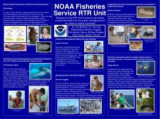
NOAA Network Agreements @ EDC • CORS: Constantly Operating Reference Station: National Geodetic Survey/NOAA • http://www.ngs.noaa.gov/CORS/ • GSOS: GPS Surface Observing System: Forecast Systems Lab/NOAA • http://gpsmet.noaa.gov/jsp/index.jsp • SURFRAD: Surface Radiation Budget Network: Surface Radiation Research Branch/NOAA http://www.srrb.noaa.gov/surfrad/ • SURFRAD consist of a tower and instrument platform. The requirements are the same. • CRN: Climate Reference Network: National Climatic Data Center/NOAA http://www.ncdc.noaa.gov/oa/climate/uscrn/index.html • CRN consists of a rain gauge fenced area and a tower. The requirements are the same.