Figure and Gravity
Figure and Gravity. Figure of a planet (Earth) Geoid Gravity field Gravity anomalies Isostatic principle Reference: Physics of the Earth, F. D. Stacey & P. M. Davis, Cambridge University Press, 2008. Why are planets spherical.


Figure and Gravity
E N D
Presentation Transcript
Figure and Gravity • Figure of a planet (Earth) • Geoid • Gravity field • Gravity anomalies • Isostatic principle Reference: Physics of the Earth, F. D. Stacey & P. M. Davis, Cambridge University Press, 2008
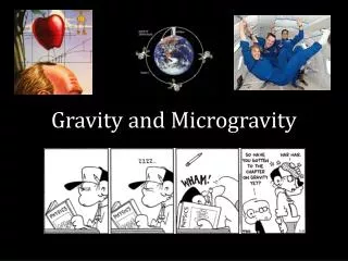
Why are planets spherical • A celestial body will assume the lowest state of potential energy • Given enough mass any rocky body will form into a nearly spherical object. More obviously this is valid for gaseous Objects too. • Larger objects will start to differentiate internally over time. • Deviations from an ideal sphere can be caused by • Rotation • Tidal forces • Internal movements of large masses • Plate tectonics • Mantle convection • Glaciation, Polar caps • Oceanic flows • Large impactors (Lunar Mare)
Comet 103P/Hartley Asteroid 433 Eros Asteroid 4 Vesta Phobos
Figure of the earth • For large distances spherical approximation sufficient • Interaction with other astronomical bodies • Sphere not accurate enough for local applications • Can not satisfy e.g. precession of the rotation axis, tides • Satellite orbits • Navigation • Geoid as standard figure description • First order approximation as oblate ellipsoid • Available for most of planets and larger objects • For earth • Solutions available from satellite geodesy • CHAMP, GRACE, GOCE Missions • Reference stations on ground
Gravitational potential • The shape of a planet is determined by the gravity • Gravity is a potential field V • Potential fields can be described by Laplaces’s equation • In spherical polar coordinates it is:
Solutions to the potential equation • Solutions to Laplace’s equation are the spherical harmonic functions • Gravitational potential V(r,Θ) as a function of • radius rand co-latitude Θ =90° - Φ (Latitude) • G is the gravitational constant • M mass of the object (Earth) • a is the equatorial radius • P0, P1, P2are the Legendre polynomials • J0, J1, J2represent the distribution of mass • J0 = 1 becauseP0 = 1 and dominates at large distances • J1 = 0 because P1 = cosΘand that would be an off centre potential • J2 describes the oblate ellipsoid, all higher terms are much smaller Describing a geoid that way is analogous to a Fourier synthesis only for spherical coordinates
The true figure is approximated by: precisely measuring the gravitation gradient in low orbit orbit perturbations of satellites Images: ESA GOCE Deriving the true figure of a planet
Gravitational potential of a planet • Neglecting higher orders of Jn for the moment we can describe the gravity field of a planet by a standard ellipsoid: • This is the potential at a stationary point without rotation • The geopotentialU on a rotating planet including centrifugal forces is: • The surface of the earth (Geoid) is defined as the surface of constant potential U0at the equator(r = a, Φ = 0) and A and C are the moments of inertia at the equator (x,y axis) and the pole (z)
Surface of constant potential • Calculating the non rotating gravitational potential of a flattened planet • J2 describes the principal form of the geoid • for Earth J2 = 1.082626x10⁻³ • The surface of the rotating potential • (r = aequator, Φ = 0) and (r = cpole, Φ = 0)
Flattening of the ellipsoid • The flattening f (ratio of equatorial radius to polar radius) • For earth f = 3.3528 ˟ 10-3 • If f and the rotation ωof a planet can be determined, we can estimate the moments of inertia, which can give information on core mantle ratios and other internal mass distributions • Earth radius • Equator: a = 6378.1 km • Pole: c = 6356.8 km m is the ratio of the centrifugal component to total gravity at equator
For earth exists different geoid standards: ED50, ETRS89, NAD83, NAVD88, SAD69, SRID, UTM, WGS84,… Earth geoid derived from GRACE data. The geoids of Earth, Mars and Venus Mars topographic map from the MOLA experiment of MGS Venus geoid model from Magellan data
Gravity • The gravity on the geoid (or any equipotential surface U) can be derived from: g = - grad U • The international gravity formula is • Departures from the reference value are regarded as gravity anomalies • On earth gravity anomalies are very small • The standard unit for gravity measurements is 1mGal ≡ 10-5 ms-2 • In practice topographic features have also an influence on the local gravity (Mountains, sea level, ore deposits, large artificial lakes) and have to be corrected (e.g. Bouguer correction for altitude above topographic features).
Determining heights above sea level • Local deviations from the equipotential surface (geoid) • Ocean level – follows equipotential line • Reference ellipsoid • Local plump line - follows local gravity normal • Continent – causes local deviations of normal • Geoid • Satellites (GPS) give heights relative to the geocentric reference ellipsoid • Local height measurements are always based on the geoid • Connection between both are via reference stations and a correction grid for the satellites Image: NOAA Image: Wikipedia based on WGS84
Isostatic principle Airy-Heiskanen or Pratt-Hayford models • Gravity measurements over mountains reveal that they are mostly in static equilibrium • This is called the isostatic principle • The crustal material floats on the denser mantle material • A mountain has to have a root that is approximately as deep as it protrudes above the surface (iceberg principle) to be stable • Ocean floors are thinner
Isostatic adjustments • The (fast) removal of large masses or the accumulation of them will cause a non-equilibrium state (glaciers) • This can be seen in gravity anomalies • The local crust will react by either an up- or down—movement Image: NASA GRACE
Platte tectonics and isostasy • The creation of mountains on continental plates upon collision is related to isostatic adjustments • The rim of the colliding plates is thickening and thus following the isostatic principle this thicker part of one plate is lifted up whereas the other plate is subducted Image: USGS