Download

1 / 31
310 likes | 320 Vues
This study quantifies the increase in impervious surface and describes land cover changes in the Twin Cities Metro-Area from 1991 to 2005. Applications include water quality and population growth analysis.

E N D
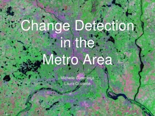
Urbanization in The Metro-Area By: Reid Swanson Sam Soper
Goal: • To describe land cover/use changes that have occurred in the Twin Cities Metro-Area from the 1991 to 2005 • Quantifying the increase in impervious surface • Applications for which this type of study would be useful:
Introduction Data Rectification Classification Change Detection Accuracy
Data • Classification image: Multispectral image provided by Joe Knight • Reference images: • 1991: • Most of the state was flown in spring of 1991; the remainder was completed spring 1992. Photos are available in both color-infrared and black-and-white; the latter were used to produce statewide digital orthophotos • The original images from both flights are 9" x 9" and cover about 25 square miles at an approximate scale of 1:40,000
Data • Reference images: • 2005: • a 2006 image taking in Summer - Fall MDA natural color 1-meter USGS procured photos from MDA for public distribution. • Twin Cities 2006 Spring USGS natural color 0.3-meter Minneapolis - St. Paul area
Rectification • Regular linear features (ex. Roads) lined up GOOD • Area did not match up Subset Image • Some atmospheric interference creation an unclassified class
Classification • Unsupervised classification • Maximum likelihood-(grouping pixels to nearest class mean) • 20 spectral responses Need more variation between classes • 40 spectral responses Recoded into 7 distinct classes • Classes: • Urban • Forest • Green Space • Agriculture • Water • Wetland • Unclassified
Classification • PROBLEM recode needs to work • Couldn’t run thematic change detection • Need same # of classes • Output results wouldn’t have been clear • Addition problems with accuracy assessment
Change Detection • Plan: Thematic Change Detection • Results in “from-to” change • Actual: Manual interpretation of histogram values • Digital number comparison • Allows us to see the magnitude of change, but not “from-to”
Accuracy Assessment • Reference data : • 1991: • Most of the state was flown in spring of 1991; the remainder was completed spring 1992. Photos are available in both color-infrared and black-and-white; the latter were used to produce statewide digital orthophotos • The original images from both flights are 9" x 9" and cover about 25 square miles at an approximate scale of 1:40,000 • 2005: • a 2006 image taking in Summer - Fall MDA natural color 1-meter USGS procured photos from MDA for public distribution. • Twin Cities 2006 Spring USGS natural color 0.3-meter Minneapolis - St. Paul area
Accuracy Assessment • Generated X,Y coordinates in ERDAS • Sampling method: Simple random • Exported to ARCMAP • MANUAL MANIPULATION OF ACCURACY DUE TO RECODE FAILURE • Allowed ourselves to see classification data • Compared classified to reference data Error Matrix(by hand!)
Minimum Mapping Unit • 30 meters
Applications: • Change in impervious surface (urban areas) and its impacts on water quality • Identifying areas of population increases examine commuter effect on carbon emissions
Conclusion • Despite program errors our data allows us to see the change in cover type as a result of population growth and human expansion • 198 more km^2 of urban area in 2005 • This information can useful in application to a variety of studies