WJEC A2 Geology
350 likes | 563 Vues
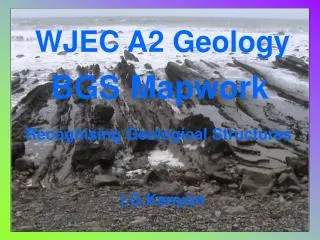
WJEC A2 Geology. BGS Mapwork. Recognising Geological Structures. I.G.Kenyon . Moreton-in-Marsh 1:50,000 Sheet 217. Horizontal beds Evidence + symbols Bed outcrops run parallel to contour lines Outcrop pattern controlled by relief/topography. +. Youngest bed. Oldest bed LLi.

WJEC A2 Geology
E N D
Presentation Transcript
WJEC A2 Geology BGSMapwork Recognising Geological Structures I.G.Kenyon
Moreton-in-Marsh 1:50,000 Sheet 217 Horizontal beds Evidence + symbols Bed outcrops run parallel to contour lines Outcrop pattern controlled by relief/topography + Youngest bed Oldest bed LLi + No strike and dip values can be given
Moreton-in-Marsh 1:50,000 Sheet 217 Graben Ticks on faults indicate downthrown side Horst Graben
Moreton-in-Marsh 1:50,000 Sheet 217 Outliers-areas of younger rock completely surrounded by older rock
Cheddar 1:25,000 Sheet ST 45 Inlier-an area of older rock completely surrounded by younger rocks Older Carboniferous Limestone Younger Triassic red mudstone Unusually this inlier also forms a hill
Cheddar 1:25,000 Sheet ST 45 N Repeated outcrop pattern, only core bed is not repeated North side dips more steeply (dips 42-60°) Outcrops narrower Anticlinal Axis Oldest bed in the core of the fold Slight plunge to the east as core bed gets narrower in outcrop Asymmetrical Anticline South side dips more gently (dips 25-30°) Outcrops wider
Cheddar 1:25,000 Sheet ST 45 MMG overlaps DCg here DCg shows angular overstep here as it extends over several older rocks + Lower older series dip North 60-80° and strike East-West + DCg is a basal conglomerate and is unconformable on the older carboniferous rocks + Upper younger series are horizontal
Monmouth 1:50,000 Sheet 233 Beds above and below unconformity have parallel outcrop patterns and the same dip and strike values Angular overstep unconformity here between the carboniferous limestone and the upper coal measures C3 quartz conglomerate forms a parallel unconformity between the upper and lower old red sandstone
Craven Arms 1:25,000 Sheet SO48 Solid & Drift Account for the V shaped pattern of outcrop of bed b7b here
Malmesbury One inch Sheet 251 Solid & Drift Describe the strike and dip of the Carboniferous beds here Identify the relationship between beds d5 and f6 here
Malmesbury One inch Sheet 251, Solid & Drift Describe the main fold structure here, refer to strike and dip values, symmetry and plunge Name this feature
Haverfordwest 1:50,000 Sheet 228 Describe the main fold structure here, refer to strike and dip values, symmetry and plunge
Chepstow 1:50,000 Sheet 250 Describe the main fold structure here, refer to strike and dip values, symmetry and plunge Approximate position of fold axis
Chepstow 1:50,000 Sheet 250 This fault dips east at 79°, identify the fault type Identify this deposit and account for its distribution on this map extract
Haverfordwest 1:50,000 Sheet 228 Identify this feature Describe and identify the main fold structure in the map extract above. Refer to dip and strike values, symmetry and plunge where appropriate
Haverfordwest 1:50,000 Sheet 228 Identify the relationship between beds (b4 and d4) and (d2 and d4) in this box Describe and identify the main fold structure in the map extract above. Refer to dip and strike values, symmetry and plunge where appropriate
Hawes 1:50,000 Solid & Drift Describe the evidence on the map for the Carboniferous beds GL and DBL being horizontal Describe the fold structures in the InG beds within this box
Chepstow 1:50,000 Sheet 250 Describe the strike and dip of the Carboniferous beds BRL, BRD, GuO and CDLin this box Identify an angular unconformity on the map extract and locate examples of overstep and overlap
Cockermouth 1:50,000 Sheet 23 If the Crummock and Waverbank Faults dip North East, what type of faults are they? Identify an area of Step-Faulting and a Horst Block on the map extract
Ayr 1:50,000 Sheet 14(W) If this fault dips steeply to the SSW, what is the type of fault?
Ayr 1:50,000 Sheet 14(W) Describe the main fault trends on the extract above. Identify 2 Grabens, 2 Horst Wedges and an area of Step Faulting
Carmarthen 1:50,000 Sheet 229 Solid This fault plane dips steeply to the South East. Identify the type of fault This fault plane dips steeply to the South East. Identify the type of fault
Carmarthen 1:50,000 Sheet 229 Solid F1 F2 Name the types of faults F1 and F2 on the cross section above
Alloa 1:50,000 Sheet 13 Solid Account for the repeated outcrop of bed dc2 on the map extract above
Alloa 1:50,000 Sheet 13 Solid Describe and identify the major fold structure on the map extract above. Refer to dips and strikes, symmetry and plunge where appropriate.
Alloa 1:50,000 Sheet 13 Solid Metamorphic Aureole The Ochil Fault dips at a high angle to the South. Which is the downthrown side? What type of fault is the Ochil Fault? Account for the variation in width of the metamorphic aureole
Brough-under-Stainmore 1:50,000 Sheet 31 Solid Describe the outcrop of the quartz dolerite qD and outline the likely nature of this igneous intrusion
Chapel en le Frith 1:50,000 Sheet 99 Solid Identify 2 major fold structures on the map extract above Refer to dip and strike, symmetry and plunge where appropriate
Chapel en le Frith 1:50,000 Sheet 99 Solid Describe the relationship between geological structure and topography on the cross section above. Comment on the areas highlighted by the boxes.
Winchester 1:50,000 Solid & Drift a b Cross section shown on next slide Identify the major fold structure on the map extract above
Winchester 1:50,000 Solid & Drift a b Describe and explain the relationship between topography and structure on the cross section above
Falmouth 1:50,000 Sheet 352 Solid & Drift Inliers-outcrops of older rock completely surrounded by younger rocks Grampound Grit River Allen Mica-rich dykes (Minette) Truro School River Kenwyn Falmouth Series Portscatho Series Quartz Porphyry Dykes Mylor Series Sediments are Devonian 408-360 Ma
The End Ash deposits of the Las Canadas Volcano, Tenerife, Canary Islands