Download
1 / 59
590 likes | 789 Vues
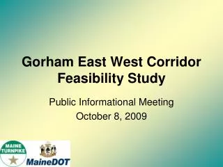
Gorham East West Corridor Feasibility Study. Public Informational Meeting October 8, 2009. Public Meeting Agenda. Welcome and Introductions Study Background, Purpose, and Overview Economic Outlook Linking Land Use and Transportation Planning

E N D
Gorham East West Corridor Feasibility Study Public Informational Meeting October 8, 2009
Public Meeting Agenda • Welcome and Introductions • Study Background, Purpose, and Overview • Economic Outlook • Linking Land Use and Transportation Planning • Input Session: Benefits, opportunities and drawbacks of projected growth • Study Findings To-Date • What’s Next
Gorham East West Feasibility Study • Why are we here • Discuss what this Study needs to achieve • Provide important information that affects you • Why conduct this Study? • Serious congestion and safety issues • Regional growth • Four communities looking ahead: worked with Legislature to request Study
Gorham East West Feasibility Study • Why are you here • Want public input on information presented • Have we overlooked or missed anything
Background • Congestion likely to increase/safety issues • Over last 10 years - fastest growing region in Maine • Gorham Bypass one piece of the solution • A range of additional solutions likely • This is not JUST a transportation study - looking at land use/land development patterns is key to finding the right solutions
Study Purpose • Evaluate feasible transportation strategies and corresponding land use actions • Consistent with federal and state requirements: NEPA and STPA • Include all affected communities and relevant stakeholders • Open and unbiased process • No predetermined outcome • Purpose and Need Statement developed by stakeholders outlines goals and values
Study Overview • Started in Spring of 2009 • 15-month Study (to June 2010) • First 6 months • Collecting and summarizing data • Working with Steering and Advisory Committees • Developed Purpose and Need Statement • Rest of 2009: • Work with communities and committees to develop growth scenarios and measures of effectiveness
Study Overview (cont.) • January/February 2010 • Brainstorm all possible transportation and land use strategies (solutions) • March-June 2010 • Analyze transportation and land use strategies • Identify recommended strategy(s)
Employment-Population Changes in the South Portland-Scarborough-Gorham-Westbrook RegionA Preliminary Outlook
Total Population Growth 14% 38% 24% 31%
Total Employment Growth 30% 22% 25% 11%
Major Economic Development Issues • The Most Jobs: Retail and Services • The Retail Hangover • Professional and technical services • Health: • Ambulatory Health Services • Social Assistance • Fastest Growing • Amusement and recreation services • Social assistance • Museums • Nursing/Ambulatory Health
Three Keys to Transportation-Economic Growth Link • Access – ease of moving goods and people • Agglomeration - benefits that occur when locating near each other • Avoided Costs – these include: • Cost of utilities • Cost of transportation/moving goods • Local costs
Where Key Jobs are Located Trade, Health, Professional-Tech Services Professional-Technical Services Trade Health- Social Assistance
Why Plan for Land Use and Transportation? • First, it makes sense: managing land use can reduce demand on highways • Second, Maine’s laws require careful consideration of how development will affect and be affected by “significant” transportation projects
Does Managing Land Use Make a Difference? • Transportation is simply a way of connecting one land use to another: home to work, business to warehouse, skier to ski resort, worker to lunchtime restaurant • Over last 40 years, trend has been to separate one type of land use from another and put more distance between them • This pattern has contributed to: • highway demand and congestion, • reduced choices in feasible ways of getting from one place to another, and, • the conversion of thousands of extra acres of rural land into development
Land Use Decisions Do Matter Certain arrangements of land use can: • Reduce traffic volumes by 20% - 30% compared with a spread-out pattern of development • Improve safety and traffic flow by managing access onto and off the roads • Increase choice in how to move about – walking, bicycling, ride-sharing, transit as well as single-occupancy auto • Help preserve rural and scenic character of highways (by avoiding excessive commercial strips)
Why Plan for Land Use and Transportation…together? • The State’s major metropolitan economy will continue to put pressure on the land market, rural character, and the transportation system • While land use is regulated locally, the market operates regionally • Each community has something to gain and lose – fiscally, character of community – from the decisions of neighbors • This region has begun to think about the transportation – land use connection • PACTS “Destination Tomorrow” • Revised zoning approaches • Leadership in transit TIF legislation
The approach to measuring effect of land use • Where will next 50,000 jobs & 50,000 homes go, and how will this affect the transportation system? • Study Approach to include two land use scenarios: • Low Density Scenario: An extension of the last 25 years. • Land Use/Transportation Scenario: Evaluate the results of adopting land use policies and infrastructure investments that follow best practices with respect to the 4 Ds (density, distance, design, diversity) • Evaluated by “measures of effectiveness”
How decide on an “alternative” land use scenario? • Technical workshops with community planners and leaders and Steering Committee • Review by Advisory Committee • Review by Public
Audience Feedback • Question for You: • In your opinion, is growth in your community a problem or a benefit? • Is the problem the amount of growth or the location of growth? • Specific examples are welcome
Suggested Protocol • NO SOLUTIONS! • Please state your name, town, organization if applicable • Please speak into the microphone
Study Findings to Date What did we collect and why??
Study Findings Categories Natural and Physical Resources Land Use Transportation Other 33
1 • Rare Species • New England Cottontail • Upland Sandpiper 2 1
3 2 • Rare Species • New England Cottontail • Wood Turtle • Spotted Turtle 1
1 4 1 3 1 1 1 5 1 6 7 1 • Rare Species • New England Cottontail • Upland Sandpiper 3. Blanding’s Turtle 4. Eastern Box Turtle 5. Least Bittern 6. Saltmarsh Sharp-tailed sparrow 7. Harlequin Duck
1 • Rare Species • New England Cottontail