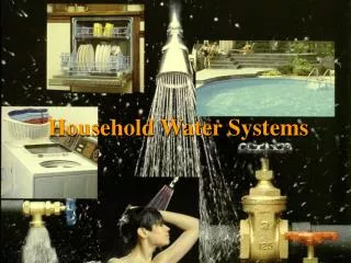
Water Systems
Water Systems. The Water Cycle, Streams, and Ground Water. Earth’s Water Supply. Water Cycle. movement of water between the atmosphere, the land, and the oceans. Evaporation. Water changing from liquid phase to a gaseous phase( water vapor) without boiling. Surface 2/3 Water

Water Systems
E N D
Presentation Transcript
Water Systems The Water Cycle, Streams, and Ground Water
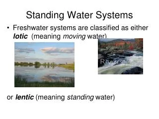
Water Cycle • movement of water between the atmosphere, the land, and the oceans.
Evaporation • Water changing from liquid phase to a gaseous phase(water vapor) without boiling. • Surface 2/3 Water • 500,000 km3 /year • Evapotranspiration – evaporation from plant leaves.
Condensation • change of state from a gas to a liquid • When water vapor rises in the atmosphere, it expands and cools. • As the vapor becomes cooler; some of it condenses back to liquid • High – Clouds • Low – Fog • Surface - Dew
Precipitation • Any form of water that falls to Earth’s surface (rain, snow, sleet, and hail) • Most precipitation falls on Earth’s oceans. • The rest falls on land and becomes runoff or infiltrates the soil to become groundwater.
Runoff • Rain that falls to the ground and is not absorbed • Moves along the surface of the land until it flows into a stream system • Causes erosion.
Factors Affecting Runoff • Rate of rain Runoff • Slope Runoff • Buildings Runoff • Plants Runoff
River Systems • watershed (AKA basin)the area of land that is drained by a river system • The ridges or elevated regions that separate watersheds are calleddivides. • tributariesstreams that flows into a lake or into a larger stream • A river system is made up of a main stream and tributaries.
MooseheadLake Watershed • Contains: • 31 lakes • 549 m2 of land • 400 miles of rivers and streams • empties out into the Atlantic Ocean
River Systems • Channel - Depression that a stream follows as it flows downhill • Banks - The edges of a stream channel that are above water level • Bed - The part of the stream channel that is below the water level • A stream channel gradually becomes wider and deeper as it erodes its banks and bed.
River Systems stream load - Sediment carried by a stream • Stream load takes three forms • suspended load • bed load • dissolved load
River Systems Stream gradientthe change in elevation over a given distance • Near the headwaters, or the beginning of a stream, the gradient generally is steep. • As the stream nears its mouth, its gradient often becomes flatter. • The characteristics of streams with different gradients are very different
River Systems • River systems change continuously because of erosion. • Depending on the slope of the land, streams have three stages of development. Young, Mature, and Old • These differing streams support different types of organisms
Young Streams • Flow swiftly through a steep valley. • Lots of whitewater and waterfalls because they have not yet eroded all the material in their way. • Young streams erode most on the bottom and less on the sides.
Qualities • Fast Moving • High oxygen • Cold • Little Nutrients
Stream Merging • Many young streams join together to form larger streams. • Depending on the slope of the land and the amount of water they will form either mature or old streams
Mature and Old Streams • Mature and Old Streams flow through floodplains. • floodplainan area along a river that forms from sediments deposited when the river overflows its banks • Occurs when water levels increase depending on the amount of rainfall and snowmelt in the watershed.
Mature Streams • Curving streams that flow down a gradual slope • Erode more on their sides than on the bottom. • This leads to the creation of meanders (curves in a stream)
Qualities • Lots of sediment/nutrients • Erosion from young streams • Slow moving • Algae can grow
Evolution of Mature Streams meander • When a river rounds a bend, the velocity of the water on the outside of the curve increases. • Increase erosion • On the inside of the curve, the velocity of the water decreases. • Increased deposition • Causes curves to widen
Oxbow Lakes • The curve enlarges while further erosion takes place on the opposite bank, where the water is moving more quickly. • Meanders can become so curved that they almost form a loop, separated by only a narrow neck of land • This can eventually become separated into an oxbow lake
Old Streams • Old streams flow very slowly through a broad flat floodplain. • Usually they have lost their meanders and flow more straightly.
Deltas and Alluvial Fans • Fan-shaped masses of sediment deposited as a stream slows • Deltas occur where streams meet oceans • Alluvial fans result where streams loose energy as the slope decreases rapidly.
Groundwater • Water that absorbs into the ground and is located in the spaces between sediments (pores) • These pores are connected and allow water to flow through them.
Permeability • Ability of a material(rock/sediment) to allow water to flow through it. • Permeable rock/sediment layers allow water to pass through easily • Impermeable rock/sediment layers resist the flow of water. • Depends on size and shape of sediment
Zone of Saturation • Ground water fills the pores in the permeable rock/sediment layer creating an aquifer. • The area of the soil where all of the pores have completely filled with water is referred to as the zone of saturation. • The upper limit of this zone is called the water table.