Download
1 / 21
210 likes | 385 Vues
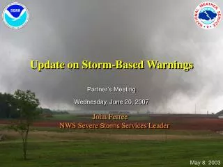
Storm Based Warnings A New Direction in the Warning Process. Add Name National Weather Service Add Office. Overview. Brief History of Storm Based (SB) Warnings Implementation Schedule SB Methodology Resources Benefits Challenges Summary. Brief History.

E N D
Storm Based WarningsA New Direction in the Warning Process Add Name National Weather Service Add Office
Overview • Brief History of Storm Based (SB) Warnings • Implementation Schedule • SB Methodology • Resources • Benefits • Challenges • Summary
Brief History • Sub County Information Added to NWS Short Duration Warnings in the late 1990s • “Area of Maximum Impact” Defined by Sets of LAT/LON Point Pairs At Bottom of Text Warnings • Polygon – Graphical Depiction of the LAT/LON Point Pairs • Short Duration Warnings – Tornado, Severe Thunderstorm, Flash Flood and Special Marine • Sub County Information Added to Follow Up Statements in 2002 • Allowed Forecasters to Update the “Area of Maximum Impact” Based on Current Conditions • The Warning Still Involved the Entire County!
Brief History Part II • Demonstration at 25 Forecast Offices in 2005 • Reduction in total area warned - 73% • Reduction in total number of towns warned - 70% • NWS Senior Leadership Approves The Change to Storm Based Warnings in December 2005 • NWS Meets With National Private Weather Vendors in December 2006 to Discuss Software Changes Required to Support The Change to Storm Based Warnings
SB False Alarm Area Reduction SB Approach Eliminates Area False Alarmed
SB False Alarm Area Reduction Storm Based Warnings County Based Warnings
Value of reduced area warned Dr. Daniel S. Sutter*, Associate Professor of Economics, University of Oklahoma estimates that… • If the typical polygon warning was about 1/4 the size of the typical warned county, the value of reduced area under warnings would be almost $50 million per year; • Reducing the area of the typical tornado warning to 1/4 of the current county size would produce about the same increase in value of the warning as reducing the false alarm rate to zero. * Author of “eco-weather” articles in Weather and Forecasting 2002 and 2005
SB Implementation • Implementation Date – October 1, 2007 • Products Impacted • Tornado Warnings • Severe Thunderstorm Warnings • Flash Flood Warnings • Special Marine Warnings • Severe Weather Statements • Flash Flood Statements • Marine Weather Statements
SB Methodology • Forecast Office Issues a Warning For A Portion of County or Counties • Warned Area Defined and Depicted By The Polygon (LAT/LON Point Pairs) • Portions of Counties Verbally Described by Compass Points (e.g. North, Northeast, East, Southwest, Central etc.) • Forecast Office Updates a Warning Using a Follow Statement • Polygon Can Shrink In Area, But Not Expand • Forecast Office Cancels the Warning or Allows It to Expire When Conditions No Longer Meet Warning Criteria • IMPORTANT – More Than One Warning Can Be In Effect For One County at the Same Time!
SB Resources • NWS RIDGE Radar Display • Available on Every WFO Web Site • Private Weather Vendors Were Briefed In December 2006 • Weather Data, WSI • Barons, Meteorologix • Graphical displays via weather radios, cell phones, PDAs, etc.
SB Benefits • Warnings Focused on Weather and Water Hazards • Warned Area Reduced on Average By 75%; Up to 97% Reduction in Western U.S. Counties • “Blue Sky” Effect Reduced By Finer Resolution Warnings • Warnings Defined By GIS Coordinates • Adaptable to Local Distribution Via Cell Phones, PDAs, etc. • Improved Display Capabilities for Television, Internet • Better Public Service • Improved Information For Decision Makers – Emergency Managers • More Accurate Depiction of Threat To U.S. Citizens • Warnings Are The Best Science and Technology Can Provide
One WFOs Study (2004) • In 2004, issued tornado warnings for counties that covered: • 31,990 square miles • Included 494 individual towns • Utilizing the polygon approach, the polygons covered: • 9,500 square miles • Included 152 individual towns • If the polygon approach were in place: • Would have reduced our total warning area by 22,490 square miles • Would have unnecessarily warned 242 fewer towns • That's a reduction of 70%!
SB Challenges • Legacy Dissemination Technology Is County Based • NOAA Weather Radio • EAS Activation (FCC) • Majority of Siren Systems (County/Local Government) • Multiple Warnings in One County • Easy To Differentiate Graphically; Hard to Describe Verbally • VTEC Event Tracking Number Uniquely Defines Multiple Warnings For Parsing Computer Programs • Environmental Factors and Drawing Polygons • Right and Left Turning Supercells • Pulse Thunderstorms • Basin Flooding
Multiple Warnings in One County/Parish • Issue for text, radio, TV crawls • Add reference to other valid warnings • Include counties with directional delimiters? • Summary severe weather statements? Bond Fayette Madison Marion Clinton SVR until 3:45PM St. Clair Washington Jefferson TOR until 3:30PM Perry Randolph Franklin Jackson Williamson
SUMMARY • SB Warnings Start On October 1, 2007 • These Warnings Are Weather and Water Specific and Use GIS Coordinates to Define the Warned Area • Resources Such As The NWS RIDGE Radar Display Are Available Now For Partners and Customers • Challenges Remain Such as Current NOAA Weather Radio and EAS Activation Technology • SB Warnings Provide Better Public Service and Reflect The Cutting Edge of Meteorology and Hydrology
Questions wcm.name@noaa.gov xxx-xxx-xxxx