Dane County Water Body Classification Study Phase I
280 likes | 464 Vues
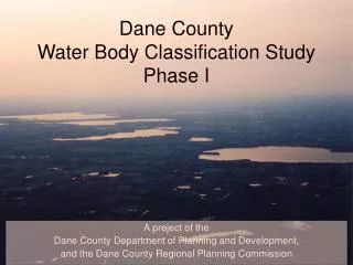
A project of the Dane County Department of Planning and Development, and the Dane County Regional Planning Commission. Dane County Water Body Classification Study Phase I. Lake Classification:. Lake Classification. Seepage/Spring lakes. Drainage Lakes. Shallow. Deep. Shallow. Deep.

Dane County Water Body Classification Study Phase I
E N D
Presentation Transcript
A project of the Dane County Department of Planning and Development, and the Dane County Regional Planning Commission Dane CountyWater Body Classification StudyPhase I
Lake Classification Seepage/Spring lakes Drainage Lakes Shallow Deep Shallow Deep Most Sensitive Least Sensitive Decreasing Sensitivity
Lake Classification Seepage/Spring lakes Drainage Lakes Shallow Deep Shallow Deep 23 1 (A) High Sensitivity (B) Medium Sensitivity (C) Low Sensitivity Sensitivity Ranking
Additional Factors • Area -- small lakes more sensitive • Shoreline Development -- irregular lakes more sensitive • Stratification -- stratified lakes more sensitive • Steep Slopes -- high potential for erosion/sedimentation • Septic Suitability -- high water table/sandy soils
Impervious Cover Calculations: • 300-foot buffer • Determined acres of each land use present within buffer • Assigned each land use an impervious cover percentage • Calculated the average percent impervious cover for each named lake/pond
I I II (A) High Sensitivity Ranking (B) Medium I II III (C) Low II III III (B) Medium Development Levels (C) High Development Levels (A) Low Development Levels Impervious Cover
Impervious Cover Calculations • Determine area of each land use in a subwatershed • Assign an impervious cover percentage to each land use • Calculate the average impervious cover percentage for each subwatershed
Management Implications • Lake or Stream • Protection, Restoration, or Enhancement • based on classification • Regulatory, Incentive, or Educational • Updating the County Shoreland Zoning Ordinance • Environmental Corridors, Rural Protection Areas • PDRs, TDRs, DNR grants, CRP, WRP, etc. • Urban or Rural Design • Maximizing infiltration and natural vegetation • Minimizing impervious cover • Cost-sharing, BMPs, conservation plans • Conservation easements, etc.
Management Programs/Strategies • Shoreland Vegetation (e.g., Buffer Size and Quality) • Wetlands Restoration • Shoreland Development • Floodplain Management • Land Disturbance/Construction Site Erosion Control • Stormwater Management and Urban BMPs • Rural Runoff and Agricultural BMPs • Comprehensive Land Use Planning
Water Body Classification: Phase I: - Provide the scientific basis/rationale - Develop management strategies/alternatives Phase II: - Develop a water body management program; - Including policies, programs and guidelines based on: Classification Public input